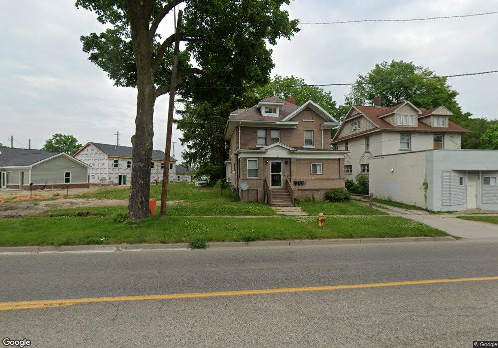
908 M l King Ave Flint, MI 48503
Downtown Flint NeighborhoodEstimated Value: $90,000 - $110,000
3
Beds
4
Baths
2,380
Sq Ft
$40/Sq Ft
Est. Value
About This Home
This home is located at 908 M l King Ave, Flint, MI 48503 and is currently estimated at $96,231, approximately $40 per square foot. 908 M l King Ave is a home located in Genesee County with nearby schools including Doyle/Ryder School, Flint Cultural Center Academy, and WAY Academy of Flint.
Ownership History
Date
Name
Owned For
Owner Type
Purchase Details
Closed on
Feb 2, 2007
Sold by
Paschal Charles J
Bought by
P C Interprize Inc
Current Estimated Value
Purchase Details
Closed on
Jan 24, 2005
Sold by
Souders Catherine I and Hokanson Alvin C
Bought by
Paschal Charles J
Home Financials for this Owner
Home Financials are based on the most recent Mortgage that was taken out on this home.
Original Mortgage
$42,000
Interest Rate
5.79%
Mortgage Type
Purchase Money Mortgage
Create a Home Valuation Report for This Property
The Home Valuation Report is an in-depth analysis detailing your home's value as well as a comparison with similar homes in the area
Home Values in the Area
Average Home Value in this Area
Purchase History
| Date | Buyer | Sale Price | Title Company |
|---|---|---|---|
| P C Interprize Inc | -- | None Available | |
| Paschal Charles J | $19,127 | Multiple |
Source: Public Records
Mortgage History
| Date | Status | Borrower | Loan Amount |
|---|---|---|---|
| Previous Owner | Paschal Charles J | $42,000 |
Source: Public Records
Tax History Compared to Growth
Tax History
| Year | Tax Paid | Tax Assessment Tax Assessment Total Assessment is a certain percentage of the fair market value that is determined by local assessors to be the total taxable value of land and additions on the property. | Land | Improvement |
|---|---|---|---|---|
| 2025 | $1,175 | $29,700 | $0 | $0 |
| 2024 | $1,126 | $22,300 | $0 | $0 |
| 2023 | $1,117 | $21,000 | $0 | $0 |
| 2022 | $0 | $17,600 | $0 | $0 |
| 2021 | $1,052 | $16,100 | $0 | $0 |
| 2020 | $1,004 | $11,600 | $0 | $0 |
| 2019 | $660 | $9,000 | $0 | $0 |
| 2018 | $932 | $8,200 | $0 | $0 |
| 2017 | $918 | $0 | $0 | $0 |
| 2016 | $914 | $0 | $0 | $0 |
| 2015 | -- | $0 | $0 | $0 |
| 2014 | -- | $0 | $0 | $0 |
| 2012 | -- | $7,900 | $0 | $0 |
Source: Public Records
Map
Nearby Homes
- 1016 Garland St
- 217 W 7th Ave
- 1303 Root St
- 416 W 2nd Ave Unit 4
- 329 E Wood St
- 407 W 2nd Ave
- 805 Columbia Dr
- 1606 Garland St
- 235 Page St
- 227 W 5th Ave Unit 3
- 1706 Wilberforce Cir
- 1409 Prospect St
- 503 W 2nd St
- 607 East St
- 620 E 2nd St
- 1645 Seminole St
- 325 W Paterson St
- 1717 Wolcott St
- 1802 Mackin Rd
- 621 Pierson St
- 912 M l King Ave
- 822 M l King Ave
- 524 Louisa St
- 818 M l King Ave
- 907 Root St
- 909 M l King Ave
- 909 Root St
- 901 M l King Ave
- 913 Root St
- 819 Root St
- 5743 Argyl Stocker Ave
- 821 M l King Ave
- 815 Root St
- 810 Martin Luther King Ave
- 927 M l King Ave
- 811 M l King Ave
- 807 M l King Ave
- 112 W 5th Ave
- 916 Garland St
- 805 M l King Ave