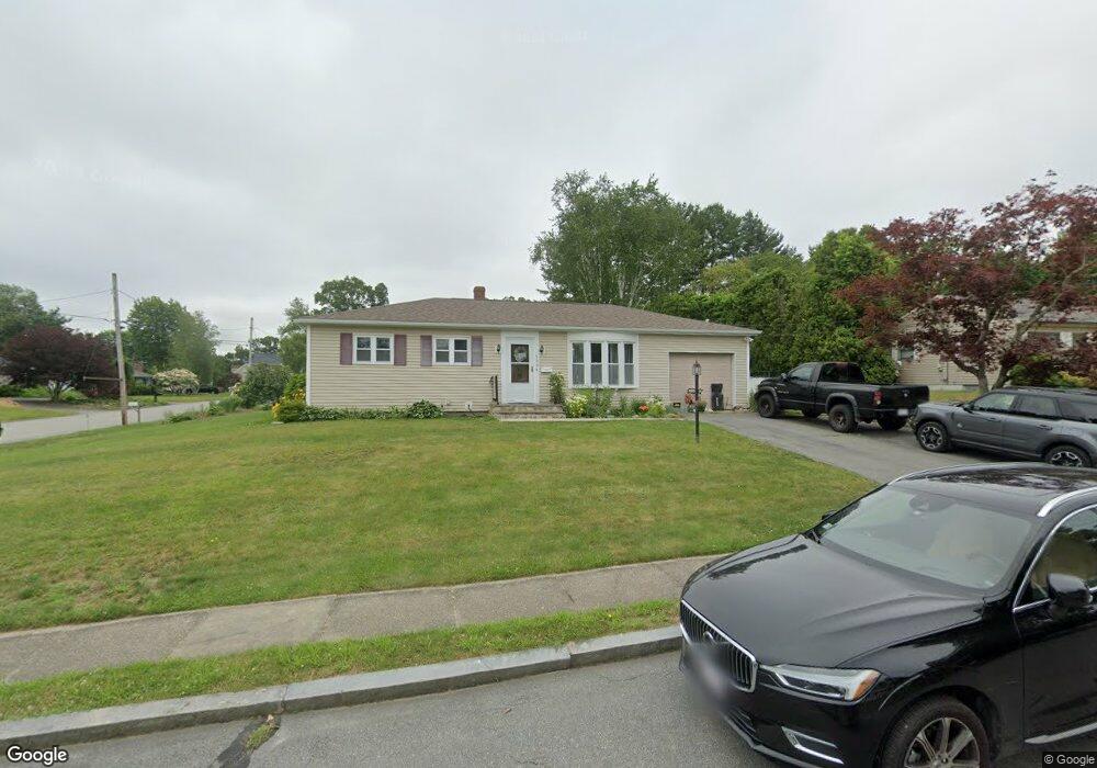
908 Tobey St New Bedford, MA 02745
Estimated Value: $368,000 - $437,619
2
Beds
1
Bath
1,026
Sq Ft
$401/Sq Ft
Est. Value
About This Home
This home is located at 908 Tobey St, New Bedford, MA 02745 and is currently estimated at $411,905, approximately $401 per square foot. 908 Tobey St is a home located in Bristol County with nearby schools including Casimir Pulaski Elementary School, Normandin Middle School, and New Bedford High School.
Ownership History
Date
Name
Owned For
Owner Type
Purchase Details
Closed on
Sep 30, 2021
Sold by
Vieira Zelia
Bought by
908 Tobey St Nt and Vieira
Current Estimated Value
Purchase Details
Closed on
Jan 26, 1995
Sold by
Department Of Housing & Urban Dev
Bought by
Vieira Jose and Vieira Olivia
Purchase Details
Closed on
Jun 24, 1994
Sold by
Vieira Paul M
Bought by
Fleet Mtg Corp
Purchase Details
Closed on
Oct 16, 1989
Sold by
Marshall Agnes V
Bought by
Vieira Paul M
Home Financials for this Owner
Home Financials are based on the most recent Mortgage that was taken out on this home.
Original Mortgage
$105,097
Interest Rate
10.13%
Mortgage Type
Purchase Money Mortgage
Create a Home Valuation Report for This Property
The Home Valuation Report is an in-depth analysis detailing your home's value as well as a comparison with similar homes in the area
Home Values in the Area
Average Home Value in this Area
Purchase History
| Date | Buyer | Sale Price | Title Company |
|---|---|---|---|
| 908 Tobey St Nt | -- | None Available | |
| Vieira Jose | $69,000 | -- | |
| Vieira Jose | $69,000 | -- | |
| Fleet Mtg Corp | $129,991 | -- | |
| Fleet Mtg Corp | $129,991 | -- | |
| Vieira Paul M | $122,000 | -- | |
| Vieira Paul M | $122,000 | -- |
Source: Public Records
Mortgage History
| Date | Status | Borrower | Loan Amount |
|---|---|---|---|
| Previous Owner | Vieira Paul M | $105,097 |
Source: Public Records
Tax History Compared to Growth
Tax History
| Year | Tax Paid | Tax Assessment Tax Assessment Total Assessment is a certain percentage of the fair market value that is determined by local assessors to be the total taxable value of land and additions on the property. | Land | Improvement |
|---|---|---|---|---|
| 2025 | $4,149 | $366,800 | $138,800 | $228,000 |
| 2024 | $4,097 | $341,400 | $151,000 | $190,400 |
| 2023 | $4,037 | $282,500 | $121,500 | $161,000 |
| 2022 | $3,728 | $239,900 | $112,800 | $127,100 |
| 2021 | $3,670 | $235,400 | $112,800 | $122,600 |
| 2020 | $3,702 | $229,100 | $112,800 | $116,300 |
| 2019 | $3,534 | $214,600 | $108,500 | $106,100 |
| 2018 | $3,346 | $201,200 | $108,500 | $92,700 |
| 2017 | $3,201 | $191,800 | $106,300 | $85,500 |
| 2016 | $2,971 | $180,200 | $104,100 | $76,100 |
| 2015 | $2,740 | $174,200 | $99,800 | $74,400 |
| 2014 | $2,617 | $172,600 | $97,600 | $75,000 |
Source: Public Records
Map
Nearby Homes
- 946 Thorndike St
- 26 Blueberry Dr
- 2 Woodland Rd
- 16 Swallow St
- 13 Luscomb Ln
- 34 Poplar Rd
- 4597 Acushnet Ave
- 1063 Westgate St
- SS Charbonneau Ln
- 82 Susan St
- 210 Heritage Dr
- 145 Heritage Dr
- 34 Wood Duck Rd
- 62 Longview Rd
- 63 County Rd
- 700 Pine Hill Dr
- 1269 Bartlett St
- 67 Morses Ln
- 3289 Acushnet Ave Unit 2
- 1045 Forbes St