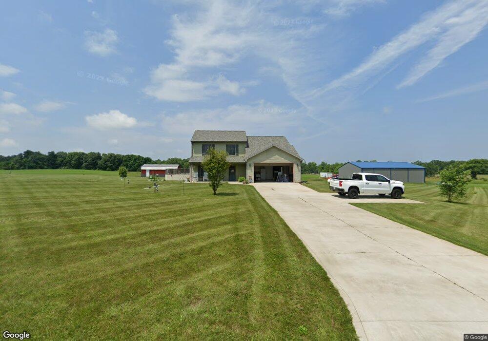
9082 N 650 E New Carlisle, IN 46552
Estimated Value: $281,000 - $344,000
3
Beds
3
Baths
1,728
Sq Ft
$182/Sq Ft
Est. Value
About This Home
This home is located at 9082 N 650 E, New Carlisle, IN 46552 and is currently estimated at $313,754, approximately $181 per square foot. 9082 N 650 E is a home with nearby schools including New Prairie High School.
Ownership History
Date
Name
Owned For
Owner Type
Purchase Details
Closed on
Oct 27, 2015
Sold by
Palmer Brian J and Palmer Amanda J
Bought by
Palmer Brian J and Palmer Amanda J
Current Estimated Value
Home Financials for this Owner
Home Financials are based on the most recent Mortgage that was taken out on this home.
Original Mortgage
$205,049
Outstanding Balance
$161,718
Interest Rate
3.87%
Mortgage Type
New Conventional
Estimated Equity
$152,036
Purchase Details
Closed on
May 4, 2015
Sold by
Tabaka Peter F
Bought by
Palmer Brian J and Stiffler Amanda J
Home Financials for this Owner
Home Financials are based on the most recent Mortgage that was taken out on this home.
Original Mortgage
$183,465
Interest Rate
3.68%
Mortgage Type
New Conventional
Create a Home Valuation Report for This Property
The Home Valuation Report is an in-depth analysis detailing your home's value as well as a comparison with similar homes in the area
Home Values in the Area
Average Home Value in this Area
Purchase History
| Date | Buyer | Sale Price | Title Company |
|---|---|---|---|
| Palmer Brian J | -- | None Available | |
| Palmer Brian J | -- | None Available |
Source: Public Records
Mortgage History
| Date | Status | Borrower | Loan Amount |
|---|---|---|---|
| Open | Palmer Brian J | $205,049 | |
| Closed | Palmer Brian J | $183,465 |
Source: Public Records
Tax History Compared to Growth
Tax History
| Year | Tax Paid | Tax Assessment Tax Assessment Total Assessment is a certain percentage of the fair market value that is determined by local assessors to be the total taxable value of land and additions on the property. | Land | Improvement |
|---|---|---|---|---|
| 2024 | $2,297 | $198,100 | $39,000 | $159,100 |
| 2022 | $1,964 | $190,500 | $39,000 | $151,500 |
| 2021 | $1,964 | $179,500 | $39,000 | $140,500 |
| 2020 | $2,004 | $179,500 | $39,000 | $140,500 |
| 2019 | $1,987 | $177,000 | $39,000 | $138,000 |
| 2018 | $1,825 | $173,100 | $34,500 | $138,600 |
| 2017 | $1,755 | $167,000 | $34,500 | $132,500 |
| 2016 | $0 | $168,800 | $35,000 | $133,800 |
Source: Public Records
Map
Nearby Homes
- 6484 E 1000 N
- 0 N Bluebird Ln
- 5613 E Saugana Trail
- 0 N Miller Blvd
- 0 N Holling Blvd Unit NRA816189
- 5563 Spring Creek Rd
- 8101 N Laporte Blvd
- 4318 Olive Branch Rd
- 8679 E 850 N
- 7838 N Walker Rd
- 7769 E Bell Ave
- 0 E John Emery Rd
- 5665 W Phillips Rd
- 7462 W Martin Rd
- 55584 County Line Rd
- 55564 County Line Rd
- 55544 County Line Rd
- 55574 County Line Rd
- 55594 County Line Rd
- 3071 E 1000 N