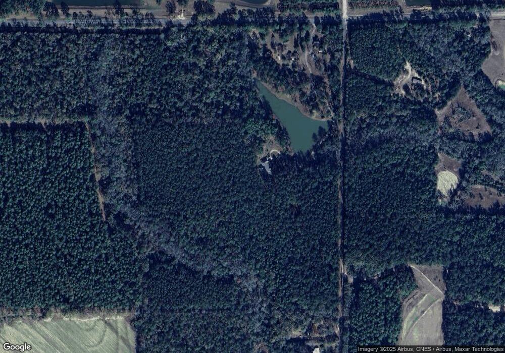
9085 State Highway 85 Laurel Hill, FL 32567
Estimated Value: $635,000 - $994,000
4
Beds
4
Baths
3,392
Sq Ft
$246/Sq Ft
Est. Value
About This Home
This home is located at 9085 State Highway 85, Laurel Hill, FL 32567 and is currently estimated at $834,373, approximately $245 per square foot. 9085 State Highway 85 is a home located in Okaloosa County with nearby schools including Laurel Hill School.
Ownership History
Date
Name
Owned For
Owner Type
Purchase Details
Closed on
Nov 17, 2023
Sold by
Sharp Mikie K and Sharp Alectia K
Bought by
Sharp Mikie K and Sharp Alectia K
Current Estimated Value
Purchase Details
Closed on
Nov 29, 2004
Sold by
Gredan Development Inc
Bought by
Sharp Mikie K and Sharp Alectia K
Purchase Details
Closed on
Jun 28, 2004
Sold by
Wang Arvy Lee and Wang Faye S
Bought by
Gredan Development Inc
Home Financials for this Owner
Home Financials are based on the most recent Mortgage that was taken out on this home.
Original Mortgage
$400,000
Interest Rate
6.24%
Mortgage Type
Unknown
Purchase Details
Closed on
Jun 24, 2002
Sold by
Wang Arvy Lee and Wang Bama Mae
Bought by
Wang Arvy Lee and Wang Faye S
Create a Home Valuation Report for This Property
The Home Valuation Report is an in-depth analysis detailing your home's value as well as a comparison with similar homes in the area
Home Values in the Area
Average Home Value in this Area
Purchase History
| Date | Buyer | Sale Price | Title Company |
|---|---|---|---|
| Sharp Mikie K | $100 | None Listed On Document | |
| Sharp Mikie K | $100 | None Listed On Document | |
| Sharp Mikie K | $100 | None Listed On Document | |
| Sharp Mikie K | $375,000 | -- | |
| Gredan Development Inc | $450,000 | Reliable Land Title Corp | |
| Wang Arvy Lee | -- | -- |
Source: Public Records
Mortgage History
| Date | Status | Borrower | Loan Amount |
|---|---|---|---|
| Previous Owner | Gredan Development Inc | $400,000 |
Source: Public Records
Tax History Compared to Growth
Tax History
| Year | Tax Paid | Tax Assessment Tax Assessment Total Assessment is a certain percentage of the fair market value that is determined by local assessors to be the total taxable value of land and additions on the property. | Land | Improvement |
|---|---|---|---|---|
| 2024 | $4,655 | $409,305 | -- | -- |
| 2023 | $4,655 | $471,273 | $0 | $0 |
| 2022 | $4,534 | $456,326 | $0 | $0 |
| 2021 | $4,518 | $441,152 | $0 | $0 |
| 2020 | $4,479 | $435,616 | $24,712 | $410,904 |
| 2019 | $4,459 | $426,888 | $25,532 | $401,356 |
| 2018 | $4,453 | $422,168 | $0 | $0 |
| 2017 | $4,363 | $414,781 | $0 | $0 |
| 2016 | $4,245 | $406,747 | $0 | $0 |
| 2015 | $4,346 | $404,020 | $0 | $0 |
| 2014 | $4,365 | $401,133 | $0 | $0 |
Source: Public Records
Map
Nearby Homes
- 8106 County Line Rd
- 72 Acres Grimes Rd
- 8094 Highway 393
- 0 Co Hwy 147 Unit LotWP001
- 0 Co 147 Hwy Unit 779361
- 2206 Wood Ave
- 7934 Steel Mill Creek Rd
- 21418 Tuscarora Ave
- 21117 Catawba Ave
- 8360 Thomas Rd
- 521 Landing Ave
- 523 Landing Ave
- 3368 Alabama 55
- 20531 Harbuck-Bradley Rd
- Parcel E Millside Rd
- Parcel D Millside Rd
- 261.6 ac Millside Rd
- Parcel A Millside Rd
- 12 Acres Florida 85 Unit Lot 1
- 363 Acres Florida 85
- 8320 County Line Rd
- 9062 Highway 85 N
- 9091 State Highway 85
- 4181 State Highway 85 Unit CO
- 8144 County Line Rd
- 3920 Fl-85
- 4773 Grimes Rd
- 4797 Grimes Rd
- 4712 Grimes Rd
- 1869 Varnum Rd
- 000 Shady Ln
- 0000 St Hwy85 Hwy
- 8116 County Road 393
- 8116 Highway 393
- 3654 State Highway 85
- 1775 Varnum Rd
- 4701 Grimes Rd
- 8937 Highway 85 N
- 1770 Varnum Rd
- 1681 Varnum Rd
