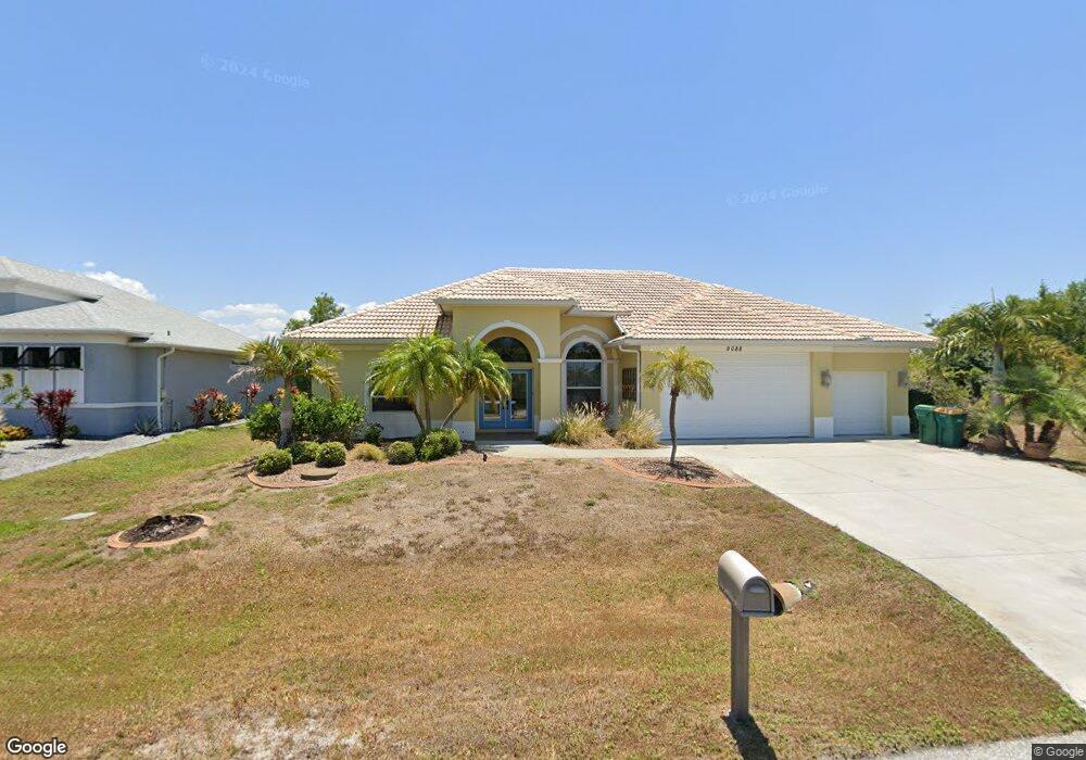
9088 Sandspur St Port Charlotte, FL 33981
Gulf Cove NeighborhoodEstimated Value: $577,325 - $672,000
3
Beds
2
Baths
2,338
Sq Ft
$271/Sq Ft
Est. Value
About This Home
This home is located at 9088 Sandspur St, Port Charlotte, FL 33981 and is currently estimated at $633,331, approximately $270 per square foot. 9088 Sandspur St is a home located in Charlotte County with nearby schools including Myakka River Elementary School, L.A. Ainger Middle School, and Lemon Bay High School.
Ownership History
Date
Name
Owned For
Owner Type
Purchase Details
Closed on
Sep 16, 2021
Sold by
Lewis Kerry L
Bought by
Muina Rafael B and Muina Alicia A
Current Estimated Value
Home Financials for this Owner
Home Financials are based on the most recent Mortgage that was taken out on this home.
Original Mortgage
$324,000
Outstanding Balance
$294,376
Interest Rate
2.7%
Mortgage Type
New Conventional
Estimated Equity
$338,955
Purchase Details
Closed on
Mar 29, 2019
Sold by
Jago Roberta J and Jago Joe R
Bought by
Lewis Kerry L
Home Financials for this Owner
Home Financials are based on the most recent Mortgage that was taken out on this home.
Original Mortgage
$101,750
Interest Rate
4.5%
Mortgage Type
FHA
Purchase Details
Closed on
Jan 22, 2002
Sold by
Robertson Dorothy
Bought by
Jago Joe R and Jago Roberta J
Create a Home Valuation Report for This Property
The Home Valuation Report is an in-depth analysis detailing your home's value as well as a comparison with similar homes in the area
Home Values in the Area
Average Home Value in this Area
Purchase History
| Date | Buyer | Sale Price | Title Company |
|---|---|---|---|
| Muina Rafael B | $570,000 | Stewart Title Company | |
| Lewis Kerry L | $210,000 | Stewart Title Company | |
| Jago Joe R | $33,000 | -- |
Source: Public Records
Mortgage History
| Date | Status | Borrower | Loan Amount |
|---|---|---|---|
| Open | Muina Rafael B | $324,000 | |
| Previous Owner | Lewis Kerry L | $101,750 |
Source: Public Records
Tax History Compared to Growth
Tax History
| Year | Tax Paid | Tax Assessment Tax Assessment Total Assessment is a certain percentage of the fair market value that is determined by local assessors to be the total taxable value of land and additions on the property. | Land | Improvement |
|---|---|---|---|---|
| 2023 | $10,505 | $588,190 | $0 | $0 |
| 2022 | $9,258 | $534,718 | $98,600 | $436,118 |
| 2021 | $5,205 | $312,407 | $0 | $0 |
| 2020 | $7,321 | $399,565 | $63,750 | $335,815 |
| 2019 | $4,106 | $250,263 | $0 | $0 |
| 2018 | $3,830 | $245,597 | $0 | $0 |
| 2017 | $3,798 | $240,546 | $0 | $0 |
| 2016 | $3,783 | $235,598 | $0 | $0 |
| 2015 | $3,752 | $233,960 | $0 | $0 |
| 2014 | $3,719 | $232,103 | $0 | $0 |
Source: Public Records
Map
Nearby Homes
- 13313 Clarence Ln
- 13332 Keystone Blvd
- 9241 Santa Lucia Dr
- 9219 Canna St
- 9354 Gazania Dr
- 9362 Gazania Dr
- 13399 Chenille Dr
- 13488 Frost Ln
- 13257 Blake Dr
- 13283 Keystone Blvd
- 9178 Arberg St
- 9193 Arberg St
- 9177 Santa Lucia Dr
- 9186 Arberg St
- 13341 Gershwin Ln
- 13305 Blake Dr
- 13474 Abutilon Ln
- 9177 Arberg St
- 13344 Gershwin Ln
- 13468 Rayburn Ln
- 9080 Sandspur St
- 9104 Sandspur St
- 13417 Blake Dr
- 13425 Blake Dr
- 9114 Sandspur St
- 13372 Journal Ln
- 13371 Journal Ln
- 13388 Clarence Ln
- 13385 Blake Dr
- 13364 Journal Ln
- 13257 Clarence Ln
- 13298 Clarence Ln
- 13290 Clarence Ln
- 13385 Clarence Ln
- 13433 Blake Dr
- 13363 Journal Ln
- 13352 Clarence Ln
- 13396 Clarence Ln
- 13400 Blake Dr
- 13392 Blake Dr