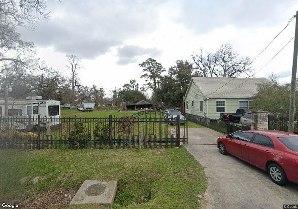
909 Duff Ln Houston, TX 77022
Northside-Northline NeighborhoodEstimated Value: $253,000 - $407,000
3
Beds
1
Bath
1,312
Sq Ft
$259/Sq Ft
Est. Value
About This Home
This home is located at 909 Duff Ln, Houston, TX 77022 and is currently estimated at $339,960, approximately $259 per square foot. 909 Duff Ln is a home located in Harris County with nearby schools including Burbank Elementary School, Burbank Middle School, and Sam Houston Math, Science & Technology Center.
Ownership History
Date
Name
Owned For
Owner Type
Purchase Details
Closed on
Nov 29, 2006
Sold by
Burns Burns John Wayne John Wayne and Burns Trahan Monica L
Bought by
Carcamo Marcos A and Carcamo Maria J
Current Estimated Value
Purchase Details
Closed on
Sep 27, 1993
Sold by
Deleon Leonora R
Bought by
Delacruz Randy
Purchase Details
Closed on
Jan 24, 1979
Sold by
Weatherford John Patrick and Weatherford Sidney David
Bought by
Burns James
Create a Home Valuation Report for This Property
The Home Valuation Report is an in-depth analysis detailing your home's value as well as a comparison with similar homes in the area
Home Values in the Area
Average Home Value in this Area
Purchase History
| Date | Buyer | Sale Price | Title Company |
|---|---|---|---|
| Carcamo Marcos A | -- | Chicago Title | |
| Delacruz Randy | -- | -- | |
| Burns James | -- | Chicago Title |
Source: Public Records
Tax History Compared to Growth
Tax History
| Year | Tax Paid | Tax Assessment Tax Assessment Total Assessment is a certain percentage of the fair market value that is determined by local assessors to be the total taxable value of land and additions on the property. | Land | Improvement |
|---|---|---|---|---|
| 2025 | $7,071 | $382,387 | $283,480 | $98,907 |
| 2024 | $7,071 | $360,410 | $295,043 | $65,367 |
| 2023 | $7,071 | $281,622 | $179,775 | $101,847 |
| 2022 | $5,749 | $261,109 | $179,775 | $81,334 |
| 2021 | $5,573 | $239,119 | $179,775 | $59,344 |
| 2020 | $5,604 | $231,428 | $179,775 | $51,653 |
| 2019 | $5,161 | $203,970 | $148,050 | $55,920 |
| 2018 | $4,262 | $168,425 | $123,728 | $44,697 |
| 2017 | $4,259 | $168,425 | $123,728 | $44,697 |
| 2016 | $3,902 | $154,318 | $116,325 | $37,993 |
| 2015 | $2,761 | $107,406 | $84,600 | $22,806 |
| 2014 | $2,761 | $107,406 | $84,600 | $22,806 |
Source: Public Records
Map
Nearby Homes
- 723 Doverside St
- 1104 Charnwood St
- 1207 Firnat St
- 807 Firnat St
- 8411 Berry Brush Ln
- 8402 Berry Green Ln
- 802 Berry Sage Ln
- 88 Berry Rd
- 743 Apache St
- 631 Apache St
- 9026 Mcgallion Rd
- 714 Apache St
- 702 Pennington St
- 8205 Appleton St
- 411 Berry Rd
- 8109 W Hardy Rd
- 1016 Apache St
- 0 Appleton St
- 741 Mcdaniel St
- 726 Mcdaniel St