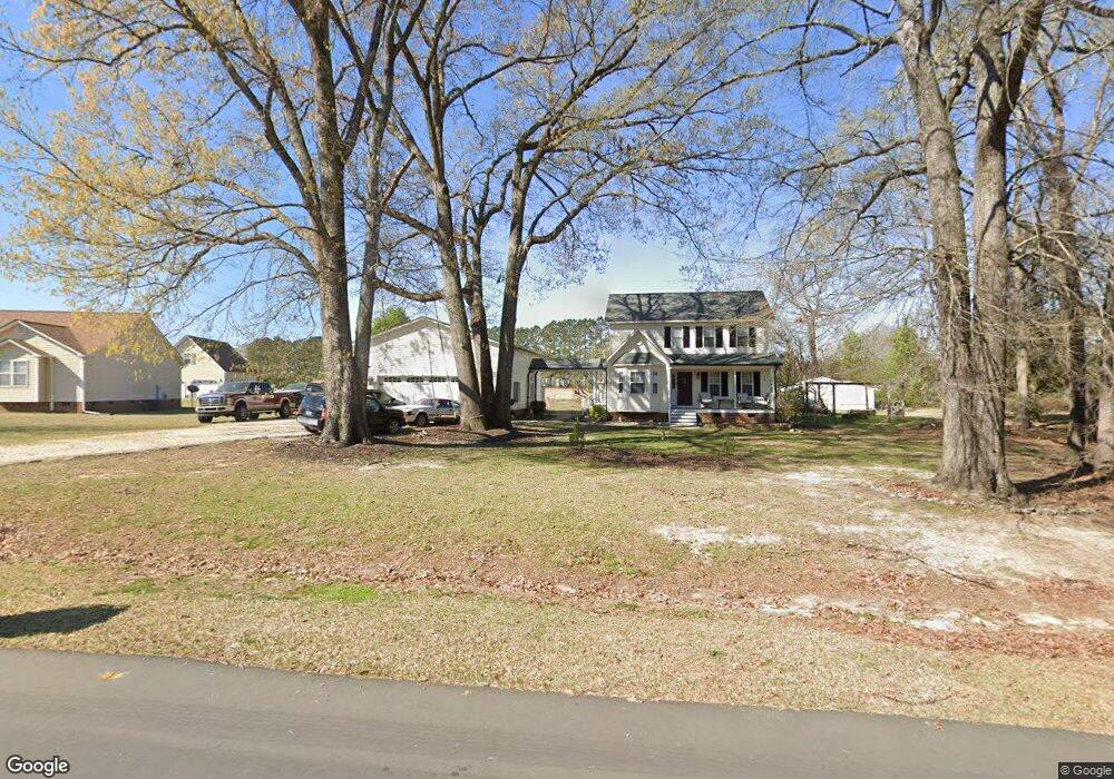
909 Lazy Branch Dr Benson, NC 27504
Pleasant Grove NeighborhoodEstimated Value: $322,000 - $326,065
3
Beds
3
Baths
1,647
Sq Ft
$197/Sq Ft
Est. Value
About This Home
This home is located at 909 Lazy Branch Dr, Benson, NC 27504 and is currently estimated at $325,016, approximately $197 per square foot. 909 Lazy Branch Dr is a home located in Johnston County with nearby schools including McGee's Crossroads Elementary School, McGee's Crossroads Middle School, and West Johnston High School.
Ownership History
Date
Name
Owned For
Owner Type
Purchase Details
Closed on
Apr 29, 2016
Sold by
Wendy Ruth Rogers
Bought by
Vega Ruben
Current Estimated Value
Home Financials for this Owner
Home Financials are based on the most recent Mortgage that was taken out on this home.
Original Mortgage
$143,200
Outstanding Balance
$113,997
Interest Rate
3.66%
Estimated Equity
$211,019
Purchase Details
Closed on
Jul 24, 2014
Sold by
Perricone John H and Perricone Rosanne
Bought by
Vega Ruben and Rodriguez Adriana I
Home Financials for this Owner
Home Financials are based on the most recent Mortgage that was taken out on this home.
Original Mortgage
$142,373
Interest Rate
4.12%
Mortgage Type
FHA
Purchase Details
Closed on
May 21, 2003
Sold by
Burgess Shaun G
Bought by
Burgess Nathan C
Create a Home Valuation Report for This Property
The Home Valuation Report is an in-depth analysis detailing your home's value as well as a comparison with similar homes in the area
Home Values in the Area
Average Home Value in this Area
Purchase History
| Date | Buyer | Sale Price | Title Company |
|---|---|---|---|
| Vega Ruben | -- | -- | |
| Vega Ruben | $145,000 | None Available | |
| Burgess Nathan C | -- | -- |
Source: Public Records
Mortgage History
| Date | Status | Borrower | Loan Amount |
|---|---|---|---|
| Open | Vega Ruben | $143,200 | |
| Closed | Vega Ruben | -- | |
| Previous Owner | Vega Ruben | $142,373 |
Source: Public Records
Tax History Compared to Growth
Tax History
| Year | Tax Paid | Tax Assessment Tax Assessment Total Assessment is a certain percentage of the fair market value that is determined by local assessors to be the total taxable value of land and additions on the property. | Land | Improvement |
|---|---|---|---|---|
| 2025 | $2,244 | $353,320 | $85,000 | $268,320 |
| 2024 | $1,760 | $217,260 | $44,000 | $173,260 |
| 2023 | $1,705 | $217,260 | $44,000 | $173,260 |
| 2022 | $1,760 | $217,260 | $44,000 | $173,260 |
| 2021 | $1,760 | $217,260 | $44,000 | $173,260 |
| 2020 | $1,825 | $217,260 | $44,000 | $173,260 |
| 2019 | $1,782 | $217,260 | $44,000 | $173,260 |
| 2018 | $1,258 | $149,820 | $27,500 | $122,320 |
| 2017 | $1,258 | $149,820 | $27,500 | $122,320 |
| 2016 | $1,258 | $149,820 | $27,500 | $122,320 |
| 2015 | -- | $149,820 | $27,500 | $122,320 |
| 2014 | -- | $149,820 | $27,500 | $122,320 |
Source: Public Records
Map
Nearby Homes
- 121 Wilmack Dr
- 926 Lazy Branch Dr
- 171 Creekstone Dr
- 219 Beaver Ridge Way
- 216 Deep Pool Ct
- 300 Still Meadows Ct
- 180 Hot Springs Way
- 160 Hot Springs Way
- 142 Hot Springs Way
- 111 Hot Springs Way
- 93 Hot Springs Way
- 58 Mineral Springs Way
- 268 Busterfield Ct
- 309 Busterfield Ct
- 208 Hunting Lodge Rd
- 164 George Wilton Dr
- 400 Rose Ct
- 100 Parrish Farm Ln
- 296 Gordon Farm Dr
- 520 Contessa Ct
- 905 Lazy Branch Dr
- 913 Lazy Branch Dr
- 910 Lazy Branch Dr
- 904 Lazy Branch Dr
- 134 Wilmack Dr
- 146 Wilmack Dr
- 130 Wilmack Dr
- 140 Wilmack Dr
- 914 Lazy Branch Dr
- 900 Lazy Branch Dr
- 917 Lazy Branch Dr
- 194 Wilmack Dr
- 195 Wilmack Dr
- 806 Sanders Rd
- 109 Bay Meadow Ln
- 113 Bay Meadow Ln
- 105 Bay Meadow Ln
- 145 Wilmack Dr
- 921 Lazy Branch Dr
- 117 Bay Meadow Ln