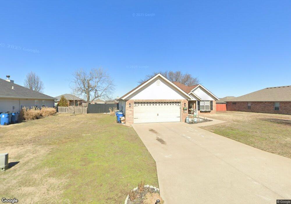
909 Monroe Cir Carl Junction, MO 64834
Estimated Value: $206,000 - $244,000
3
Beds
2
Baths
1,464
Sq Ft
$158/Sq Ft
Est. Value
About This Home
This home is located at 909 Monroe Cir, Carl Junction, MO 64834 and is currently estimated at $230,631, approximately $157 per square foot. 909 Monroe Cir is a home located in Jasper County with nearby schools including Carl Junction Primary School (K-1), Carl Junction Intermediate School, and Carl Junction Primary School (2-3).
Ownership History
Date
Name
Owned For
Owner Type
Purchase Details
Closed on
Dec 23, 2020
Sold by
Amy Louise Frett Ret
Bought by
Ware Daniel and Ware Chelsea
Current Estimated Value
Home Financials for this Owner
Home Financials are based on the most recent Mortgage that was taken out on this home.
Original Mortgage
$148,265
Outstanding Balance
$131,696
Interest Rate
2.7%
Mortgage Type
FHA
Estimated Equity
$98,935
Purchase Details
Closed on
Apr 29, 2014
Sold by
Frett Amy Louise
Bought by
Frett Amy Louise and Amy Louise Frett Revocable Trust Agreeme
Home Financials for this Owner
Home Financials are based on the most recent Mortgage that was taken out on this home.
Original Mortgage
$90,000
Interest Rate
4.36%
Mortgage Type
New Conventional
Purchase Details
Closed on
Jun 1, 2013
Sold by
Hamilton David W
Bought by
Frett Amy Louise and The Amy Louise Frett Revocable Trust
Home Financials for this Owner
Home Financials are based on the most recent Mortgage that was taken out on this home.
Original Mortgage
$99,600
Interest Rate
3.41%
Mortgage Type
Future Advance Clause Open End Mortgage
Purchase Details
Closed on
Dec 30, 2010
Sold by
Redwood Development Inc
Bought by
Hamilton David W
Home Financials for this Owner
Home Financials are based on the most recent Mortgage that was taken out on this home.
Original Mortgage
$131,773
Interest Rate
3.25%
Mortgage Type
Adjustable Rate Mortgage/ARM
Create a Home Valuation Report for This Property
The Home Valuation Report is an in-depth analysis detailing your home's value as well as a comparison with similar homes in the area
Home Values in the Area
Average Home Value in this Area
Purchase History
| Date | Buyer | Sale Price | Title Company |
|---|---|---|---|
| Ware Daniel | -- | None Available | |
| Frett Amy Louise | -- | None Available | |
| Frett Amy Louise | -- | None Available | |
| Frett Amy Louise | -- | None Available | |
| Hamilton David W | -- | Fatco |
Source: Public Records
Mortgage History
| Date | Status | Borrower | Loan Amount |
|---|---|---|---|
| Open | Ware Daniel | $148,265 | |
| Previous Owner | Frett Amy Louise | $90,000 | |
| Previous Owner | Frett Amy Louise | $99,600 | |
| Previous Owner | Hamilton David W | $131,773 |
Source: Public Records
Tax History Compared to Growth
Tax History
| Year | Tax Paid | Tax Assessment Tax Assessment Total Assessment is a certain percentage of the fair market value that is determined by local assessors to be the total taxable value of land and additions on the property. | Land | Improvement |
|---|---|---|---|---|
| 2025 | $1,329 | $25,700 | $2,260 | $23,440 |
| 2024 | $1,338 | $22,720 | $2,260 | $20,460 |
| 2023 | $1,338 | $22,720 | $2,260 | $20,460 |
| 2022 | $1,339 | $22,690 | $2,260 | $20,430 |
| 2021 | $1,149 | $22,690 | $2,260 | $20,430 |
| 2020 | $1,075 | $20,860 | $2,260 | $18,600 |
| 2019 | $1,020 | $20,860 | $2,260 | $18,600 |
| 2018 | $1,062 | $21,760 | $0 | $0 |
| 2017 | $1,065 | $21,760 | $0 | $0 |
| 2016 | $1,084 | $22,360 | $0 | $0 |
| 2015 | $1,084 | $22,360 | $0 | $0 |
| 2014 | $1,084 | $22,070 | $0 | $0 |
Source: Public Records
Map
Nearby Homes
- 907 Aberdeen Ave
- TBD Route Yy
- 29320 State Highway Yy
- 819 Delaney Dr
- 815 Delaney Dr
- Tract 3 Prairie Ln
- Tract 2 Prairie Ln
- Tract 1 Prairie Ln
- Tract 4 Prairie Ln
- 711 Prairie Ln
- Tract D1 County Road 284
- Tract D2 County Road 284
- Tract D3 County Road 284
- 311 S Roney St
- 1550KP-4 Plan at Rainer Farms
- 2360 Two Story Plan at Rainer Farms
- 1714 Plan at Rainer Farms
- 2575 Plan at Rainer Farms
- 1950-4 3-Car Plan at Rainer Farms
- 1950 Plan at Rainer Farms