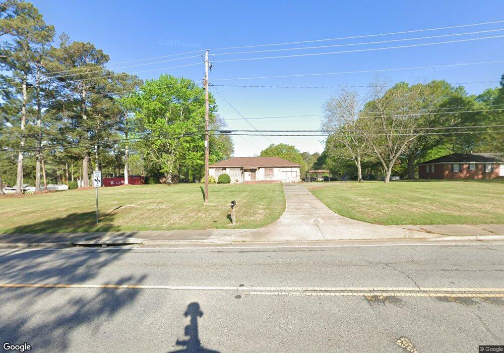
909 N Main St Cedartown, GA 30125
Estimated Value: $227,000 - $276,000
4
Beds
2
Baths
1,771
Sq Ft
$138/Sq Ft
Est. Value
About This Home
This home is located at 909 N Main St, Cedartown, GA 30125 and is currently estimated at $244,764, approximately $138 per square foot. 909 N Main St is a home located in Polk County with nearby schools including Vineyard Harvester Christian Academy and Cedar Christian School.
Ownership History
Date
Name
Owned For
Owner Type
Purchase Details
Closed on
Aug 1, 2000
Sold by
Hawkins Kim and Paula Frasier
Bought by
Brumbelow Steven E and Kay Drennon
Current Estimated Value
Purchase Details
Closed on
Mar 27, 2000
Sold by
Byrom William L
Bought by
Hawkins Kim and Paula Frasier
Purchase Details
Closed on
Aug 23, 1999
Sold by
Byrom Sharon P
Bought by
Byrom William L
Purchase Details
Closed on
Jul 23, 1999
Sold by
Byrom Sharon P
Bought by
Byrom William L
Purchase Details
Closed on
Jan 20, 1961
Bought by
Byrom William L
Create a Home Valuation Report for This Property
The Home Valuation Report is an in-depth analysis detailing your home's value as well as a comparison with similar homes in the area
Home Values in the Area
Average Home Value in this Area
Purchase History
| Date | Buyer | Sale Price | Title Company |
|---|---|---|---|
| Brumbelow Steven E | $50,000 | -- | |
| Hawkins Kim | $100,000 | -- | |
| Byrom William L | -- | -- | |
| Byrom William L | -- | -- | |
| Byrom William L | -- | -- |
Source: Public Records
Tax History Compared to Growth
Tax History
| Year | Tax Paid | Tax Assessment Tax Assessment Total Assessment is a certain percentage of the fair market value that is determined by local assessors to be the total taxable value of land and additions on the property. | Land | Improvement |
|---|---|---|---|---|
| 2024 | $2,733 | $86,519 | $40,970 | $45,549 |
| 2023 | $2,339 | $67,474 | $39,019 | $28,455 |
| 2022 | $1,470 | $61,948 | $38,069 | $23,879 |
| 2021 | $1,463 | $60,839 | $36,960 | $23,879 |
| 2020 | $1,466 | $60,839 | $36,960 | $23,879 |
| 2019 | $1,687 | $62,802 | $36,960 | $25,842 |
| 2018 | $1,707 | $61,944 | $36,960 | $24,984 |
| 2017 | $1,686 | $61,944 | $36,960 | $24,984 |
| 2016 | $1,683 | $61,845 | $36,960 | $24,885 |
| 2015 | $919 | $33,672 | $8,740 | $24,932 |
| 2014 | $926 | $33,672 | $8,740 | $24,932 |
Source: Public Records
Map
Nearby Homes
- 207 John Phillips Rd
- 812 Blanche Rd
- 0 Woodlawn Dr Unit 7638056
- 0 Woodlawn Dr Unit 10590789
- 112 College Cir
- 220 Greenbriar Dr
- 403 Lakeside Dr
- 292 Kimwood Dr
- 64 Virginia Cir
- 521 W John Hand Rd
- 362 Oakwood Dr
- 462 Oakwood Dr
- 133 Virginia Cir
- 214 Jule Peek Ave
- 254 E Girard Ave
- 607 N College St
- 00 Oak Crest Dr
- 77 Ben Dr W
- 621 N College Dr
- 12 Breckenridge Dr
- 917 N Main St
- 912 N Main St
- N N Main St
- 206 John Phillips Rd
- 220 John Phillips Rd
- 224 John Phillips Rd
- 202 John Phillips Rd
- 244 Piedmont Ave
- 228 John Phillips Rd
- 211 John Phillips Rd
- 232 John Phillips Rd
- 105 Plantation Ave
- 215 John Phillips Rd
- 940 N Main St
- 915 Blanche Rd
- 219 John Phillips Rd
- 113 Plantation Ave
- 236 John Phillips Rd
- 223 John Phillips Rd
- 203 Piedmont Ave