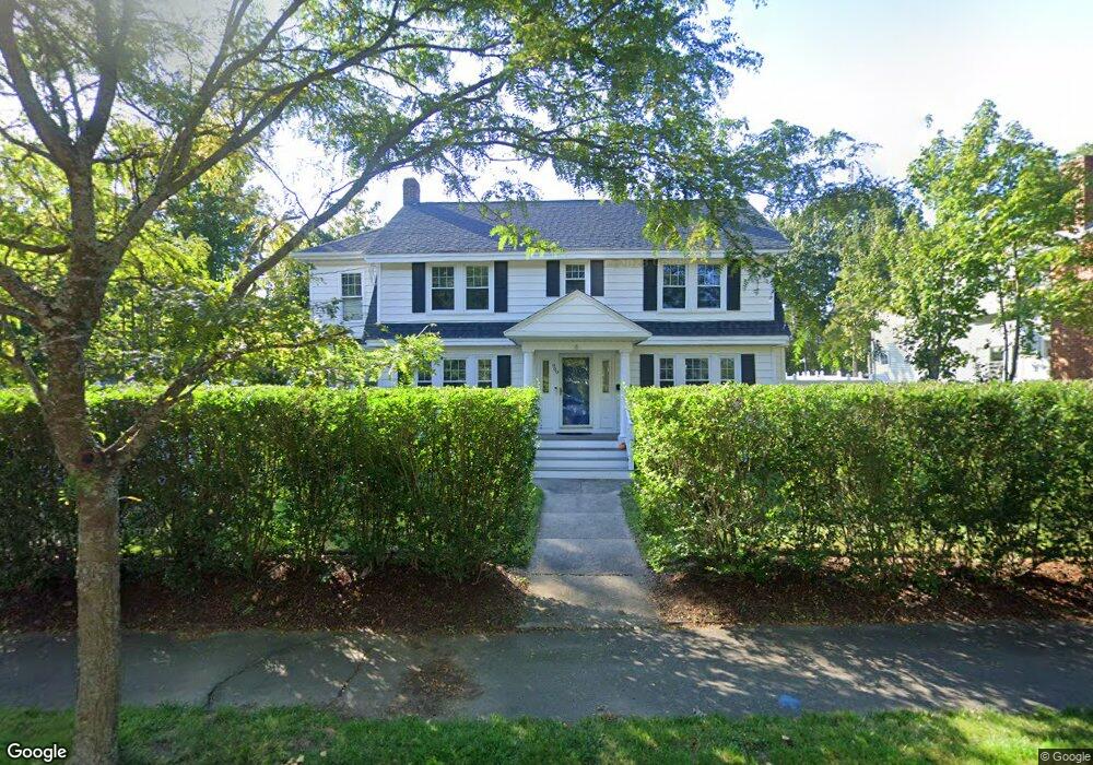
909 Webster St Needham, MA 02492
Estimated Value: $1,307,000 - $1,577,000
4
Beds
3
Baths
2,016
Sq Ft
$713/Sq Ft
Est. Value
About This Home
This home is located at 909 Webster St, Needham, MA 02492 and is currently estimated at $1,436,909, approximately $712 per square foot. 909 Webster St is a home located in Norfolk County with nearby schools including Newman Elementary School, High Rock Middle School, and Pollard Middle School.
Ownership History
Date
Name
Owned For
Owner Type
Purchase Details
Closed on
May 12, 2011
Sold by
Frederickson Seth and Kilduff Joseph M
Bought by
Davis Timothy C and Davis Elizabeth A
Current Estimated Value
Home Financials for this Owner
Home Financials are based on the most recent Mortgage that was taken out on this home.
Original Mortgage
$494,000
Outstanding Balance
$343,307
Interest Rate
4.88%
Mortgage Type
Purchase Money Mortgage
Estimated Equity
$1,093,602
Purchase Details
Closed on
Jun 3, 2005
Sold by
Manning Thomas F
Bought by
Kilduff Joseph M and Scranton Matthew
Home Financials for this Owner
Home Financials are based on the most recent Mortgage that was taken out on this home.
Original Mortgage
$359,650
Interest Rate
5.83%
Mortgage Type
Purchase Money Mortgage
Create a Home Valuation Report for This Property
The Home Valuation Report is an in-depth analysis detailing your home's value as well as a comparison with similar homes in the area
Home Values in the Area
Average Home Value in this Area
Purchase History
| Date | Buyer | Sale Price | Title Company |
|---|---|---|---|
| Davis Timothy C | $617,500 | -- | |
| Kilduff Joseph M | $538,000 | -- |
Source: Public Records
Mortgage History
| Date | Status | Borrower | Loan Amount |
|---|---|---|---|
| Open | Davis Timothy C | $494,000 | |
| Previous Owner | Kilduff Joseph M | $359,650 | |
| Previous Owner | Kilduff Joseph M | $124,550 |
Source: Public Records
Tax History
| Year | Tax Paid | Tax Assessment Tax Assessment Total Assessment is a certain percentage of the fair market value that is determined by local assessors to be the total taxable value of land and additions on the property. | Land | Improvement |
|---|---|---|---|---|
| 2025 | $10,395 | $980,700 | $672,700 | $308,000 |
| 2024 | $9,625 | $768,800 | $488,500 | $280,300 |
| 2023 | $9,753 | $747,900 | $488,500 | $259,400 |
| 2022 | $9,382 | $701,700 | $452,400 | $249,300 |
| 2021 | $9,143 | $701,700 | $452,400 | $249,300 |
| 2020 | $8,829 | $706,900 | $452,300 | $254,600 |
| 2019 | $8,217 | $663,200 | $411,200 | $252,000 |
| 2018 | $7,879 | $663,200 | $411,200 | $252,000 |
| 2017 | $7,516 | $632,100 | $411,200 | $220,900 |
| 2016 | $7,327 | $634,900 | $411,200 | $223,700 |
| 2015 | $7,168 | $634,900 | $411,200 | $223,700 |
| 2014 | $6,676 | $573,500 | $357,500 | $216,000 |
Source: Public Records
Map
Nearby Homes
- 100 Bradford St
- 233 Warren St
- 68 Pleasant St Unit 68
- 971 Webster St
- 1011 Webster St
- 90 Norfolk St
- 60 Sutton Rd
- 36 Otis St Unit 36
- 150 Laurel Dr
- 73 Maple St Unit 1
- 126 Prince St
- 193 Garden St
- 19 Highland Ct Unit 19
- 19 Oakland Ave Unit 19
- 638 Webster St
- 638 Webster St Unit 638
- 47 Emerson Rd
- 31 Birds Hill Ave
- 569 Chestnut St
- 287 High Rock St
- 903 Webster St
- 180 Dedham Ave
- 181 Dedham Ave
- 897 Webster St
- 897 Webster St Unit 2
- 897 Webster St Unit 1
- 32 Gordon Rd
- 914 Webster St
- 183 Dedham Ave
- 179 Dedham Ave
- 893 Webster St
- 893 Webster St Unit 1
- 31 Gordon Rd
- 172 Dedham Ave
- 16 Pleasant St
- 173 Dedham Ave
- 30 Pleasant St Unit 2
- 925 Webster St
- 30 Pleasant St Unit 6
- 30 Pleasant St Unit 4
Your Personal Tour Guide
Ask me questions while you tour the home.