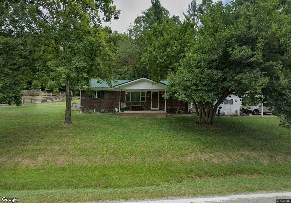
9097 State Route 243 South Point, OH 45680
Estimated Value: $78,000 - $166,000
3
Beds
1
Bath
1,232
Sq Ft
$103/Sq Ft
Est. Value
About This Home
This home is located at 9097 State Route 243, South Point, OH 45680 and is currently estimated at $126,316, approximately $102 per square foot. 9097 State Route 243 is a home located in Lawrence County with nearby schools including Dawson-Bryant Elementary School, Dawson-Bryant Middle School, and Dawson-Bryant High School.
Ownership History
Date
Name
Owned For
Owner Type
Purchase Details
Closed on
Sep 22, 2022
Sold by
Ramsey Roger D
Bought by
Tax Ease Ohio V Llc
Current Estimated Value
Purchase Details
Closed on
Dec 21, 2021
Sold by
Ramey Roger D
Bought by
Tax Ease Oh V Llc
Purchase Details
Closed on
Mar 11, 2004
Sold by
Powell Karen S
Bought by
Ramey Roger D and Ramey Melis
Purchase Details
Closed on
Nov 19, 1999
Sold by
Powell Galen Lee and Powell Karen
Bought by
Powell Karen S
Create a Home Valuation Report for This Property
The Home Valuation Report is an in-depth analysis detailing your home's value as well as a comparison with similar homes in the area
Home Values in the Area
Average Home Value in this Area
Purchase History
| Date | Buyer | Sale Price | Title Company |
|---|---|---|---|
| Tax Ease Ohio V Llc | $811 | -- | |
| Tax Ease Oh V Llc | $4,335 | None Listed On Document | |
| Ramey Roger D | $75,000 | -- | |
| Powell Karen S | -- | -- |
Source: Public Records
Tax History Compared to Growth
Tax History
| Year | Tax Paid | Tax Assessment Tax Assessment Total Assessment is a certain percentage of the fair market value that is determined by local assessors to be the total taxable value of land and additions on the property. | Land | Improvement |
|---|---|---|---|---|
| 2024 | -- | $27,030 | $3,470 | $23,560 |
| 2023 | $773 | $27,030 | $3,470 | $23,560 |
| 2022 | $772 | $27,030 | $3,470 | $23,560 |
| 2021 | $649 | $22,590 | $3,280 | $19,310 |
| 2020 | $665 | $22,590 | $3,280 | $19,310 |
| 2019 | $662 | $22,590 | $3,280 | $19,310 |
| 2018 | $657 | $22,150 | $3,220 | $18,930 |
| 2017 | $656 | $22,150 | $3,220 | $18,930 |
| 2016 | $606 | $22,150 | $3,220 | $18,930 |
| 2015 | $596 | $20,970 | $3,230 | $17,740 |
| 2014 | $588 | $20,970 | $3,230 | $17,740 |
| 2013 | $588 | $20,970 | $3,230 | $17,740 |
Source: Public Records
Map
Nearby Homes
- 9040 Ohio 243
- 66 County Road 30
- 6881 State Route 243
- 1122 Township Road 266
- 1122 Township Road 266
- 3493 County Road 31
- 66 Township Road 1523
- 3171 County Road 31
- 25 Township Road 1524
- 3569 County Road 6
- 4404 County Road 15
- 6757 County Road 15
- 71 Private Dr
- 6897 County Road 15
- 859 County Road 53
- 885 County Road 53
- 00 Township Road 219 N
- 1334 McKinney Creek-Hesson Hollow Rd N
- 1334 Township Road 214th N
- 7428 County Road 15
- 9088 State Route 243
- 9164 State Route 243
- 8969 State Route 243
- 9247 State Route 243
- 9287 State Route 243
- 8881 State Route 243
- 9301 State Route 243
- 9317 State Route 243
- 8829 State Route 243
- 8902 State Route 243
- 4036 County Road 55
- 4014 County Road 55
- 4113 County Road 55
- 3954 County Road 55
- 4091 County Road 55
- 203 Private Road 1653 Unit 17
- 8754 State Route 243
- 3943 County Road 55
- 9466 State Route 243
- 22 Private Road 1653 Unit 17