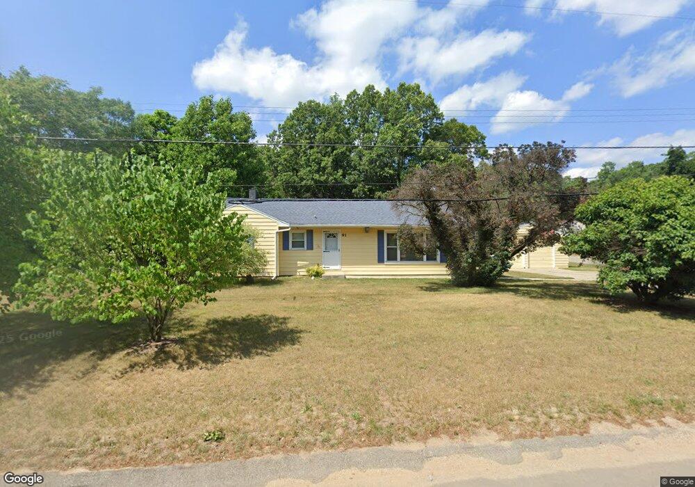
91 6 Mile Rd NE Comstock Park, MI 49321
Estimated Value: $270,000 - $336,000
3
Beds
1
Bath
1
Sq Ft
$312,734/Sq Ft
Est. Value
About This Home
This home is located at 91 6 Mile Rd NE, Comstock Park, MI 49321 and is currently estimated at $312,734, approximately $312,734 per square foot. 91 6 Mile Rd NE is a home located in Kent County with nearby schools including Stoney Creek Elementary School, Pine Island Elementary School, and Mill Creek Middle School.
Ownership History
Date
Name
Owned For
Owner Type
Purchase Details
Closed on
Aug 18, 2025
Sold by
Anderson Connie
Bought by
Anderson Nathan J and Anderson Nicholas
Current Estimated Value
Home Financials for this Owner
Home Financials are based on the most recent Mortgage that was taken out on this home.
Original Mortgage
$157,500
Outstanding Balance
$156,952
Interest Rate
5.86%
Mortgage Type
New Conventional
Estimated Equity
$155,782
Purchase Details
Closed on
Apr 19, 1990
Bought by
Anderson Connie and Anderson Connie
Create a Home Valuation Report for This Property
The Home Valuation Report is an in-depth analysis detailing your home's value as well as a comparison with similar homes in the area
Home Values in the Area
Average Home Value in this Area
Purchase History
| Date | Buyer | Sale Price | Title Company |
|---|---|---|---|
| Anderson Nathan J | $262,500 | None Listed On Document | |
| Anderson Connie | $70,500 | -- |
Source: Public Records
Mortgage History
| Date | Status | Borrower | Loan Amount |
|---|---|---|---|
| Open | Anderson Nathan J | $157,500 |
Source: Public Records
Tax History Compared to Growth
Tax History
| Year | Tax Paid | Tax Assessment Tax Assessment Total Assessment is a certain percentage of the fair market value that is determined by local assessors to be the total taxable value of land and additions on the property. | Land | Improvement |
|---|---|---|---|---|
| 2025 | $1,956 | $148,600 | $0 | $0 |
| 2024 | $1,956 | $146,000 | $0 | $0 |
| 2023 | $1,869 | $129,500 | $0 | $0 |
| 2022 | $2,246 | $94,400 | $0 | $0 |
| 2021 | $2,185 | $95,900 | $0 | $0 |
| 2020 | $1,716 | $76,900 | $0 | $0 |
| 2019 | $2,131 | $76,900 | $0 | $0 |
| 2018 | $2,087 | $73,000 | $0 | $0 |
| 2017 | $2,033 | $64,200 | $0 | $0 |
| 2016 | $1,966 | $61,900 | $0 | $0 |
| 2015 | $1,964 | $61,900 | $0 | $0 |
| 2013 | -- | $58,000 | $0 | $0 |
Source: Public Records
Map
Nearby Homes
- 72 6 Mile Rd NE
- 33 Star Gazer Ln NE
- 5090 Wakefield Ave NE
- 4893 Stony Creek Ave NW
- 578 Melissa Ct NE
- 5105 Wallingford Dr NW
- 5621 Pine Island Dr NE
- 5819 Grand Oaks Dr NE
- 446 Windchime Dr
- 4422 Division Ave N
- 4678 Westshire Dr NW
- 681 Strawberry Valley Ave NW Unit 7
- 5702 Comstock Park Dr NW
- 452 Springfield St NW
- 266 7 Mile Rd NW
- 4581 Westshire Dr NW
- 980 River Rock Dr NE
- 510 Clark St NW
- 996 Scioto Dr NW Unit 1
- Wilshire Plan at The Range
- 105 6 Mile Rd NE
- 5228 Larkin Ave NE
- 84 6 Mile Rd NE
- 5238 Larkin Ave NE
- 5251 Larkin Ave NE
- 49 6 Mile Rd NE
- 66 6 Mile Rd NE
- 5248 Larkin Ave NE
- 111 6 Mile Rd NE
- 5263 Larkin Ave NE
- 5256 Larkin Ave NE
- 47 6 Mile Rd NE
- 114 6 Mile Rd NE
- 5266 Larkin Ave NE
- 5273 Larkin Ave NE
- 40 6 Mile Rd NE
- 5276 Larkin Ave NE
- 5283 Larkin Ave NE
- 52 6 Mile Rd NE
- 5286 Larkin Ave NE