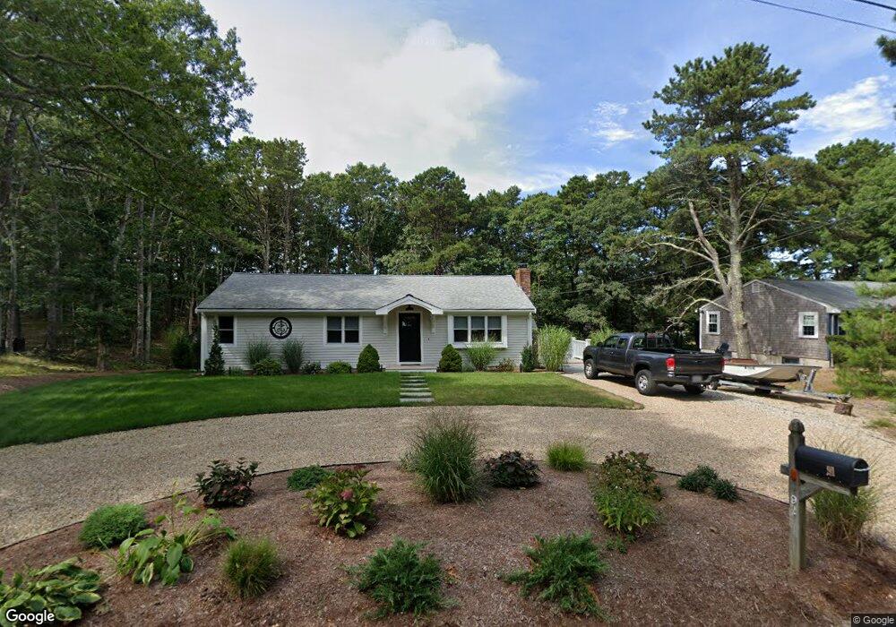
91 Acorn Rd Dennis, MA 02638
East Dennis NeighborhoodEstimated Value: $523,731 - $610,000
3
Beds
2
Baths
1,056
Sq Ft
$528/Sq Ft
Est. Value
About This Home
This home is located at 91 Acorn Rd, Dennis, MA 02638 and is currently estimated at $557,183, approximately $527 per square foot. 91 Acorn Rd is a home located in Barnstable County with nearby schools including Dennis-Yarmouth Regional High School and Latham School.
Ownership History
Date
Name
Owned For
Owner Type
Purchase Details
Closed on
Jun 9, 2023
Sold by
Silk Ann Est and Silk
Bought by
Silk Michael T and Silk Eileen M
Current Estimated Value
Purchase Details
Closed on
Aug 25, 1993
Sold by
Silk Arthur T and Silk Mildred T
Bought by
Silk Ann
Home Financials for this Owner
Home Financials are based on the most recent Mortgage that was taken out on this home.
Original Mortgage
$65,600
Interest Rate
7.06%
Mortgage Type
Purchase Money Mortgage
Create a Home Valuation Report for This Property
The Home Valuation Report is an in-depth analysis detailing your home's value as well as a comparison with similar homes in the area
Home Values in the Area
Average Home Value in this Area
Purchase History
| Date | Buyer | Sale Price | Title Company |
|---|---|---|---|
| Silk Michael T | $340,000 | None Available | |
| Silk Ann | $82,000 | -- |
Source: Public Records
Mortgage History
| Date | Status | Borrower | Loan Amount |
|---|---|---|---|
| Previous Owner | Silk Ann | $51,000 | |
| Previous Owner | Silk Ann | $65,600 |
Source: Public Records
Tax History Compared to Growth
Tax History
| Year | Tax Paid | Tax Assessment Tax Assessment Total Assessment is a certain percentage of the fair market value that is determined by local assessors to be the total taxable value of land and additions on the property. | Land | Improvement |
|---|---|---|---|---|
| 2025 | $2,128 | $491,400 | $149,000 | $342,400 |
| 2024 | $1,995 | $454,400 | $143,300 | $311,100 |
| 2023 | $1,929 | $413,100 | $130,200 | $282,900 |
| 2022 | $1,906 | $340,300 | $130,400 | $209,900 |
| 2021 | $1,816 | $301,200 | $127,800 | $173,400 |
| 2020 | $1,739 | $285,000 | $127,800 | $157,200 |
| 2019 | $2,712 | $265,000 | $125,300 | $139,700 |
| 2018 | $1,486 | $234,400 | $107,400 | $127,000 |
| 2017 | $2,438 | $230,300 | $107,400 | $122,900 |
| 2016 | $1,348 | $206,400 | $119,300 | $87,100 |
| 2015 | $1,321 | $206,400 | $119,300 | $87,100 |
| 2014 | $1,213 | $191,000 | $119,300 | $71,700 |
Source: Public Records
Map
Nearby Homes
- 15 Trudy Cir
- 61 Barque Cir
- 32 Captain Walsh Dr
- 102 Prince Way
- 21 Compass Ln
- 25 Ronda Ln
- 55 Monument View Rd
- 1706 Route 6a Unit 3
- 4 Landing Ln
- 1706 Massachusetts 6a Unit 3
- 15 Captain Jud Rd
- 102 Wildwood Rd
- 6 Match Point
- 4 Maureens Way
- 16 Uncle Stanleys Way
- 11 Uncle Stanleys Way
- 1376 Bridge St Unit 16
- 88 Whiffletree Ave
- 92 Whiffletree Ave