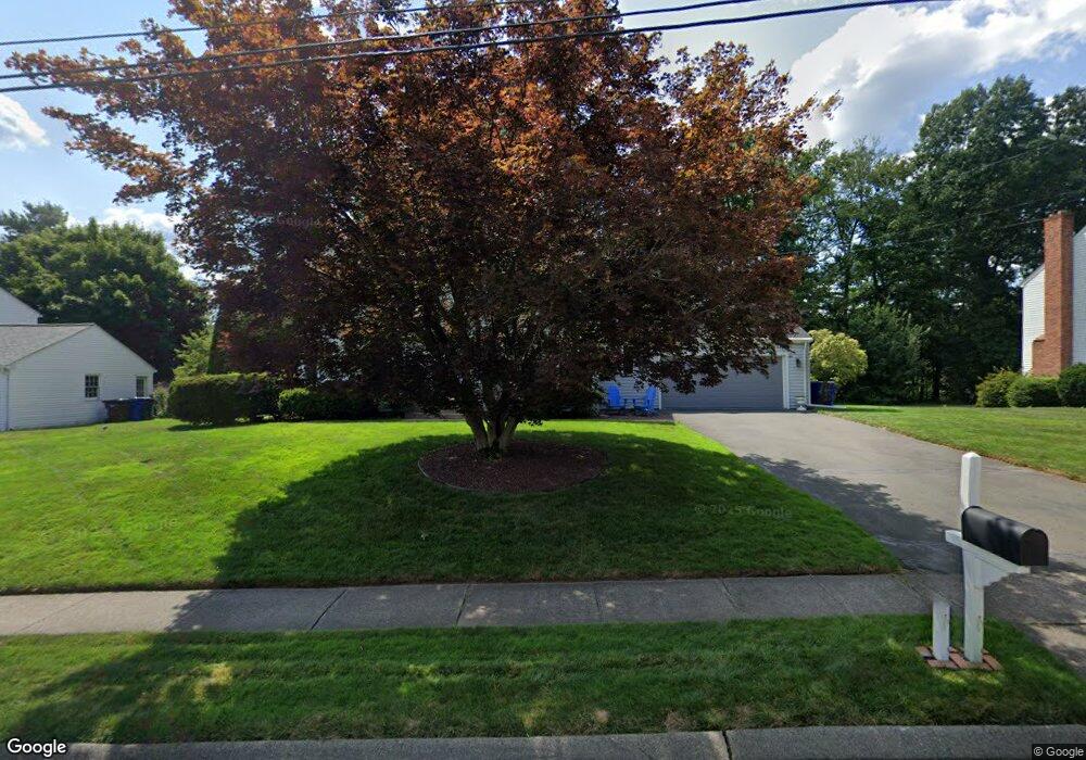
91 Apple Hill Wethersfield, CT 06109
Estimated Value: $553,000 - $595,000
4
Beds
3
Baths
2,216
Sq Ft
$261/Sq Ft
Est. Value
About This Home
This home is located at 91 Apple Hill, Wethersfield, CT 06109 and is currently estimated at $577,720, approximately $260 per square foot. 91 Apple Hill is a home located in Hartford County with nearby schools including Samuel B. Webb Elementary School, Silas Deane Middle School, and Wethersfield High School.
Ownership History
Date
Name
Owned For
Owner Type
Purchase Details
Closed on
Jul 17, 2012
Sold by
Alamprese Keith
Bought by
Alamprese Keith and Alamprese Elieen
Current Estimated Value
Home Financials for this Owner
Home Financials are based on the most recent Mortgage that was taken out on this home.
Original Mortgage
$309,000
Outstanding Balance
$214,205
Interest Rate
3.76%
Estimated Equity
$363,515
Purchase Details
Closed on
Dec 29, 2006
Sold by
Vaughn John F and Shaughnessy Colleen
Bought by
Alamprese Keith
Home Financials for this Owner
Home Financials are based on the most recent Mortgage that was taken out on this home.
Original Mortgage
$292,000
Interest Rate
6.29%
Purchase Details
Closed on
Nov 30, 1999
Sold by
Paly Katherine
Bought by
Voughn John F and Voughn Colleen S
Create a Home Valuation Report for This Property
The Home Valuation Report is an in-depth analysis detailing your home's value as well as a comparison with similar homes in the area
Home Values in the Area
Average Home Value in this Area
Purchase History
| Date | Buyer | Sale Price | Title Company |
|---|---|---|---|
| Alamprese Keith | -- | -- | |
| Alamprese Keith | $365,000 | -- | |
| Voughn John F | $263,000 | -- |
Source: Public Records
Mortgage History
| Date | Status | Borrower | Loan Amount |
|---|---|---|---|
| Open | Voughn John F | $309,000 | |
| Previous Owner | Voughn John F | $292,000 | |
| Previous Owner | Voughn John F | $36,500 | |
| Previous Owner | Voughn John F | $204,000 |
Source: Public Records
Tax History
| Year | Tax Paid | Tax Assessment Tax Assessment Total Assessment is a certain percentage of the fair market value that is determined by local assessors to be the total taxable value of land and additions on the property. | Land | Improvement |
|---|---|---|---|---|
| 2025 | $13,618 | $330,380 | $105,560 | $224,820 |
| 2024 | $9,692 | $224,240 | $86,430 | $137,810 |
| 2023 | $9,369 | $224,240 | $86,430 | $137,810 |
| 2022 | $9,212 | $224,240 | $86,430 | $137,810 |
| 2021 | $9,120 | $224,240 | $86,430 | $137,810 |
| 2020 | $9,404 | $231,120 | $86,430 | $144,690 |
| 2019 | $9,136 | $224,240 | $86,430 | $137,810 |
| 2018 | $8,409 | $206,200 | $79,300 | $126,900 |
| 2017 | $8,201 | $206,200 | $79,300 | $126,900 |
| 2016 | $7,947 | $206,200 | $79,300 | $126,900 |
| 2015 | $7,875 | $206,200 | $79,300 | $126,900 |
| 2014 | $7,576 | $206,200 | $79,300 | $126,900 |
Source: Public Records
Map
Nearby Homes
- 62 Harold Dr
- 76 Luca Lane Homesite 8
- 61 Luca Ln
- 8 Stella Dr
- 6 Vinnie Dr
- 378 Cypress Rd
- 5 Robeth Ln
- 229 Cottonwood Rd Unit 229
- 101 Collier Rd
- 0 Collier Rd
- 7 Barrington Dr Unit C
- 98 Crown Ridge
- 508 Highland St
- 155 Old Common Rd
- 15 Woodsedge Dr Unit 5C
- 35 Woodsedge Dr Unit 4C
- 32 Flagler St
- 417 Churchill Dr Unit 417
- 104 Willow St
- 144 Churchill Dr
- 99 Apple Hill
- 60 Black Birch Rd
- 52 Black Birch Rd
- 68 Black Birch Rd
- 107 Apple Hill
- 75 Apple Hill
- 96 Apple Hill
- 88 Apple Hill
- 44 Black Birch Rd
- 76 Black Birch Rd
- 104 Apple Hill
- 78 Apple Hill
- 115 Apple Hill
- 67 Apple Hill
- 112 Apple Hill
- 34 Black Birch Rd
- 84 Black Birch Rd
- 70 Apple Hill
- 63 Black Birch Rd
- 55 Black Birch Rd
Your Personal Tour Guide
Ask me questions while you tour the home.