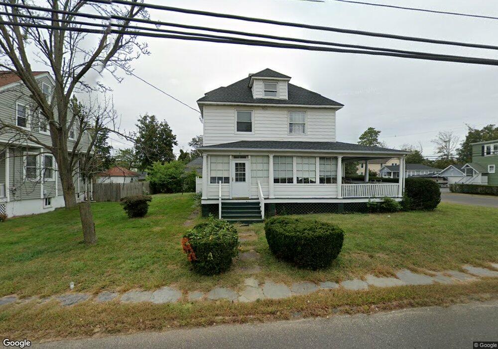
91 Atlantic Ave Long Branch, NJ 07740
Estimated Value: $486,000 - $738,000
5
Beds
2
Baths
2,300
Sq Ft
$285/Sq Ft
Est. Value
About This Home
This home is located at 91 Atlantic Ave, Long Branch, NJ 07740 and is currently estimated at $655,860, approximately $285 per square foot. 91 Atlantic Ave is a home located in Monmouth County with nearby schools including Long Branch High School and Holy Trinity School.
Ownership History
Date
Name
Owned For
Owner Type
Purchase Details
Closed on
Dec 16, 2016
Sold by
Byrne John L and Byrne Nancy
Bought by
Byrne John L
Current Estimated Value
Home Financials for this Owner
Home Financials are based on the most recent Mortgage that was taken out on this home.
Original Mortgage
$225,000
Outstanding Balance
$183,999
Interest Rate
3.94%
Mortgage Type
New Conventional
Estimated Equity
$471,861
Purchase Details
Closed on
May 2, 2005
Sold by
Estate Of Janet V Blizard
Bought by
Byrne John L and Byrne Nancy
Home Financials for this Owner
Home Financials are based on the most recent Mortgage that was taken out on this home.
Original Mortgage
$359,650
Interest Rate
4.62%
Mortgage Type
Adjustable Rate Mortgage/ARM
Create a Home Valuation Report for This Property
The Home Valuation Report is an in-depth analysis detailing your home's value as well as a comparison with similar homes in the area
Home Values in the Area
Average Home Value in this Area
Purchase History
| Date | Buyer | Sale Price | Title Company |
|---|---|---|---|
| Byrne John L | $225,000 | None Available | |
| Byrne John L | $475,000 | -- |
Source: Public Records
Mortgage History
| Date | Status | Borrower | Loan Amount |
|---|---|---|---|
| Open | Byrne John L | $225,000 | |
| Previous Owner | Byrne John L | $359,650 |
Source: Public Records
Tax History Compared to Growth
Tax History
| Year | Tax Paid | Tax Assessment Tax Assessment Total Assessment is a certain percentage of the fair market value that is determined by local assessors to be the total taxable value of land and additions on the property. | Land | Improvement |
|---|---|---|---|---|
| 2025 | $8,105 | $621,600 | $311,600 | $310,000 |
| 2024 | $7,591 | $527,300 | $230,800 | $296,500 |
| 2023 | $7,591 | $488,800 | $205,800 | $283,000 |
| 2022 | $7,580 | $425,000 | $175,700 | $249,300 |
| 2021 | $7,580 | $378,800 | $145,700 | $233,100 |
| 2020 | $7,764 | $371,500 | $139,700 | $231,800 |
| 2019 | $7,372 | $350,700 | $129,700 | $221,000 |
| 2018 | $6,915 | $327,100 | $125,700 | $201,400 |
| 2017 | $6,517 | $316,200 | $118,700 | $197,500 |
| 2016 | $7,336 | $318,100 | $125,700 | $192,400 |
| 2015 | $6,040 | $271,200 | $99,800 | $171,400 |
| 2014 | $5,684 | $269,000 | $116,900 | $152,100 |
Source: Public Records
Map
Nearby Homes
- 381 Long Branch Ave
- 9 Manahassett Park Dr
- 154 Atlantic Ave
- 50 Valentine St Unit 27A
- 50 Valentine St Unit 22A
- 50 Valentine St Unit 12B
- 432 Ocean Blvd N Unit 506
- 432 Ocean Blvd N Unit 315
- 8 Ocean Ave
- 43 Valentine St
- 164 Airsdale Ave
- 172 Chelton Ave
- 138 Rosewood Ave
- 17 Riviera Dr
- 323 Florence Ave
- 188 Chelton Ave
- 165 Kingsley St
- 422 Ocean Blvd N Unit 5H
- 16 Shore Dr
- 392 Florence Ave
- 95 Atlantic Ave
- 95 Atlantic Ave Unit SUMMER
- 95 Atlantic Ave Unit ANNUAL
- 409 West St
- 458 West St
- 89 Atlantic Ave
- 97 Atlantic Ave
- 457 West St
- 464 West St
- 99-2 Atlantic Ave
- 99-2 Atlantic Ave Unit 99 Atlantic - 2 Upst
- 99 Atlantic Ave Unit 1 - Downstairs
- 99 Atlantic Ave
- 99 Atlantic Ave
- 99 Atlantic Ave Unit 2
- 459 West St
- 85 Atlantic Ave
- 468 West St
- 90 Atlantic Ave
- 92 Atlantic Ave