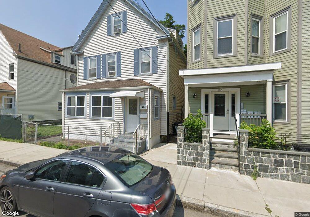
91 Clarkson St Dorchester, MA 02125
Bowdoin North-Mount Bowdoin NeighborhoodEstimated Value: $743,254 - $884,000
6
Beds
2
Baths
2,520
Sq Ft
$320/Sq Ft
Est. Value
About This Home
This home is located at 91 Clarkson St, Dorchester, MA 02125 and is currently estimated at $806,564, approximately $320 per square foot. 91 Clarkson St is a home located in Suffolk County with nearby schools including UP Academy Charter School of Dorchester and Uncommon Schools Roxbury Prep Dorchester Campus.
Ownership History
Date
Name
Owned For
Owner Type
Purchase Details
Closed on
Jun 8, 1994
Sold by
Dime Sb Ny
Bought by
Lida Holdings Corp
Current Estimated Value
Purchase Details
Closed on
Dec 1, 1988
Sold by
Flaherty Carol A
Bought by
Hill Edward R
Create a Home Valuation Report for This Property
The Home Valuation Report is an in-depth analysis detailing your home's value as well as a comparison with similar homes in the area
Home Values in the Area
Average Home Value in this Area
Purchase History
| Date | Buyer | Sale Price | Title Company |
|---|---|---|---|
| Lida Holdings Corp | $40,000 | -- | |
| Hill Edward R | $134,900 | -- |
Source: Public Records
Mortgage History
| Date | Status | Borrower | Loan Amount |
|---|---|---|---|
| Open | Hill Edward R | $60,000 | |
| Previous Owner | Hill Edward R | $128,000 | |
| Previous Owner | Hill Edward R | $16,080 |
Source: Public Records
Tax History Compared to Growth
Tax History
| Year | Tax Paid | Tax Assessment Tax Assessment Total Assessment is a certain percentage of the fair market value that is determined by local assessors to be the total taxable value of land and additions on the property. | Land | Improvement |
|---|---|---|---|---|
| 2025 | $6,709 | $579,400 | $172,700 | $406,700 |
| 2024 | $5,641 | $517,500 | $168,100 | $349,400 |
| 2023 | $5,293 | $492,800 | $160,100 | $332,700 |
| 2022 | $4,921 | $452,300 | $146,900 | $305,400 |
| 2021 | $4,553 | $426,700 | $138,600 | $288,100 |
| 2020 | $4,126 | $390,700 | $130,800 | $259,900 |
| 2019 | $3,922 | $372,100 | $97,100 | $275,000 |
| 2018 | $3,483 | $332,300 | $97,100 | $235,200 |
| 2017 | $3,350 | $316,300 | $97,100 | $219,200 |
| 2016 | $3,192 | $290,200 | $97,100 | $193,100 |
| 2015 | $2,825 | $233,300 | $85,800 | $147,500 |
| 2014 | $2,618 | $208,100 | $85,800 | $122,300 |
Source: Public Records
Map
Nearby Homes
- 70-72 Clarkson St
- 70 Hamilton St
- 76 Bellevue St
- 51 Hamilton St Unit 3
- 52 Bellevue St Unit 1
- 52 Bellevue St Unit 3
- 52 Bellevue St Unit 2
- 1 Rock Terrace Unit 1
- 1 Rock Terrace Unit 3
- 60 Stanley St Unit 301
- 60 Stanley St Unit 302
- 60 Stanley St
- 60 Stanley St Unit 101
- 35-37 Clarkson St
- 1 Dever St
- 19 Mount Ida Rd
- 53 Mount Ida Rd Unit 1
- 139 Bowdoin St
- 69 Mount Ida Rd Unit 1
- 22 Ronan St
- 91 Clarkson St Unit 2
- 89 Clarkson St
- 89 Clarkson St Unit 2
- 93 Clarkson St
- 93 Hamilton St
- 89 Hamilton St
- 94 Clarkson St
- 96 Clarkson St
- 101 Hamilton St Unit 103
- 101 Hamilton St Unit 101
- 87 Hamilton St
- 101-103 Hamilton St
- 105 Hamilton St
- 85 Hamilton St
- 26 Norton St
- 28 Norton St
- 22 Norton St
- 22 Norton St Unit 3
- 18 Norton St
- 106 Clarkson St