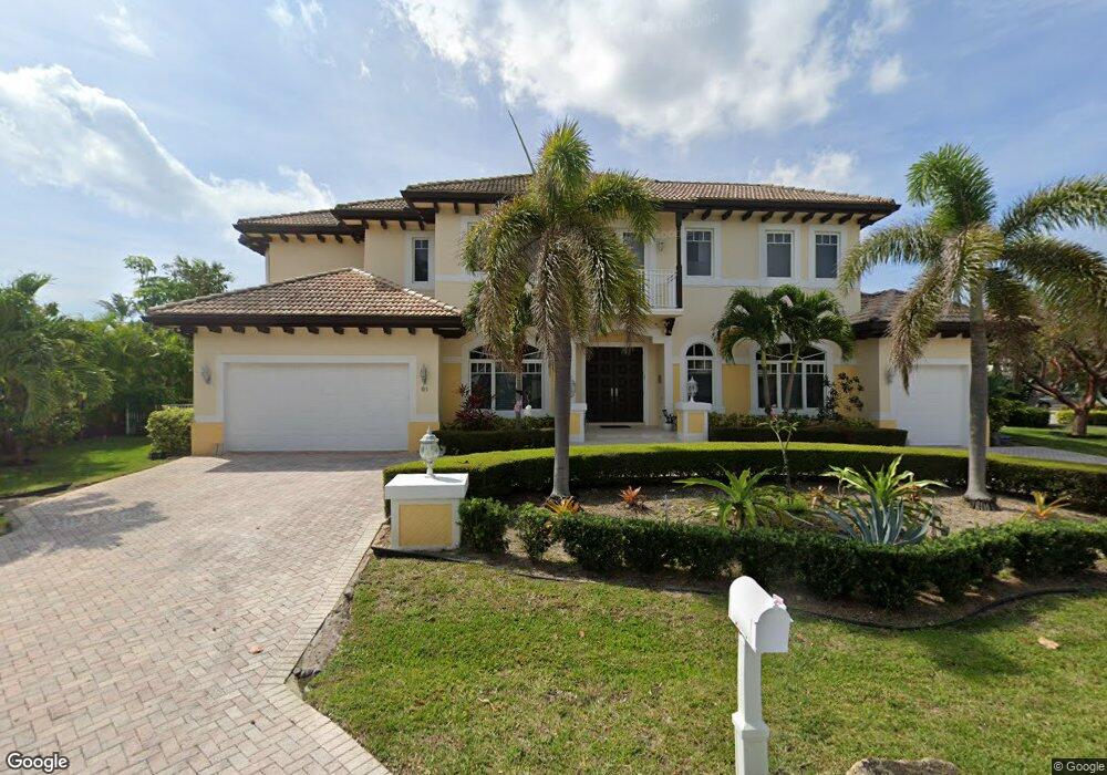
91 Island Dr S Boynton Beach, FL 33435
Estimated Value: $4,298,966 - $5,406,000
4
Beds
5
Baths
4,495
Sq Ft
$1,101/Sq Ft
Est. Value
About This Home
This home is located at 91 Island Dr S, Boynton Beach, FL 33435 and is currently estimated at $4,950,742, approximately $1,101 per square foot. 91 Island Dr S is a home located in Palm Beach County with nearby schools including Rolling Green Elementary School, Boynton Beach Community High School, and Lantana Middle School.
Ownership History
Date
Name
Owned For
Owner Type
Purchase Details
Closed on
Dec 16, 2005
Sold by
Hennigan Neil and Hennigan Zoanne R
Bought by
Hennigan Edward Neil
Current Estimated Value
Purchase Details
Closed on
May 29, 2002
Sold by
Hennigan Neil and Hennigan Zoanne R
Bought by
Hennigan Neil
Purchase Details
Closed on
May 28, 2002
Sold by
Krich Bonnie B and Krich Jeffrey S
Bought by
Hennigan Neil
Purchase Details
Closed on
Jul 1, 1999
Sold by
Thomas Sheila B and Thomas Dyer
Bought by
Brittingham James L
Create a Home Valuation Report for This Property
The Home Valuation Report is an in-depth analysis detailing your home's value as well as a comparison with similar homes in the area
Home Values in the Area
Average Home Value in this Area
Purchase History
| Date | Buyer | Sale Price | Title Company |
|---|---|---|---|
| Hennigan Edward Neil | -- | -- | |
| Hennigan Neil | -- | -- | |
| Hennigan Neil | $1,765,000 | -- | |
| Brittingham James L | $350,000 | -- |
Source: Public Records
Tax History Compared to Growth
Tax History
| Year | Tax Paid | Tax Assessment Tax Assessment Total Assessment is a certain percentage of the fair market value that is determined by local assessors to be the total taxable value of land and additions on the property. | Land | Improvement |
|---|---|---|---|---|
| 2024 | $29,007 | $1,622,856 | -- | -- |
| 2023 | $28,362 | $1,575,588 | $0 | $0 |
| 2022 | $28,284 | $1,529,697 | $0 | $0 |
| 2021 | $28,207 | $1,485,143 | $0 | $0 |
| 2020 | $27,836 | $1,464,638 | $0 | $0 |
| 2019 | $27,776 | $1,431,709 | $0 | $0 |
| 2018 | $26,223 | $1,405,014 | $0 | $0 |
| 2017 | $25,925 | $1,376,116 | $0 | $0 |
| 2016 | $26,138 | $1,347,812 | $0 | $0 |
| 2015 | $26,752 | $1,338,443 | $0 | $0 |
| 2014 | $26,806 | $1,327,820 | $0 | $0 |
Source: Public Records
Map
Nearby Homes
- 3 Sabal Island Dr
- 81 Island Dr S
- 18 Sabal Island Dr
- 6711 N Ocean Blvd Unit 130
- 6885 N Ocean Blvd Unit 1040
- 6885 N Ocean Blvd Unit 3040
- 33 Spanish River Dr
- 6665 N Ocean Blvd Unit B1
- 720 Mariners Way
- 718 NE 12th Terrace Unit 4
- 662 Mariners Way
- 732 Rider Rd
- 620 NE 15th Place
- 634 Ocean Inlet Dr
- 1820 New Palm Way Unit 402
- 1820 New Palm Way Unit 306
- 1820 New Palm Way Unit 202
- 7 Via Lago
- 626 Mariners Way
- 6590 N Ocean Blvd Unit 30
- 90 Island Dr S
- 92 Island Dr S
- 92 92 Island Dr
- 99 Island Dr S
- 98 Island Dr S
- 89 Island Dr S
- 95 Island Dr S
- 97 Island Dr S
- 100 Island Dr S
- 94 Island Dr S
- 88 Island Dr S
- 2 Sabal Island Dr
- 101 Island Dr S
- 4 Sabal Island Dr
- 1 Sabal Island Dr
- 104 Bonito Dr
- 5 Sabal Island Dr
- 101 Bonito Dr
- 103 Bonito Dr
- 102 Bonito Dr