Estimated Value: $143,592 - $165,000
Studio
2
Baths
1,224
Sq Ft
$129/Sq Ft
Est. Value
About This Home
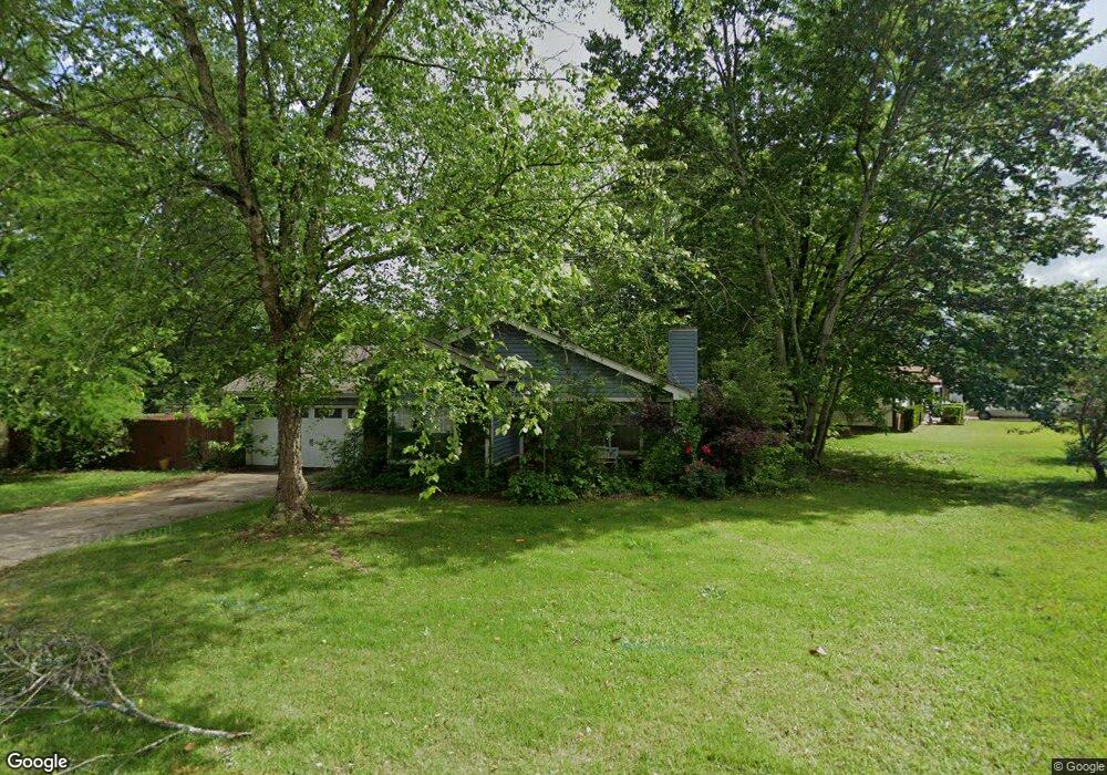
This home is located at 91 Pheasant Run Dr, Cabot, AR 72023 and is currently estimated at $157,898, approximately $129 per square foot. 91 Pheasant Run Dr is a home located in Lonoke County with nearby schools including Westside Elementary School, Cabot Junior High South, and Cabot Middle School South.
Ownership History
Date
Name
Owned For
Owner Type
Purchase Details
Closed on
Sep 2, 2011
Sold by
Polantz Robert J and Polantz May Lee
Bought by
Polantz David J and Polantz Daniel E
Current Estimated Value
Purchase Details
Closed on
Aug 31, 2011
Sold by
Polantz Robert J and Polantz May Lee
Bought by
Polantz David J and Polantz Daniel E
Purchase Details
Closed on
Jul 25, 1995
Bought by
Polantz
Purchase Details
Closed on
Feb 14, 1994
Bought by
Polantz and Polantz May
Purchase Details
Closed on
Jul 21, 1986
Bought by
Heckmaster
Purchase Details
Closed on
Feb 21, 1986
Bought by
Fisk Const
Create a Home Valuation Report for This Property
The Home Valuation Report is an in-depth analysis detailing your home's value as well as a comparison with similar homes in the area
Purchase History
| Date | Buyer | Sale Price | Title Company |
|---|---|---|---|
| Polantz David J | -- | -- | |
| Polantz David J | -- | -- | |
| Polantz | -- | -- | |
| Polantz | $56,000 | -- | |
| Polantz | $56,000 | -- | |
| Heckmaster | $56,000 | -- | |
| Fisk Const | $7,000 | -- |
Source: Public Records
Tax History
| Year | Tax Paid | Tax Assessment Tax Assessment Total Assessment is a certain percentage of the fair market value that is determined by local assessors to be the total taxable value of land and additions on the property. | Land | Improvement |
|---|---|---|---|---|
| 2025 | $440 | $16,990 | $2,000 | $14,990 |
| 2024 | $440 | $16,990 | $2,000 | $14,990 |
| 2023 | $440 | $16,990 | $2,000 | $14,990 |
| 2022 | $490 | $16,990 | $2,000 | $14,990 |
| 2021 | $490 | $16,990 | $2,000 | $14,990 |
| 2020 | $465 | $16,510 | $2,000 | $14,510 |
| 2019 | $465 | $16,510 | $2,000 | $14,510 |
| 2018 | $466 | $16,510 | $2,000 | $14,510 |
| 2017 | $758 | $16,510 | $2,000 | $14,510 |
| 2016 | $466 | $16,510 | $2,000 | $14,510 |
| 2015 | $541 | $18,040 | $2,000 | $16,040 |
| 2014 | $541 | $18,040 | $2,000 | $16,040 |
Source: Public Records
Map
Nearby Homes
- 20 Paige Ave
- 37 Saint John St
- 92 Sycamore Cir
- 49 Oak Meadows Dr
- 28 Pheasant Run Dr
- 00 Kerr Station Rd
- 12 Bellaire Dr
- 64 Saint John St
- 115 Rodney Guthrie Dr
- 51 Meadowlark Dr
- 57 Meadowlark Dr
- 30 Mcarthur Dr
- 51 Nevada Ln
- 16 Meadowlark Dr
- 34 Bent Tree Dr
- 39 Nevada Ln
- 35 Nevada Ln
- 40 Bent Tree Dr
- 408 Waymack Dr
- 509 E Myrtle St
- 54 Paige Ave
- 89 Pheasant Run Dr
- 0 Pheasant Run Dr
- 87 Pheasant Run Dr
- 52 Paige Ave
- 110 Pheasant Run Dr
- 112 Pheasant Run Dr
- 45 Paige Ave
- 85 Pheasant Run Dr
- 114 Pheasant Run Dr
- 50 Paige Ave
- 116 Pheasant Run Dr
- 83 Pheasant Run Dr
- 98 Pheasant Run Dr
- 1201 S 1st St
- 100 Pheasant Run Dr
- 1203 S 1st St
- 104 Pheasant Run Dr
- 102 Pheasant Run Dr
- 106 Pheasant Run Dr
Your Personal Tour Guide
Ask me questions while you tour the home.