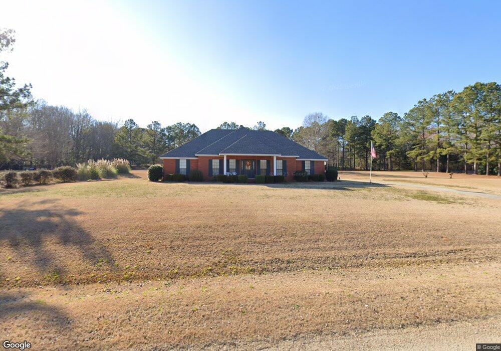
91 Richfield Ct Deatsville, AL 36022
Estimated Value: $279,000 - $308,000
--
Bed
1
Bath
2,052
Sq Ft
$142/Sq Ft
Est. Value
About This Home
This home is located at 91 Richfield Ct, Deatsville, AL 36022 and is currently estimated at $291,852, approximately $142 per square foot. 91 Richfield Ct is a home located in Elmore County with nearby schools including Coosada Elementary School, Airport Road Intermediate School, and Millbrook Middle Junior High School.
Ownership History
Date
Name
Owned For
Owner Type
Purchase Details
Closed on
Jul 20, 2023
Sold by
Davis James Donald and Davis Dora Helen
Bought by
Tarver Jesse Aaron and Tarver Marycolby
Current Estimated Value
Home Financials for this Owner
Home Financials are based on the most recent Mortgage that was taken out on this home.
Original Mortgage
$220,000
Outstanding Balance
$214,432
Interest Rate
6.69%
Mortgage Type
Credit Line Revolving
Estimated Equity
$77,420
Purchase Details
Closed on
May 29, 2018
Sold by
Davis James D and Davis Dora Helen
Bought by
Fleenor Donna Helene and Davis Susan Anita
Create a Home Valuation Report for This Property
The Home Valuation Report is an in-depth analysis detailing your home's value as well as a comparison with similar homes in the area
Home Values in the Area
Average Home Value in this Area
Purchase History
| Date | Buyer | Sale Price | Title Company |
|---|---|---|---|
| Tarver Jesse Aaron | $250,000 | None Listed On Document | |
| Fleenor Donna Helene | $184,000 | -- |
Source: Public Records
Mortgage History
| Date | Status | Borrower | Loan Amount |
|---|---|---|---|
| Open | Tarver Jesse Aaron | $220,000 |
Source: Public Records
Tax History Compared to Growth
Tax History
| Year | Tax Paid | Tax Assessment Tax Assessment Total Assessment is a certain percentage of the fair market value that is determined by local assessors to be the total taxable value of land and additions on the property. | Land | Improvement |
|---|---|---|---|---|
| 2024 | $704 | $23,220 | $0 | $0 |
| 2023 | $704 | $232,030 | $56,000 | $176,030 |
| 2022 | $0 | $18,324 | $5,600 | $12,724 |
| 2021 | $537 | $18,324 | $5,600 | $12,724 |
| 2020 | $537 | $18,324 | $5,600 | $12,724 |
| 2019 | $537 | $18,504 | $5,600 | $12,904 |
| 2018 | $0 | $17,890 | $5,600 | $12,290 |
| 2017 | $294 | $17,900 | $5,603 | $12,297 |
| 2016 | $537 | $17,890 | $5,600 | $12,290 |
| 2014 | -- | $184,100 | $56,000 | $128,100 |
Source: Public Records
Map
Nearby Homes
- 171 Harrison Hill Ct
- 227 Mcrae Rd
- 616 Maribeth Loop
- 61 Red Oak Dr
- 485 Kenner Creek Rd
- 307 Old Orchard Rd
- 20 Green Laurel Cove
- Parcel 2 White Tail Ridge
- 171 Pine Forest Dr
- 1 Ridgedale Ln Unit 2
- 31 Sunnydale Ct
- 279 Foxdale Rd
- 199 Summer Loop
- 701 Ridgedale Ln
- 143 Summer Loop
- 541 Summertime Pkwy
- 108 Foxdale Rd
- 318 Gardenia Rd
- 114 Honeysuckle Ct
- 143 Honeysuckle Ct
- 135 Richfield Ct
- 33 Richfield Ct
- 739 Myrick Rd
- 82 Richfield Ct
- 28 Richfield Ct
- 128 Richfield Ct
- 0 Myrick Rd
- 1372 Myrick Rd
- 776 Myrick Rd
- 800 Myrick Rd
- 685 Myrick Rd
- 193 Richfield Ct
- 752 Myrick Rd
- 850 Myrick Rd
- 89 Fieldcrest Ct
- 131 Fieldcrest Ct
- 190 Richfield Ct
- 31 Fieldcrest Ct
- 878 Myrick Rd
- 709 Myrick Rd