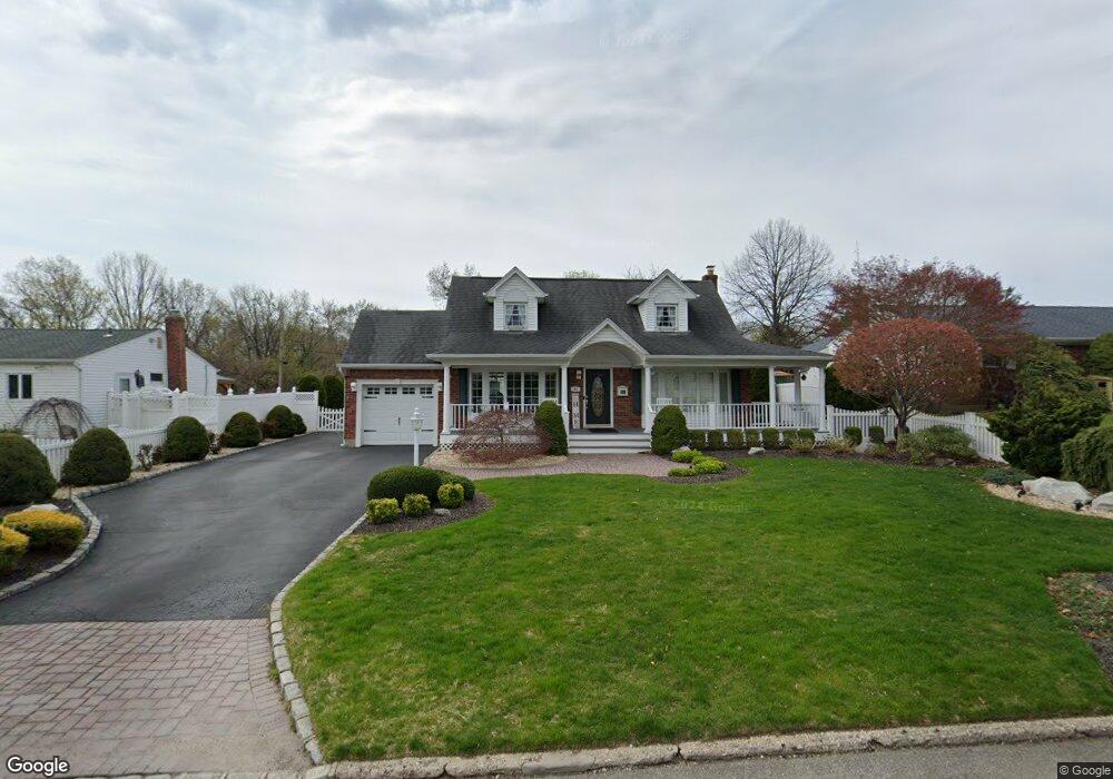
91 Roxbury Dr ComMacK, NY 11725
Estimated Value: $789,000 - $1,107,000
4
Beds
2
Baths
2,043
Sq Ft
$445/Sq Ft
Est. Value
About This Home
This home is located at 91 Roxbury Dr, ComMacK, NY 11725 and is currently estimated at $908,171, approximately $444 per square foot. 91 Roxbury Dr is a home located in Suffolk County with nearby schools including Commack Middle School and Commack High School.
Ownership History
Date
Name
Owned For
Owner Type
Purchase Details
Closed on
Nov 20, 2017
Sold by
James Donald and Obrien Roslyn L
Bought by
Bifulco Kathryn and Bifulco Frank
Current Estimated Value
Home Financials for this Owner
Home Financials are based on the most recent Mortgage that was taken out on this home.
Original Mortgage
$330,000
Outstanding Balance
$270,262
Interest Rate
3.88%
Mortgage Type
Purchase Money Mortgage
Estimated Equity
$637,909
Purchase Details
Closed on
Oct 20, 2000
Sold by
Bigus Dolores Picciano and Picciano Peter Francis
Bought by
James Donald and Obrien Roslyn L
Home Financials for this Owner
Home Financials are based on the most recent Mortgage that was taken out on this home.
Original Mortgage
$210,000
Interest Rate
7.83%
Create a Home Valuation Report for This Property
The Home Valuation Report is an in-depth analysis detailing your home's value as well as a comparison with similar homes in the area
Home Values in the Area
Average Home Value in this Area
Purchase History
| Date | Buyer | Sale Price | Title Company |
|---|---|---|---|
| Bifulco Kathryn | $560,000 | -- | |
| James Donald | $263,000 | -- |
Source: Public Records
Mortgage History
| Date | Status | Borrower | Loan Amount |
|---|---|---|---|
| Open | Bifulco Kathryn | $330,000 | |
| Previous Owner | James Donald | $210,000 |
Source: Public Records
Tax History
| Year | Tax Paid | Tax Assessment Tax Assessment Total Assessment is a certain percentage of the fair market value that is determined by local assessors to be the total taxable value of land and additions on the property. | Land | Improvement |
|---|---|---|---|---|
| 2024 | $15,932 | $6,082 | $300 | $5,782 |
| 2023 | $15,932 | $6,082 | $300 | $5,782 |
| 2022 | $9,687 | $6,082 | $300 | $5,782 |
| 2021 | $9,687 | $6,082 | $300 | $5,782 |
| 2020 | $15,299 | $6,082 | $300 | $5,782 |
| 2019 | $15,299 | $0 | $0 | $0 |
| 2018 | $0 | $6,082 | $300 | $5,782 |
| 2017 | $3,064 | $6,082 | $300 | $5,782 |
| 2016 | $8,136 | $5,782 | $300 | $5,482 |
| 2015 | -- | $5,782 | $300 | $5,482 |
| 2014 | -- | $5,782 | $300 | $5,482 |
Source: Public Records
Map
Nearby Homes
- 2 Max Way
- 6 Hillview Ct
- 4 Long Meadow Rd
- 96 Manitou Trail Unit 88
- 83 Manitou Trail
- 18 Melrose Ln
- 53 Timber Ridge Dr
- 9 Mohannis Way Unit 44
- 80 Washington Blvd
- 46 Ellen Place
- 28 Ellen Place
- 135 5th Ave
- 94 Indian Head Rd
- 30 Glacier Dr
- 11 Indian Trace
- 45 Harvard Ln
- 31 Marshmallow Dr
- 2 Amherst Ln
- 57 Old Commack Rd
- 24 Kings Park Rd
- 89 Roxbury Dr
- 93 Roxbury Dr
- 65 Montrose Dr
- 95 Roxbury Dr
- 87 Roxbury Dr
- 106 Roxbury Dr
- 63 Montrose Dr
- 104 Roxbury Dr
- 108 Roxbury Dr
- 102 Roxbury Dr
- 61 Montrose Dr
- 100 Roxbury Dr
- 14 Silver Pond Cir
- 98 Roxbury Dr
- 66 Montrose Dr
- 68 Montrose Dr
- 64 Montrose Dr
- 12 Silver Pond Cir
- 59 Montrose Dr
- 15 Silver Pond Cir
Your Personal Tour Guide
Ask me questions while you tour the home.