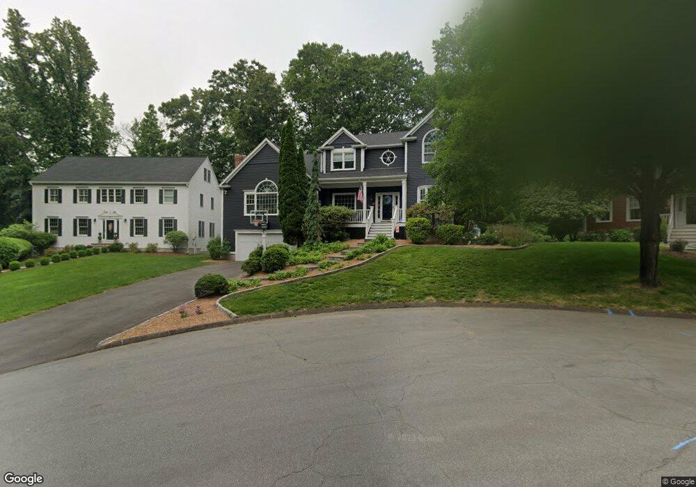
91 Running Brook Cir Fairfield, CT 06824
University NeighborhoodEstimated Value: $1,635,977 - $2,023,000
4
Beds
5
Baths
3,843
Sq Ft
$466/Sq Ft
Est. Value
About This Home
This home is located at 91 Running Brook Cir, Fairfield, CT 06824 and is currently estimated at $1,791,744, approximately $466 per square foot. 91 Running Brook Cir is a home located in Fairfield County with nearby schools including Osborn Hill Elementary School, Fairfield Woods Middle School, and Fairfield Ludlowe High School.
Ownership History
Date
Name
Owned For
Owner Type
Purchase Details
Closed on
Jun 11, 2001
Sold by
Schwarz Nancy E
Bought by
Hemphill Logan E and Hemphill Penny D
Current Estimated Value
Home Financials for this Owner
Home Financials are based on the most recent Mortgage that was taken out on this home.
Original Mortgage
$450,000
Interest Rate
7.08%
Purchase Details
Closed on
Oct 18, 1994
Sold by
W & W Assoc
Bought by
Schwartz Ronald B and Schwartz Nancy E
Create a Home Valuation Report for This Property
The Home Valuation Report is an in-depth analysis detailing your home's value as well as a comparison with similar homes in the area
Home Values in the Area
Average Home Value in this Area
Purchase History
| Date | Buyer | Sale Price | Title Company |
|---|---|---|---|
| Hemphill Logan E | $815,000 | -- | |
| Hemphill Logan E | $815,000 | -- | |
| Schwartz Ronald B | $446,660 | -- | |
| Schwartz Ronald B | $446,660 | -- |
Source: Public Records
Mortgage History
| Date | Status | Borrower | Loan Amount |
|---|---|---|---|
| Open | Schwartz Ronald B | $731,250 | |
| Closed | Schwartz Ronald B | $450,000 | |
| Closed | Schwartz Ronald B | $450,000 |
Source: Public Records
Tax History Compared to Growth
Tax History
| Year | Tax Paid | Tax Assessment Tax Assessment Total Assessment is a certain percentage of the fair market value that is determined by local assessors to be the total taxable value of land and additions on the property. | Land | Improvement |
|---|---|---|---|---|
| 2025 | $21,234 | $747,950 | $277,410 | $470,540 |
| 2024 | $20,868 | $747,950 | $277,410 | $470,540 |
| 2023 | $20,576 | $747,950 | $277,410 | $470,540 |
| 2022 | $20,374 | $747,950 | $277,410 | $470,540 |
| 2021 | $20,180 | $747,950 | $277,410 | $470,540 |
| 2020 | $19,447 | $725,900 | $248,570 | $477,330 |
| 2019 | $19,447 | $725,900 | $248,570 | $477,330 |
| 2018 | $19,135 | $725,900 | $248,570 | $477,330 |
| 2017 | $18,743 | $725,900 | $248,570 | $477,330 |
| 2016 | $18,474 | $725,900 | $248,570 | $477,330 |
| 2015 | $18,427 | $743,330 | $272,580 | $470,750 |
| 2014 | $18,137 | $743,330 | $272,580 | $470,750 |
Source: Public Records
Map
Nearby Homes
- 68 Figlar Ave
- 478 Crestwood Rd
- 45 Robin Cir
- 42 Robin Cir
- 133 Green Acre Ln
- 168 Wormwood Rd
- 109 Jeniford Rd
- 359 Reid St
- 44 Deer Run Rd
- 15 Barton Rd
- 274 High St
- 105 Charter Oak Rd
- 1207 Stillson Rd
- 338 Orchard Hill Ln
- 2107 N Benson Rd
- 41 Pepperbush Ln
- 115 Mayfair Rd
- 1165 Stillson Rd
- 79 Mayfair Rd
- 25 Country Rd
- 107 Running Brook Cir
- 111 Running Brook Cir
- 60 Knollwood Dr
- 40 Knollwood Dr
- 71 Running Brook Cir
- 101 Glen Arden Dr
- 121 Glen Arden Dr
- 79 Glen Arden Dr
- 22 Knollwood Dr
- 106 Knollwood Dr
- 148 Osborne Hill Rd
- 126 Knollwood Dr
- 19 Knollwood Dr
- 47 Knollwood Dr
- 165 Glen Arden Dr
- 67 Knollwood Dr
- 112 Glen Arden Dr
- 141 Glen Arden Dr
- 100 Glen Arden Dr