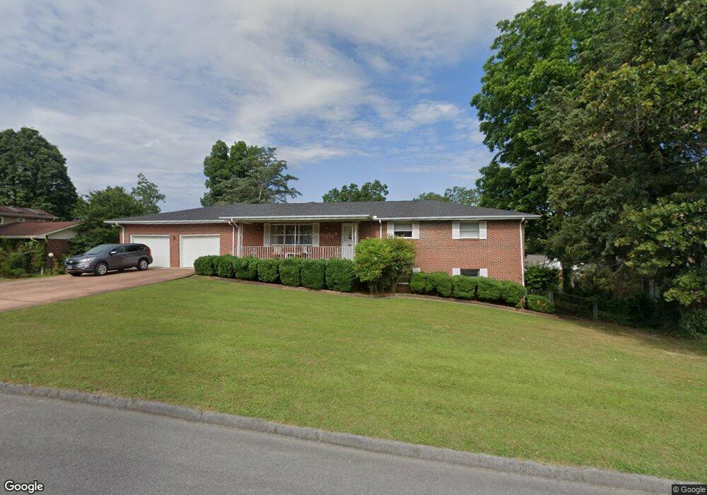
91 S Glade Rd Fort Oglethorpe, GA 30742
Estimated Value: $258,325 - $317,000
--
Bed
2
Baths
1,537
Sq Ft
$183/Sq Ft
Est. Value
About This Home
This home is located at 91 S Glade Rd, Fort Oglethorpe, GA 30742 and is currently estimated at $281,581, approximately $183 per square foot. 91 S Glade Rd is a home located in Catoosa County with nearby schools including Battlefield Primary School, Battlefield Elementary School, and Lakeview Middle School.
Ownership History
Date
Name
Owned For
Owner Type
Purchase Details
Closed on
Aug 25, 2017
Sold by
Fletcher
Bought by
Humphreys Robert H and Humphreys Patrice F
Current Estimated Value
Home Financials for this Owner
Home Financials are based on the most recent Mortgage that was taken out on this home.
Original Mortgage
$119,000
Outstanding Balance
$64,221
Interest Rate
3.92%
Mortgage Type
New Conventional
Estimated Equity
$217,360
Purchase Details
Closed on
May 22, 2011
Sold by
Fletcher Mary Louise
Bought by
Fletcher
Purchase Details
Closed on
Jan 7, 2011
Sold by
Fletcher Mary Louise and Fletcher Robbie Jo
Bought by
Fletcher Mary Louise And
Purchase Details
Closed on
Mar 2, 1976
Sold by
Pierce Pierce A and Pierce
Bought by
Fletcher Mary Louise And
Purchase Details
Closed on
Mar 1, 1976
Bought by
Pierce Pierce A and Pierce
Create a Home Valuation Report for This Property
The Home Valuation Report is an in-depth analysis detailing your home's value as well as a comparison with similar homes in the area
Home Values in the Area
Average Home Value in this Area
Purchase History
| Date | Buyer | Sale Price | Title Company |
|---|---|---|---|
| Humphreys Robert H | $140,000 | -- | |
| Fletcher | -- | -- | |
| Fletcher Mary Louise And | -- | -- | |
| Fletcher Mary Louise And | -- | -- | |
| Pierce Pierce A | -- | -- |
Source: Public Records
Mortgage History
| Date | Status | Borrower | Loan Amount |
|---|---|---|---|
| Open | Humphreys Robert H | $119,000 |
Source: Public Records
Tax History Compared to Growth
Tax History
| Year | Tax Paid | Tax Assessment Tax Assessment Total Assessment is a certain percentage of the fair market value that is determined by local assessors to be the total taxable value of land and additions on the property. | Land | Improvement |
|---|---|---|---|---|
| 2024 | $2,810 | $110,310 | $9,090 | $101,220 |
| 2023 | $2,403 | $89,160 | $9,090 | $80,070 |
| 2022 | $1,871 | $70,230 | $9,090 | $61,140 |
| 2021 | $1,771 | $70,230 | $9,090 | $61,140 |
| 2020 | $1,854 | $62,773 | $9,090 | $53,683 |
| 2019 | $1,761 | $62,773 | $9,090 | $53,683 |
| 2018 | $1,891 | $60,334 | $8,888 | $51,446 |
| 2017 | $377 | $58,196 | $8,888 | $49,308 |
| 2016 | $377 | $55,663 | $8,888 | $46,775 |
| 2015 | -- | $56,628 | $8,888 | $47,740 |
| 2014 | -- | $56,628 | $8,888 | $47,740 |
| 2013 | -- | $56,628 | $8,888 | $47,740 |
Source: Public Records
Map
Nearby Homes
- 64 Stovall St
- 52 S Glade Rd
- 84 Elaine Cir
- 99 Battlewood Dr
- 59 Gattis Dr
- 1305 Park Forrest Dr
- 0 Battlefield Pkwy Unit 129870
- 6 Rocky Ford Rd
- 15 Walker Ave
- 38 Phillips Dr
- 614 Lakeshore Cove Dr Unit 19
- 614 Lakeshore Cove Dr
- 144 Ridgelake Cir
- 631 Lakeshore Cove Dr
- 39 Rock Haven Ln
- 136 Spinnaker Dr
- 325 Mockingbird Ln
- 490 Lakeshore Cove Dr Unit 10
- 490 Lakeshore Cove Dr
- 85 Inlet Isle Dr