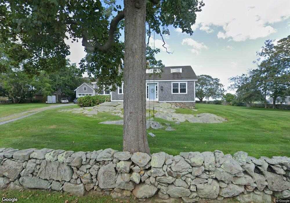
91 Sakonnet Point Rd Little Compton, RI 02837
Estimated Value: $1,756,000 - $2,079,000
6
Beds
3
Baths
2,542
Sq Ft
$746/Sq Ft
Est. Value
About This Home
This home is located at 91 Sakonnet Point Rd, Little Compton, RI 02837 and is currently estimated at $1,895,260, approximately $745 per square foot. 91 Sakonnet Point Rd is a home located in Newport County with nearby schools including Wilbur & McMahon School.
Ownership History
Date
Name
Owned For
Owner Type
Purchase Details
Closed on
Jun 8, 2020
Sold by
Dawson John E
Bought by
Dawson Kirsten M
Current Estimated Value
Purchase Details
Closed on
Aug 12, 2016
Sold by
Dawson John E and Dawson Benjamin G
Bought by
S A Geremia 1996 Ret
Purchase Details
Closed on
Feb 12, 2016
Sold by
Dawson John E and Dawson Benjamin G
Bought by
Little Compton Agric T
Purchase Details
Closed on
Sep 29, 1998
Sold by
Barnard William L and Barnard Lucinda
Bought by
Dawson John E and Dawson Kirsten M
Create a Home Valuation Report for This Property
The Home Valuation Report is an in-depth analysis detailing your home's value as well as a comparison with similar homes in the area
Home Values in the Area
Average Home Value in this Area
Purchase History
| Date | Buyer | Sale Price | Title Company |
|---|---|---|---|
| Dawson Kirsten M | -- | None Available | |
| Dawson Kirsten M | -- | None Available | |
| S A Geremia 1996 Ret | $342,500 | -- | |
| Little Compton Agric T | -- | -- | |
| Dawson John E | $530,000 | -- | |
| S A Geremia 1996 Ret | $342,500 | -- | |
| Little Compton Agric T | -- | -- | |
| Dawson John E | $530,000 | -- |
Source: Public Records
Tax History
| Year | Tax Paid | Tax Assessment Tax Assessment Total Assessment is a certain percentage of the fair market value that is determined by local assessors to be the total taxable value of land and additions on the property. | Land | Improvement |
|---|---|---|---|---|
| 2025 | $5,869 | $1,225,300 | $657,300 | $568,000 |
| 2024 | $5,225 | $1,028,500 | $571,500 | $457,000 |
| 2023 | $5,101 | $1,028,500 | $571,500 | $457,000 |
| 2022 | $5,040 | $1,028,500 | $571,500 | $457,000 |
| 2021 | $4,644 | $768,900 | $461,200 | $307,700 |
| 2020 | $4,545 | $758,700 | $461,200 | $297,500 |
| 2019 | $4,499 | $758,700 | $461,200 | $297,500 |
| 2018 | $4,335 | $727,400 | $425,700 | $301,700 |
| 2016 | $4,124 | $727,400 | $425,700 | $301,700 |
Source: Public Records
Map
Nearby Homes
- 38 Old Bull Ln
- 141 S Of Commons Rd
- 441 W Main Rd
- 49 Ocean Dr
- 30 Indian Rd
- 89 S Shore Rd
- 128 Maple Ave
- 138 Willow Ave
- 515 Indian Ave
- 0 Willow Ave
- 180 W Main Rd
- 100 Summerfield Ln
- 141 Peckham Rd
- 17 Ferolbink Way
- 155 W Main Rd
- 505 Long Hwy
- 141 Gray Craig Rd
- 0 Indian Ave
- 225 Old Mill Ln
- 180 Cottontail Dr
- 95 Sakonnet Point Rd
- 90 Sakonnet Point Rd
- 98 Sakonnet Point Rd
- 96 Sakonnet Point Rd
- 100 Sakonnet Point Rd
- 101A Sakonnet Point Rd
- 101 Sakonnet Point Rd
- 11 Goodrich Ln
- 106 Sakonnet Point Rd
- 106B Sakonnet Point Rd
- 109 Sakonnet Point Rd
- 80 Sakonnet Point Rd
- 114 Sakonnet Point Rd
- 115 Sakonnet Point Rd
- 6 Goodrich Ln
- 116 Sakonnet Point Rd
- 99F Sakonnet Point Rd
- 127 Sakonnet Point Rd
- 127C Sakonnet Point Rd
- 118 Sakonnet Point Rd
Your Personal Tour Guide
Ask me questions while you tour the home.