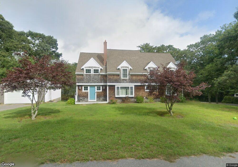
91 Sandwich Rd Bourne, MA 2532
Estimated Value: $844,000 - $893,000
5
Beds
4
Baths
2,825
Sq Ft
$309/Sq Ft
Est. Value
About This Home
This home is located at 91 Sandwich Rd, Bourne, MA 2532 and is currently estimated at $874,050, approximately $309 per square foot. 91 Sandwich Rd is a home located in Barnstable County with nearby schools including Bourne High School, St Margaret Regional School, and Cadence Academy Preschool - Bourne.
Ownership History
Date
Name
Owned For
Owner Type
Purchase Details
Closed on
Jan 3, 2023
Sold by
Brennan Robert L and Brennan Joanne C
Bought by
Robert L Brennan Ret and Brennan
Current Estimated Value
Purchase Details
Closed on
Jun 21, 2022
Sold by
Koosa Robert E and Koosa Tricia L
Bought by
Brennan Joanne C and Brennan Robert L
Purchase Details
Closed on
Oct 7, 2005
Sold by
Koosa Joan C and Koosa Robert T
Bought by
Koosa Robert E and Koosa Tricia L
Home Financials for this Owner
Home Financials are based on the most recent Mortgage that was taken out on this home.
Original Mortgage
$120,000
Interest Rate
5.81%
Mortgage Type
Purchase Money Mortgage
Create a Home Valuation Report for This Property
The Home Valuation Report is an in-depth analysis detailing your home's value as well as a comparison with similar homes in the area
Purchase History
| Date | Buyer | Sale Price | Title Company |
|---|---|---|---|
| Robert L Brennan Ret | -- | None Available | |
| Robert L Brennan Ret | -- | None Available | |
| Brennan Joanne C | $710,501 | None Available | |
| Brennan Joanne C | $710,501 | None Available | |
| Koosa Robert E | $120,000 | -- | |
| Koosa Robert E | $120,000 | -- |
Source: Public Records
Mortgage History
| Date | Status | Borrower | Loan Amount |
|---|---|---|---|
| Previous Owner | Koosa Robert E | $120,000 | |
| Previous Owner | Koosa Robert E | $110,000 | |
| Previous Owner | Koosa Robert E | $50,000 |
Source: Public Records
Tax History
| Year | Tax Paid | Tax Assessment Tax Assessment Total Assessment is a certain percentage of the fair market value that is determined by local assessors to be the total taxable value of land and additions on the property. | Land | Improvement |
|---|---|---|---|---|
| 2025 | $6,725 | $861,100 | $171,100 | $690,000 |
| 2024 | $6,200 | $773,100 | $163,000 | $610,100 |
| 2023 | $6,119 | $694,600 | $160,300 | $534,300 |
| 2022 | $5,963 | $591,000 | $141,800 | $449,200 |
| 2021 | $5,807 | $539,200 | $129,100 | $410,100 |
| 2020 | $5,302 | $493,700 | $127,800 | $365,900 |
| 2019 | $4,980 | $473,800 | $127,800 | $346,000 |
| 2018 | $4,836 | $458,800 | $121,800 | $337,000 |
| 2017 | $4,653 | $451,700 | $114,600 | $337,100 |
| 2016 | $4,500 | $442,900 | $114,600 | $328,300 |
| 2015 | $4,338 | $430,800 | $102,500 | $328,300 |
Source: Public Records
Map
Nearby Homes
- 60 Sandwich Rd
- 10 Sandy Ln
- 3 Honora Ln Unit 3
- 6 Honora Ct
- 6 Honora Ln
- 38 Old Bridge Rd
- 44 Cotuit Rd
- 304 Main St
- 5 Zoli Ln
- 58 Maple St
- 46 Holt Rd Unit B
- 46 Holt Rd
- 5 Sea Knoll Ct
- 24 Ships View Terrace
- 13 Laurel Hill Ct
- 2 Applewood Ct
- 4 Hollyhock Knoll Ct Unit 4
- 4 Hollyhock Knoll Ct Unit 4
- 29 Weather Deck Rd
- 12 Turnberry Rd Unit 12
- 91 Sandwich Rd
- 7 Farnum Rd
- 7 Farnum Rd
- 7 Farnum Rd Unit 7
- 85 Sandwich Rd
- 105 Sandwich Rd
- 90-92 Sandwich Rd Unit 15
- 90-92 Sandwich Rd Unit 9
- 90-92 Sandwich Rd Unit 5
- 90-92 Sandwich Rd Unit 22
- 90-92 Sandwich Rd Unit 12
- 90-92 Sandwich Rd Unit 18
- 90-92 Sandwich Rd Unit 7
- 90-92 Sandwich Rd Unit 10
- 90-92 Sandwich Rd
- 90-92 Sandwich Rd Unit 16
- 90-92 Sandwich Rd Unit 17
- 90-92 Sandwich Rd Unit 21
- 90-92 Sandwich Rd Unit 11
- 90-92 Sandwich Rd Unit 3
Your Personal Tour Guide
Ask me questions while you tour the home.