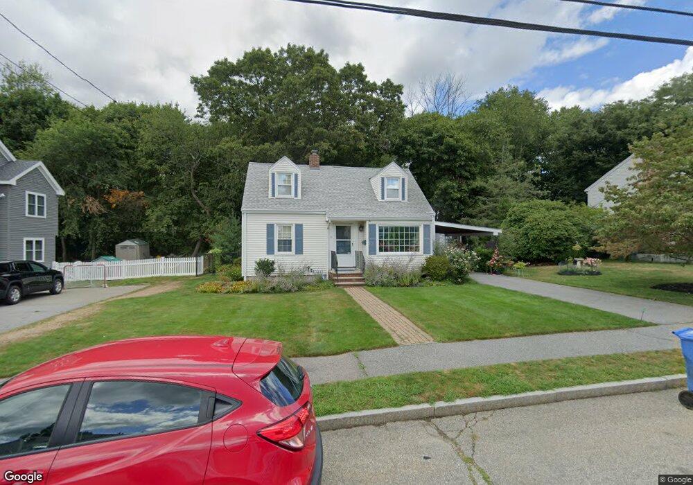
91 Sheffield Rd Waltham, MA 02451
North Waltham NeighborhoodEstimated Value: $772,162 - $818,000
3
Beds
2
Baths
1,110
Sq Ft
$720/Sq Ft
Est. Value
About This Home
This home is located at 91 Sheffield Rd, Waltham, MA 02451 and is currently estimated at $799,041, approximately $719 per square foot. 91 Sheffield Rd is a home located in Middlesex County with nearby schools including Douglas Macarthur Elementary School, John F Kennedy Middle School, and Waltham Sr High School.
Ownership History
Date
Name
Owned For
Owner Type
Purchase Details
Closed on
Dec 17, 2010
Sold by
Mcmanus Tr Kathleen M and Mccarthy Richard M
Bought by
Noel Joan M
Current Estimated Value
Home Financials for this Owner
Home Financials are based on the most recent Mortgage that was taken out on this home.
Original Mortgage
$286,000
Outstanding Balance
$188,314
Interest Rate
4.23%
Mortgage Type
Purchase Money Mortgage
Estimated Equity
$610,727
Purchase Details
Closed on
Nov 28, 2008
Sold by
Mcmanus Kathleen M
Bought by
Kathleen M Mcmanus T
Create a Home Valuation Report for This Property
The Home Valuation Report is an in-depth analysis detailing your home's value as well as a comparison with similar homes in the area
Home Values in the Area
Average Home Value in this Area
Purchase History
| Date | Buyer | Sale Price | Title Company |
|---|---|---|---|
| Noel Joan M | $358,000 | -- | |
| Kathleen M Mcmanus T | -- | -- |
Source: Public Records
Mortgage History
| Date | Status | Borrower | Loan Amount |
|---|---|---|---|
| Open | Noel Joan M | $286,000 |
Source: Public Records
Tax History
| Year | Tax Paid | Tax Assessment Tax Assessment Total Assessment is a certain percentage of the fair market value that is determined by local assessors to be the total taxable value of land and additions on the property. | Land | Improvement |
|---|---|---|---|---|
| 2025 | $6,664 | $678,600 | $441,800 | $236,800 |
| 2024 | $6,317 | $655,300 | $422,300 | $233,000 |
| 2023 | $6,249 | $605,500 | $383,200 | $222,300 |
| 2022 | $6,147 | $551,800 | $344,100 | $207,700 |
| 2021 | $6,090 | $538,000 | $344,100 | $193,900 |
| 2020 | $6,055 | $506,700 | $320,600 | $186,100 |
| 2019 | $6,097 | $481,600 | $316,700 | $164,900 |
| 2018 | $5,623 | $445,900 | $293,300 | $152,600 |
| 2017 | $5,256 | $418,500 | $265,900 | $152,600 |
| 2016 | $4,930 | $402,800 | $250,200 | $152,600 |
| 2015 | $4,585 | $349,200 | $219,000 | $130,200 |
Source: Public Records
Map
Nearby Homes
- 7 Field Rd
- 89 Hardy Pond Rd
- 14 Benjamin Rd
- 1393 Trapelo Rd
- 1105 Lexington St Unit 6-4
- 353 Concord Ave
- 33 Jacqueline Rd Unit D
- 9 April Ln Unit 9
- 44 Lakeview Terrace
- 14 Piedmont Ave
- 107 Clocktower Dr Unit 3302
- 63 Montclair Ave
- 28 Hillcrest St
- 23 Hillcrest St
- 34 Allen St
- 11 Autumn Ln
- 45 Webster Rd
- 12 Wellington Lane Ave
- 22 Fairbanks Rd
- 72 Grassland St
- 85 Sheffield Rd
- 99 Sheffield Rd
- 100 Sheffield Rd
- 80 Sheffield Rd
- 80 Sheffield Rd Unit 80
- 105 Sheffield Rd
- 81 Sheffield Rd
- 31 Essex St
- 75 Sheffield Rd
- 110 Sheffield Rd
- 111 Sheffield Rd
- 70 Sheffield Rd
- 71 Sheffield Rd
- 32 Essex St
- 23 Essex St
- 119 Sheffield Rd
- 60 Sheffield Rd
- 72 Miriam Rd
- 65 Sheffield Rd
- 5 Berkley St
Your Personal Tour Guide
Ask me questions while you tour the home.