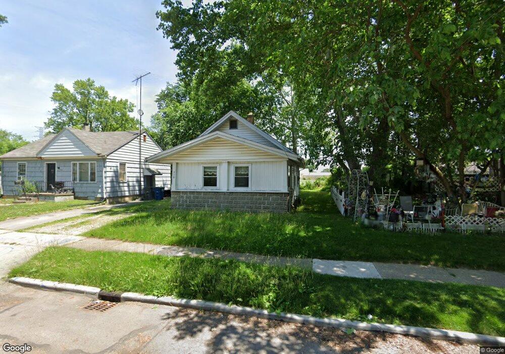
910 Elysian Ave Toledo, OH 43607
Scott Park NeighborhoodEstimated Value: $60,117 - $86,000
2
Beds
1
Bath
748
Sq Ft
$100/Sq Ft
Est. Value
About This Home
This home is located at 910 Elysian Ave, Toledo, OH 43607 and is currently estimated at $74,779, approximately $99 per square foot. 910 Elysian Ave is a home located in Lucas County with nearby schools including Keyser Elementary School, Rogers High School, and Victory Academy of Toledo.
Ownership History
Date
Name
Owned For
Owner Type
Purchase Details
Closed on
Aug 12, 2022
Sold by
Q B Ericsons Inc
Bought by
Dayton Shawn
Current Estimated Value
Purchase Details
Closed on
Jan 30, 2003
Sold by
Lehman Linda M and Lehman Eric A
Bought by
Q B Ericsons Inc
Purchase Details
Closed on
Dec 27, 2002
Sold by
Q B Ericsons Inc
Bought by
Lehman Linda M
Purchase Details
Closed on
Sep 30, 2002
Sold by
Wells Fargo Bank Minnesota Na
Bought by
Q B Ericsons Inc
Purchase Details
Closed on
Apr 10, 2002
Sold by
Gary Peatee
Bought by
Wells Fargo Bank Minnesota National Assn and Option One Mtg Loan Trust 2000-C Asset B
Create a Home Valuation Report for This Property
The Home Valuation Report is an in-depth analysis detailing your home's value as well as a comparison with similar homes in the area
Home Values in the Area
Average Home Value in this Area
Purchase History
| Date | Buyer | Sale Price | Title Company |
|---|---|---|---|
| Dayton Shawn | $9,000 | Douglas Thomas S | |
| Q B Ericsons Inc | -- | -- | |
| Lehman Linda M | -- | -- | |
| Q B Ericsons Inc | $22,000 | Midland | |
| Wells Fargo Bank Minnesota National Assn | $30,999 | -- |
Source: Public Records
Tax History
| Year | Tax Paid | Tax Assessment Tax Assessment Total Assessment is a certain percentage of the fair market value that is determined by local assessors to be the total taxable value of land and additions on the property. | Land | Improvement |
|---|---|---|---|---|
| 2025 | -- | $6,685 | $2,275 | $4,410 |
| 2024 | $242 | $6,685 | $2,275 | $4,410 |
| 2023 | $348 | $4,165 | $1,680 | $2,485 |
| 2022 | $356 | $4,165 | $1,680 | $2,485 |
| 2021 | $359 | $4,165 | $1,680 | $2,485 |
| 2020 | $377 | $3,745 | $1,540 | $2,205 |
| 2019 | $361 | $3,745 | $1,540 | $2,205 |
| 2018 | $368 | $3,745 | $1,540 | $2,205 |
| 2017 | $356 | $3,500 | $2,800 | $700 |
| 2016 | $368 | $10,000 | $8,000 | $2,000 |
| 2015 | $368 | $10,000 | $8,000 | $2,000 |
| 2014 | $226 | $3,500 | $2,800 | $700 |
| 2013 | $226 | $3,500 | $2,800 | $700 |
Source: Public Records
Map
Nearby Homes
- 914 Turner Ave
- 2925 Avondale Ave
- 834 Broer Ave
- 638 Broer Ave
- 714 Brookley Blvd
- 712 Underwood Ave
- 820 MacKow Dr
- 508 Ascot Ave
- 1408 Roosevelt Ave
- 336 Conrad Ave
- 1125 Secor Rd
- 1011 Alldays Ave
- 615 Cuthbert Rd
- 913 Coventry Ave
- 811 N University Ave
- 1814 Alvin St
- 710 N Byrne Rd
- 1901 Alvin St
- 1917 Alvin St
- 1732 Evansdale Ave
- 912 Elysian Ave
- 902 Elysian Ave
- 916 Elysian Ave
- 922 Elysian Ave
- 907 Elysian Ave
- 919 Bowlus Ave
- 901 Elysian Ave
- 926 Elysian Ave
- 915 Elysian Ave
- 919 Elysian Ave
- 2815 Avondale Ave
- 930 Elysian Ave
- 921 Elysian Ave
- 929 Bowlus Ave
- 925 Elysian Ave
- 1002 Elysian Ave
- 929 Elysian Ave
- 910 Turner Ave
- 906 Turner Ave
- 1001 Elysian Ave
Your Personal Tour Guide
Ask me questions while you tour the home.