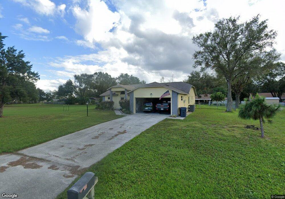
910 Flag Ct Auburndale, FL 33823
Estimated Value: $313,544 - $335,000
3
Beds
2
Baths
1,652
Sq Ft
$197/Sq Ft
Est. Value
About This Home
This home is located at 910 Flag Ct, Auburndale, FL 33823 and is currently estimated at $325,636, approximately $197 per square foot. 910 Flag Ct is a home located in Polk County with nearby schools including Auburndale Senior High School, Lena Vista Elementary School, and Jewett School of the Arts.
Ownership History
Date
Name
Owned For
Owner Type
Purchase Details
Closed on
Feb 20, 2004
Sold by
Thompson John E and Thompson Deborah S
Bought by
Szockiski Stanley L and Szocinski Joanne
Current Estimated Value
Home Financials for this Owner
Home Financials are based on the most recent Mortgage that was taken out on this home.
Original Mortgage
$88,700
Interest Rate
5.63%
Mortgage Type
Purchase Money Mortgage
Create a Home Valuation Report for This Property
The Home Valuation Report is an in-depth analysis detailing your home's value as well as a comparison with similar homes in the area
Home Values in the Area
Average Home Value in this Area
Purchase History
| Date | Buyer | Sale Price | Title Company |
|---|---|---|---|
| Szockiski Stanley L | $135,000 | Florida Professional Title I |
Source: Public Records
Mortgage History
| Date | Status | Borrower | Loan Amount |
|---|---|---|---|
| Closed | Szockiski Stanley L | $88,700 |
Source: Public Records
Tax History Compared to Growth
Tax History
| Year | Tax Paid | Tax Assessment Tax Assessment Total Assessment is a certain percentage of the fair market value that is determined by local assessors to be the total taxable value of land and additions on the property. | Land | Improvement |
|---|---|---|---|---|
| 2025 | $1,359 | $98,513 | -- | -- |
| 2024 | $1,188 | $95,737 | -- | -- |
| 2023 | $1,188 | $92,949 | $0 | $0 |
| 2022 | $1,131 | $90,242 | $0 | $0 |
| 2021 | $1,128 | $87,614 | $0 | $0 |
| 2020 | $1,097 | $86,404 | $0 | $0 |
| 2018 | $1,026 | $82,886 | $0 | $0 |
| 2017 | $1,005 | $81,181 | $0 | $0 |
| 2016 | $964 | $79,511 | $0 | $0 |
| 2015 | $618 | $78,958 | $0 | $0 |
| 2014 | $895 | $78,331 | $0 | $0 |
Source: Public Records
Map
Nearby Homes
- 910 Liberty Ln
- 1341 Mattie Pointe Blvd
- 1647 Bark Ridge Dr
- 1036 Mattie Pointe Way
- 1643 Bark Ridge Dr
- 1292 Mattie Pointe Blvd
- 1646 Bark Ridge Dr
- 1356 Oak Valley Dr
- 1361 Oak Valley Dr
- 1352 Oak Valley Dr
- 1353 Oak Valley Dr
- 1349 Oak Valley Dr
- 1336 Oak Valley Dr
- 1125 Mattie Pointe Blvd
- 1705 Forest Run Ln
- 1160 Mattie Pointe Blvd
- 1249 Oak Valley Dr
- 148 Eagle Point Blvd
- 2013 Van Buren Loop
- 137 Eagle Point Blvd