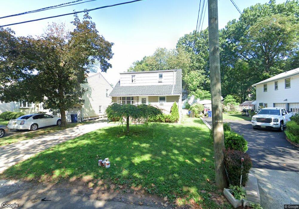
910 Lewis Ave Plainfield, NJ 07063
Estimated Value: $430,180 - $520,000
4
Beds
2
Baths
1,456
Sq Ft
$319/Sq Ft
Est. Value
About This Home
This home is located at 910 Lewis Ave, Plainfield, NJ 07063 and is currently estimated at $464,045, approximately $318 per square foot. 910 Lewis Ave is a home located in Union County with nearby schools including Cedarbrook K-8 Center, Hubbard Middle School, and Plainfield High School.
Ownership History
Date
Name
Owned For
Owner Type
Purchase Details
Closed on
Jun 29, 2017
Sold by
Bank Of America Na
Bought by
Seven Hills Portfolio 5 Llc
Current Estimated Value
Purchase Details
Closed on
Jun 28, 2016
Sold by
Union County Sheriff
Bought by
Bank Of America N A
Purchase Details
Closed on
Aug 25, 2006
Sold by
Joey D Jr Llc
Bought by
Linton Neville and Linton Ingrid Griffith
Home Financials for this Owner
Home Financials are based on the most recent Mortgage that was taken out on this home.
Original Mortgage
$234,232
Interest Rate
6.31%
Mortgage Type
FHA
Purchase Details
Closed on
Jan 24, 2006
Sold by
Carter Kathy Bennett
Bought by
Joey D Jr Llc
Create a Home Valuation Report for This Property
The Home Valuation Report is an in-depth analysis detailing your home's value as well as a comparison with similar homes in the area
Home Values in the Area
Average Home Value in this Area
Purchase History
| Date | Buyer | Sale Price | Title Company |
|---|---|---|---|
| Seven Hills Portfolio 5 Llc | $90,500 | Linear Title & Closing | |
| Bank Of America N A | $1,000 | -- | |
| Linton Neville | $238,000 | -- | |
| Joey D Jr Llc | $199,588 | -- | |
| Carter Kathy Bennett | -- | -- |
Source: Public Records
Mortgage History
| Date | Status | Borrower | Loan Amount |
|---|---|---|---|
| Previous Owner | Linton Neville | $234,232 |
Source: Public Records
Tax History
| Year | Tax Paid | Tax Assessment Tax Assessment Total Assessment is a certain percentage of the fair market value that is determined by local assessors to be the total taxable value of land and additions on the property. | Land | Improvement |
|---|---|---|---|---|
| 2025 | $7,562 | $86,600 | $23,500 | $63,100 |
| 2024 | $7,487 | $86,600 | $23,500 | $63,100 |
| 2023 | $7,487 | $86,600 | $23,500 | $63,100 |
| 2022 | $7,325 | $86,600 | $23,500 | $63,100 |
| 2021 | $7,261 | $86,600 | $23,500 | $63,100 |
| 2020 | $7,241 | $86,600 | $23,500 | $63,100 |
| 2019 | $7,241 | $86,600 | $23,500 | $63,100 |
| 2018 | $7,089 | $86,600 | $23,500 | $63,100 |
| 2017 | $6,916 | $86,600 | $23,500 | $63,100 |
| 2016 | $6,775 | $86,600 | $23,500 | $63,100 |
| 2015 | $6,575 | $86,600 | $23,500 | $63,100 |
| 2014 | $6,396 | $86,600 | $23,500 | $63,100 |
Source: Public Records
Map
Nearby Homes
- 901 Sherman Ave Unit 11
- 916 Sherman Ave
- 905 Stelle Ave Unit 7
- 139 Palmer Ave
- 413 W 8th St
- 105 Firth St
- 1210 Field Ave
- 950 W 6th St Unit 52
- 962-64 W 6th St
- 551 Melrose Ave
- 745 W 4th St Unit 47
- 1039-41 Field Ave
- 1039 Field Ave Unit 41
- 954 W 4th St
- 320 Lee Place
- 614-34 W 8th St Unit 15
- 301 Grant Ave Unit 3
- 1227 W 6th St
- 63 Leeds Dr
- 338 Manson Place Unit 40
- 912 Lewis Ave Unit 14
- 902 Lewis Ave Unit 8
- 916 Lewis Ave Unit 18
- 925 Sherman Ave Unit 27
- 921 Sherman Ave Unit 23
- 929 Sherman Ave Unit 33
- 900 Lewis Ave
- 936 Maltby Ave Unit 44
- 917-19 Sherman Ave
- 917 Sherman Ave Unit 19
- 913 Sherman Ave Unit 15
- 935-41 Sherman Ave
- 935 Sherman Ave Unit 41
- 920 Lewis Ave Unit 24
- 917 Lewis Ave Unit 23
- 946 Maltby Ave Unit 50
- 828 Huntington Ave Unit 34
- 919 Maltby Ave Unit 23
- 919-23 Maltby Ave
- 937 Maltby Ave