Estimated Value: $216,917 - $234,000
3
Beds
2
Baths
1,197
Sq Ft
$188/Sq Ft
Est. Value
About This Home
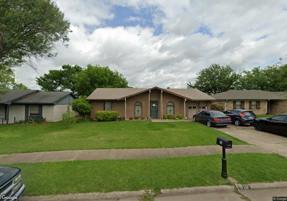
This home is located at 910 Phillips Dr, Ennis, TX 75119 and is currently estimated at $225,459, approximately $188 per square foot. 910 Phillips Dr is a home located in Ellis County with nearby schools including Austin Elementary School, Dorie Miller Int, and Ennis Junior High School.
Ownership History
Date
Name
Owned For
Owner Type
Purchase Details
Closed on
Jun 17, 2008
Sold by
Vaughan Richard Irvin
Bought by
Vaughan Nancy Kay
Current Estimated Value
Purchase Details
Closed on
Mar 30, 2006
Sold by
Lucas C Kay
Bought by
Naughan Nancy Kay
Home Financials for this Owner
Home Financials are based on the most recent Mortgage that was taken out on this home.
Original Mortgage
$73,800
Outstanding Balance
$42,067
Interest Rate
6.22%
Mortgage Type
New Conventional
Estimated Equity
$183,392
Create a Home Valuation Report for This Property
The Home Valuation Report is an in-depth analysis detailing your home's value as well as a comparison with similar homes in the area
Home Values in the Area
Average Home Value in this Area
Purchase History
| Date | Buyer | Sale Price | Title Company |
|---|---|---|---|
| Vaughan Nancy Kay | -- | -- | |
| Naughan Nancy Kay | -- | None Available |
Source: Public Records
Mortgage History
| Date | Status | Borrower | Loan Amount |
|---|---|---|---|
| Open | Naughan Nancy Kay | $73,800 |
Source: Public Records
Tax History Compared to Growth
Tax History
| Year | Tax Paid | Tax Assessment Tax Assessment Total Assessment is a certain percentage of the fair market value that is determined by local assessors to be the total taxable value of land and additions on the property. | Land | Improvement |
|---|---|---|---|---|
| 2025 | $1,666 | $190,158 | -- | -- |
| 2024 | $1,666 | $176,402 | -- | -- |
| 2023 | $1,666 | $157,155 | $0 | $0 |
| 2022 | $3,419 | $142,868 | $0 | $0 |
| 2021 | $3,270 | $129,880 | $20,000 | $109,880 |
| 2020 | $3,052 | $131,300 | $20,000 | $111,300 |
| 2019 | $2,826 | $110,070 | $0 | $0 |
| 2018 | $2,587 | $100,100 | $22,000 | $78,100 |
| 2017 | $2,364 | $91,500 | $22,000 | $69,500 |
| 2016 | $2,149 | $81,010 | $18,000 | $63,010 |
| 2015 | $1,589 | $75,420 | $18,000 | $57,420 |
| 2014 | $1,589 | $70,860 | $0 | $0 |
Source: Public Records
Map
Nearby Homes
- 1002 Hoylake Ct
- 2810 Belmont Dr
- 000 Sleepy Hollow Rd
- 801 Woodcrest Dr
- 707 Oakmont Dr
- 2800 Boyd St
- 717 Woodcrest Dr
- Lavon Plan at The Hollow
- Bowie Plan at The Hollow
- San Gabriel II Plan at The Hollow
- Cascade II Plan at The Hollow
- Bailey Plan at The Hollow
- Burnett Plan at The Hollow
- Briley Plan at The Hollow
- Basswood Plan at The Hollow
- 2308 Louise Ln
- 1207 Louise Ln
- 1703 Carnoustie Dr
- 2410 Linda Dr
- 2900 Terrytown Dr
- 908 Phillips Dr
- 912 Phillips Dr
- 2704 Park St
- 906 Phillips Dr
- 2706 Park St
- 1000 Phillips Dr
- 904 Phillips Dr
- 911 Phillips Dr
- 907 Oakmont Dr
- 909 Phillips Dr
- 913 Phillips Dr
- 907 Phillips Dr
- 1001 Hoylake Ct
- 902 Phillips Dr
- 1002 Phillips Dr
- 2800 Park St
- 905 Phillips Dr
- 1001 Phillips Dr
- 905 Oakmont Dr
- 909 Oakmont Dr