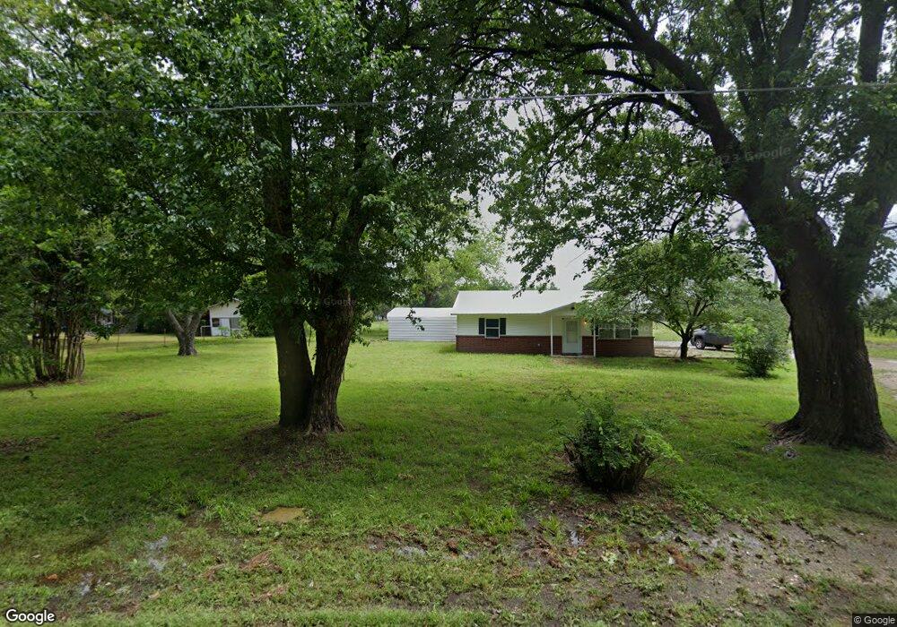
910 S Ada St Coalgate, OK 74538
Estimated Value: $124,927 - $214,000
2
Beds
1
Bath
962
Sq Ft
$170/Sq Ft
Est. Value
About This Home
This home is located at 910 S Ada St, Coalgate, OK 74538 and is currently estimated at $163,982, approximately $170 per square foot. 910 S Ada St is a home located in Coal County with nearby schools including Emerson Elementary School, Wallace Byrd Middle School, and Coalgate High School.
Ownership History
Date
Name
Owned For
Owner Type
Purchase Details
Closed on
Apr 11, 2022
Sold by
Bridges Iola M
Bought by
Hemphill David
Current Estimated Value
Home Financials for this Owner
Home Financials are based on the most recent Mortgage that was taken out on this home.
Original Mortgage
$73,525
Outstanding Balance
$22,427
Interest Rate
4.22%
Mortgage Type
Construction
Estimated Equity
$141,555
Purchase Details
Closed on
Jun 6, 1997
Sold by
Cleburn Marcum
Bought by
Joseph Olen Bridges
Create a Home Valuation Report for This Property
The Home Valuation Report is an in-depth analysis detailing your home's value as well as a comparison with similar homes in the area
Purchase History
| Date | Buyer | Sale Price | Title Company |
|---|---|---|---|
| Hemphill David | $86,167 | Complete Closing Svcs Llc | |
| Joseph Olen Bridges | $20,000 | -- |
Source: Public Records
Mortgage History
| Date | Status | Borrower | Loan Amount |
|---|---|---|---|
| Open | Hemphill David | $73,525 |
Source: Public Records
Tax History
| Year | Tax Paid | Tax Assessment Tax Assessment Total Assessment is a certain percentage of the fair market value that is determined by local assessors to be the total taxable value of land and additions on the property. | Land | Improvement |
|---|---|---|---|---|
| 2025 | $446 | $6,302 | $665 | $5,637 |
| 2024 | $431 | $6,118 | $646 | $5,472 |
| 2023 | $411 | $5,941 | $641 | $5,300 |
| 2022 | $395 | $5,767 | $635 | $5,132 |
| 2021 | $375 | $5,600 | $629 | $4,971 |
| 2020 | $362 | $5,436 | $624 | $4,812 |
| 2019 | $362 | $5,278 | $619 | $4,659 |
| 2018 | $353 | $5,125 | $588 | $4,537 |
| 2017 | $305 | $4,976 | $545 | $4,431 |
| 2016 | $294 | $4,831 | $518 | $4,313 |
| 2015 | $284 | $4,690 | $585 | $4,105 |
| 2014 | $280 | $4,553 | $262 | $4,291 |
Source: Public Records
Map
Nearby Homes
- 0 E Henry St
- 601 S Harvey St
- 606 S Ada St
- 408 S Clark St
- 00000 Highway 75
- 0 S Railroad St Unit 2607787
- 0 Industrial Blvd
- 601 S Frey St
- 1105 S Lark St
- 309 S Byrd St
- 301 S Byrd St
- 0 County Road 1720 Unit 2606059
- 17500 County Road 3762
- 0 Cedar Way
- 307 W Hanover Ave
- 01 Oklahoma 31
- 0 W Ohio Ave
- 109 S Jerome St
- 4 N Orray St
- 107 S Day Ave
- 906 S Ada St
- 911 S Ada St
- 902 S Ada St
- 607 E Dyer Ave
- 609 E Dyer Ave
- 908 S Race St
- 1102 S Race St
- 38785 State Highway 131
- 16788 County Road 3820
- 16874 County Road 3820
- 16875 County Road 3820
- 16861 County Road 3820
- 38749 State Highway 131
- 38752 State Highway 131
- 17373 County Road 3700
- 16805 County Road 3820
- 16765 County Road 3820
- 16788 County Road 3820
- 16787 County Road 3820
- 606 E Dyer Ave
Your Personal Tour Guide
Ask me questions while you tour the home.