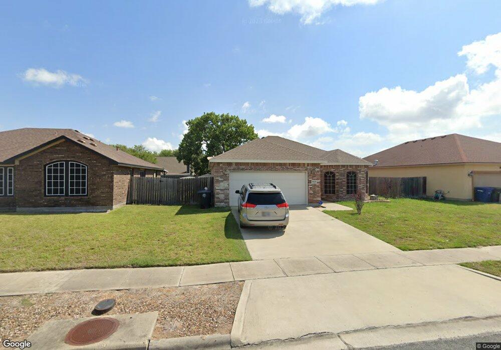
910 St Michael Ct Corpus Christi, TX 78418
Flour Bluff NeighborhoodEstimated Value: $289,786 - $319,000
--
Bed
--
Bath
1,756
Sq Ft
$171/Sq Ft
Est. Value
About This Home
This home is located at 910 St Michael Ct, Corpus Christi, TX 78418 and is currently estimated at $300,447, approximately $171 per square foot. 910 St Michael Ct is a home located in Nueces County with nearby schools including Flour Bluff Primary School, Flour Bluff Elementary School, and Flour Bluff Intermediate.
Ownership History
Date
Name
Owned For
Owner Type
Purchase Details
Closed on
Sep 19, 2017
Sold by
Evans James M and Evans Dawn M
Bought by
Revett Maude Mariom
Current Estimated Value
Purchase Details
Closed on
Apr 23, 2014
Sold by
Suncrest Construction Inc
Bought by
Evans James M and Evans Dawn M
Home Financials for this Owner
Home Financials are based on the most recent Mortgage that was taken out on this home.
Original Mortgage
$178,125
Interest Rate
4.43%
Mortgage Type
Purchase Money Mortgage
Purchase Details
Closed on
Aug 16, 2013
Sold by
Zarsky Joyce C and Zarsky Joyce C
Bought by
Suncrest Construction Inc
Home Financials for this Owner
Home Financials are based on the most recent Mortgage that was taken out on this home.
Original Mortgage
$616,000
Interest Rate
4.36%
Mortgage Type
Purchase Money Mortgage
Create a Home Valuation Report for This Property
The Home Valuation Report is an in-depth analysis detailing your home's value as well as a comparison with similar homes in the area
Home Values in the Area
Average Home Value in this Area
Purchase History
| Date | Buyer | Sale Price | Title Company |
|---|---|---|---|
| Revett Maude Mariom | -- | Security Title | |
| Evans James M | -- | Bay Area Title Services Llc | |
| Suncrest Construction Inc | -- | Bay Area Title Services Llc |
Source: Public Records
Mortgage History
| Date | Status | Borrower | Loan Amount |
|---|---|---|---|
| Previous Owner | Evans James M | $178,125 | |
| Previous Owner | Suncrest Construction Inc | $616,000 |
Source: Public Records
Tax History Compared to Growth
Tax History
| Year | Tax Paid | Tax Assessment Tax Assessment Total Assessment is a certain percentage of the fair market value that is determined by local assessors to be the total taxable value of land and additions on the property. | Land | Improvement |
|---|---|---|---|---|
| 2025 | $4,538 | $282,164 | $46,851 | $235,313 |
| 2024 | $5,876 | $292,040 | $0 | $0 |
| 2023 | $4,091 | $265,491 | $0 | $0 |
| 2022 | $5,564 | $241,355 | $0 | $0 |
| 2021 | $5,386 | $219,414 | $23,426 | $195,988 |
| 2020 | $5,005 | $204,208 | $23,426 | $180,782 |
| 2019 | $5,299 | $211,211 | $23,426 | $187,785 |
| 2018 | $5,009 | $202,798 | $23,426 | $179,372 |
| 2017 | $4,833 | $195,899 | $23,426 | $172,473 |
| 2016 | $4,660 | $188,891 | $23,426 | $165,465 |
| 2015 | $4,312 | $183,491 | $23,091 | $160,400 |
| 2014 | $4,312 | $172,166 | $13,386 | $158,780 |
Source: Public Records
Map
Nearby Homes
- 826 Saint Paul Cir
- 809 Saint Peter St
- 2916 Saint Joseph St Unit D
- 2916 Saint Joseph St Unit C
- 2936 Saint Joseph St Unit O
- 910 Saint Timothy St
- 722 Saint Perpetua Dr
- 917 Saint Bernard St
- 2705 Saint Joseph St Unit G
- 1209 Schell Dr
- 2814 Held Dr
- 682 Kaipo Dr
- 2638 Date Palm Dr
- 2622 Date Palm Dr
- 710 Mereet Dr
- 637 Bel Air Dr
- 645 Sandy Oaks Dr
- 610 Bel Air Dr
- 3030 Waldron Rd
- 3449 Waldron Rd
- 910 Saint Michael Ct
- 906 Saint Michael Ct
- 906 St Michael Ct
- 914 Saint Michael Ct
- 905 Saint Gregory St
- 902 St Michael Ct
- 918 St Michael Ct
- 902 Saint Michael Ct
- 909 Saint Gregory St
- 918 Saint Michael Ct
- 909 St Gregory St
- 2833 Saint Peter St
- 909 St Michael Ct
- 913 Saint Gregory St
- 905 Saint Michael Ct
- 913 Saint Michael Ct
- 901 Saint Gregory St
- 922 Saint Michael Ct
- 922 Saint Michael Ct
- 901 Saint Michael Ct