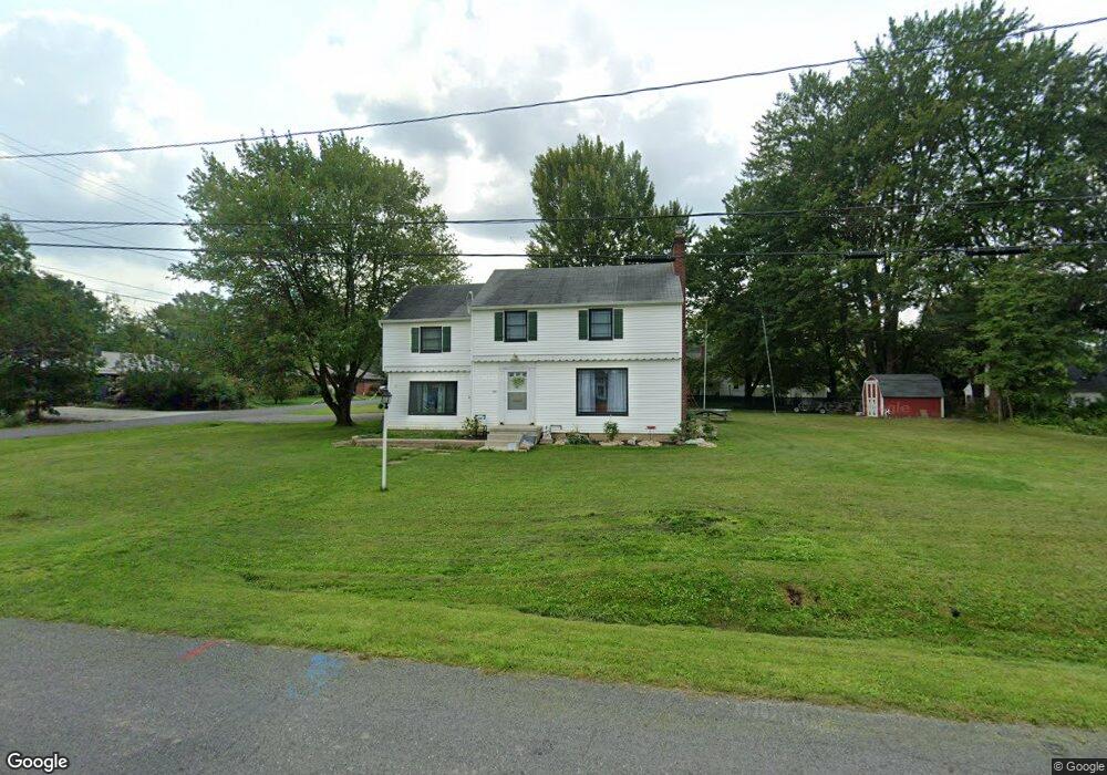
910 W Mill St Alliance, OH 44601
Estimated Value: $170,231 - $206,000
4
Beds
2
Baths
1,596
Sq Ft
$115/Sq Ft
Est. Value
About This Home
This home is located at 910 W Mill St, Alliance, OH 44601 and is currently estimated at $184,058, approximately $115 per square foot. 910 W Mill St is a home located in Stark County with nearby schools including Alliance Elementary School at Rockhill, Alliance Intermediate School at Northside, and Alliance Middle School.
Ownership History
Date
Name
Owned For
Owner Type
Purchase Details
Closed on
Sep 26, 2011
Sold by
Last Will Of Clyde J Maloney
Bought by
Myers John E and Myers Lynette D
Current Estimated Value
Home Financials for this Owner
Home Financials are based on the most recent Mortgage that was taken out on this home.
Original Mortgage
$76,022
Outstanding Balance
$52,397
Interest Rate
4.32%
Mortgage Type
FHA
Estimated Equity
$131,661
Purchase Details
Closed on
Dec 13, 2000
Sold by
Maloney Clyde J and Maloney Deloris A
Bought by
Maloney Clyde J and Maloney Deloris A
Create a Home Valuation Report for This Property
The Home Valuation Report is an in-depth analysis detailing your home's value as well as a comparison with similar homes in the area
Home Values in the Area
Average Home Value in this Area
Purchase History
| Date | Buyer | Sale Price | Title Company |
|---|---|---|---|
| Myers John E | $78,000 | None Available | |
| Maloney Clyde J | -- | -- |
Source: Public Records
Mortgage History
| Date | Status | Borrower | Loan Amount |
|---|---|---|---|
| Open | Myers John E | $76,022 |
Source: Public Records
Tax History
| Year | Tax Paid | Tax Assessment Tax Assessment Total Assessment is a certain percentage of the fair market value that is determined by local assessors to be the total taxable value of land and additions on the property. | Land | Improvement |
|---|---|---|---|---|
| 2025 | -- | $49,110 | $17,750 | $31,360 |
| 2024 | -- | $49,110 | $17,750 | $31,360 |
| 2023 | $1,450 | $36,090 | $12,850 | $23,240 |
| 2022 | $1,460 | $36,090 | $12,850 | $23,240 |
| 2021 | $1,461 | $36,090 | $12,850 | $23,240 |
| 2020 | $1,364 | $31,470 | $11,170 | $20,300 |
| 2019 | $1,345 | $31,470 | $11,170 | $20,300 |
Source: Public Records
Map
Nearby Homes
- 1016 Roseland Rd
- 864 W College Rd
- 1539 Parkway Blvd
- 2625 Belleflower Dr
- 720 Vincent Blvd
- 2705 Shunk Ave
- 1718 Fernwood Blvd
- 2120 Blenheim Ave
- 2580 Edgewood Ave
- 856 Birchwood Dr
- 1534 Fernwood Blvd
- 0 Federal Ave
- 2630 Blenheim Ave
- 2372 S Union Ave
- 2406 S Union Ave
- 2635 Blenheim Ave
- 2405 Cherry Ave
- 152 E Mill St
- 1156 Parkside Dr
- 3116 Ridgehill Ave
- 935 W 23rd St
- 905 W 23rd St
- 2220 Parkway Blvd
- 2208 Parkway Blvd
- 2232 Parkway Blvd
- 2224 Antram Ave
- 917 W Mill St
- 2242 Parkway Blvd
- 2242 Antram Ave
- 2207 S Rockhill Ave
- 919 W Mill St
- 839 W Mill St
- 921 W Mill St
- 2140 Parkway Blvd
- 829 W Mill St
- 906 W 23rd St
- 2217 Parkway Blvd
- 2310 Parkway Blvd
- 2225 S Rockhill Ave
- 2107 Antram Ave
Your Personal Tour Guide
Ask me questions while you tour the home.