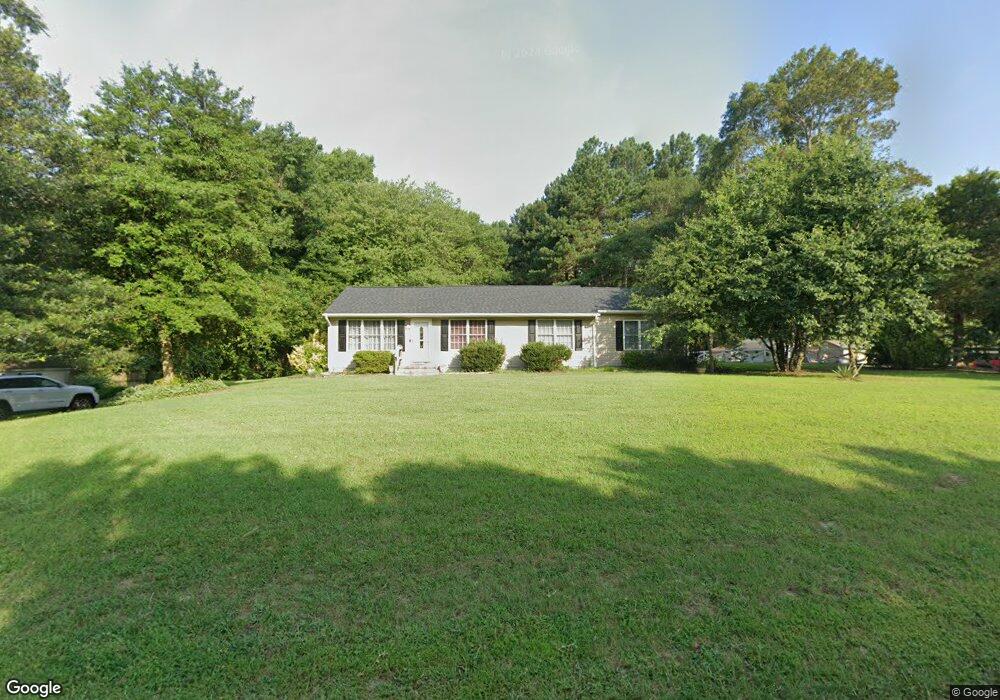
9100 Hampton Ct Delmar, MD 21875
North Salisbury NeighborhoodEstimated Value: $259,923 - $357,000
Studio
2
Baths
2,144
Sq Ft
$140/Sq Ft
Est. Value
About This Home
This home is located at 9100 Hampton Ct, Delmar, MD 21875 and is currently estimated at $300,981, approximately $140 per square foot. 9100 Hampton Ct is a home located in Wicomico County with nearby schools including Delmar Elementary School, Wicomico Middle School, and Wicomico High School.
Ownership History
Date
Name
Owned For
Owner Type
Purchase Details
Closed on
Jan 25, 1988
Sold by
Trout George E
Bought by
Griffith Pamela
Current Estimated Value
Home Financials for this Owner
Home Financials are based on the most recent Mortgage that was taken out on this home.
Original Mortgage
$42,700
Interest Rate
10.34%
Purchase Details
Closed on
Jun 13, 1983
Sold by
Dennis Theresa R
Bought by
Trout George E and Trout Valerie L
Home Financials for this Owner
Home Financials are based on the most recent Mortgage that was taken out on this home.
Original Mortgage
$37,500
Interest Rate
12.82%
Create a Home Valuation Report for This Property
The Home Valuation Report is an in-depth analysis detailing your home's value as well as a comparison with similar homes in the area
Home Values in the Area
Average Home Value in this Area
Purchase History
| Date | Buyer | Sale Price | Title Company |
|---|---|---|---|
| Griffith Pamela | $42,700 | -- | |
| Trout George E | $37,500 | -- |
Source: Public Records
Mortgage History
| Date | Status | Borrower | Loan Amount |
|---|---|---|---|
| Closed | Griffith Pamela | $42,700 | |
| Previous Owner | Trout George E | $37,500 |
Source: Public Records
Tax History
| Year | Tax Paid | Tax Assessment Tax Assessment Total Assessment is a certain percentage of the fair market value that is determined by local assessors to be the total taxable value of land and additions on the property. | Land | Improvement |
|---|---|---|---|---|
| 2025 | $2,117 | $225,100 | $46,100 | $179,000 |
| 2024 | $2,037 | $206,167 | $0 | $0 |
| 2023 | $1,868 | $187,233 | $0 | $0 |
| 2022 | $1,775 | $168,300 | $36,100 | $132,200 |
| 2021 | $1,753 | $166,233 | $0 | $0 |
| 2020 | $1,753 | $164,167 | $0 | $0 |
| 2019 | $1,757 | $162,100 | $36,100 | $126,000 |
| 2018 | $1,655 | $151,667 | $0 | $0 |
| 2017 | $1,509 | $141,233 | $0 | $0 |
| 2016 | $1,302 | $130,800 | $0 | $0 |
| 2015 | $1,302 | $130,800 | $0 | $0 |
| 2014 | $1,302 | $130,800 | $0 | $0 |
Source: Public Records
Map
Nearby Homes
- 9509 Rum Ridge Rd
- 31597 E Line Rd
- 31939 Downing Rd
- 9385, 9414 Stable Ln
- 31091 Carioca Rd
- Spruce Plan at Stillwater Landing
- Birch Plan at Stillwater Landing
- Hazel Plan at Stillwater Landing
- Cedar Plan at Stillwater Landing
- 38540 Winterberry Dr
- 14018 Oak Branch Rd
- 11858 Yellowwood Dr
- 9490 Song Sparrow Cir
- Lot 8A Song Sparrow Cir
- Lot 9A Song Sparrow Cir
- Lot 7A Mourning Dove Way
- Lot 6A Mourning Dove Way
- 7837 Pristine Place
- 9518 Royal Tern Dr
- 0 Bob Smith Rd Unit MDWC2020168
- 9094 Hampton Ct
- 32125 Melson Rd
- 32111 Melson Rd
- 9105 Hampton Ct
- 9099 Hampton Ct
- 32143 Melson Rd
- 9090 Hampton Ct
- 9093 Hampton Ct
- 32101 Melson Rd
- 9089 Hampton Ct
- 9080 Hampton Ct
- 32161 Melson Rd
- 32150 Melson Rd
- 9068 Hampton Ct
- 32183 Melson Rd
- 32075 Melson Rd
- 9054 Hampton Ct
- 32180 Melson Rd
- 32195 Melson Rd
- 32061 Melson Rd
Your Personal Tour Guide
Ask me questions while you tour the home.