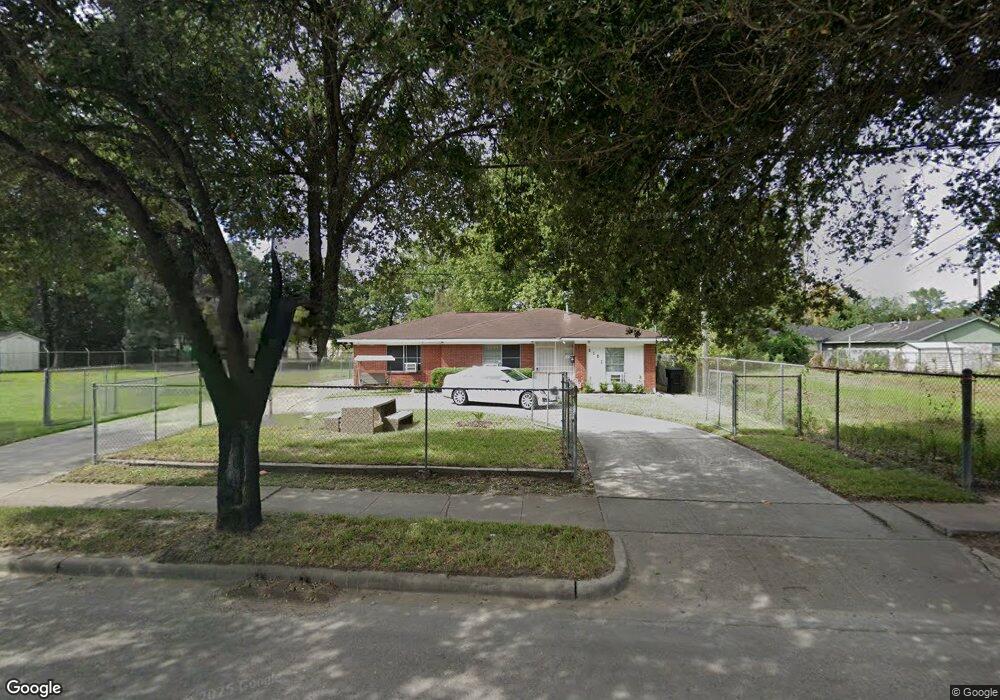
9107 Homestead Rd Houston, TX 77016
Trinity-Houston Gardens NeighborhoodEstimated Value: $192,000 - $225,000
3
Beds
2
Baths
1,455
Sq Ft
$143/Sq Ft
Est. Value
About This Home
This home is located at 9107 Homestead Rd, Houston, TX 77016 and is currently estimated at $207,651, approximately $142 per square foot. 9107 Homestead Rd is a home located in Harris County with nearby schools including Felix Cook Jr. Elementary School, Key Middle, and Kashmere High School.
Ownership History
Date
Name
Owned For
Owner Type
Purchase Details
Closed on
Jul 26, 1999
Sold by
Sloan John M
Bought by
Perkins Sybrina L
Current Estimated Value
Home Financials for this Owner
Home Financials are based on the most recent Mortgage that was taken out on this home.
Original Mortgage
$42,500
Interest Rate
7.26%
Mortgage Type
Seller Take Back
Purchase Details
Closed on
Jul 9, 1998
Sold by
Crecy Andre
Bought by
Sloan John M
Purchase Details
Closed on
Apr 4, 1996
Sold by
Sloan Gracie M
Bought by
Sloan John M
Create a Home Valuation Report for This Property
The Home Valuation Report is an in-depth analysis detailing your home's value as well as a comparison with similar homes in the area
Home Values in the Area
Average Home Value in this Area
Purchase History
| Date | Buyer | Sale Price | Title Company |
|---|---|---|---|
| Perkins Sybrina L | -- | Texas American Title Company | |
| Sloan John M | -- | -- | |
| Sloan John M | -- | -- |
Source: Public Records
Mortgage History
| Date | Status | Borrower | Loan Amount |
|---|---|---|---|
| Closed | Perkins Sybrina L | $42,500 |
Source: Public Records
Tax History Compared to Growth
Tax History
| Year | Tax Paid | Tax Assessment Tax Assessment Total Assessment is a certain percentage of the fair market value that is determined by local assessors to be the total taxable value of land and additions on the property. | Land | Improvement |
|---|---|---|---|---|
| 2025 | $1,113 | $175,172 | $95,940 | $79,232 |
| 2024 | $1,113 | $173,039 | $95,940 | $77,099 |
| 2023 | $1,113 | $138,484 | $63,960 | $74,524 |
| 2022 | $2,063 | $126,553 | $63,960 | $62,593 |
| 2021 | $1,985 | $91,365 | $42,640 | $48,725 |
| 2020 | $1,875 | $77,415 | $31,980 | $45,435 |
| 2019 | $1,951 | $80,417 | $31,980 | $48,437 |
| 2018 | $1,773 | $70,080 | $31,980 | $38,100 |
| 2017 | $1,736 | $68,653 | $31,980 | $36,673 |
| 2016 | $1,739 | $68,764 | $31,980 | $36,784 |
| 2015 | $1,746 | $68,836 | $31,980 | $36,856 |
| 2014 | $1,746 | $67,939 | $31,980 | $35,959 |
Source: Public Records
Map
Nearby Homes
- 9205 & 9207 Spaulding St
- 8928 Homestead Rd
- 9227 Homestead Rd
- 8914 Lanewood Dr
- 9317 Homestead Rd
- 9009 Compton St
- 9316 Sundown Dr
- 6513 Laura Koppe Rd
- 6415 Laura Koppe Rd
- 6213 Laura Koppe Rd
- 5009 Tidwell Rd
- 6110 Tidwell Rd
- 9412 Crofton St
- 7129 Springdale St Unit A/B
- 9313 Sherbourne St
- 8504 Shady Dr
- 0 Crofton St
- 6320 Laura Koppe Rd
- 9412 Firnat St Unit A-B
- 7321 Laura Koppe Rd
- 9113 Homestead Rd
- 9117 Homestead Rd
- 6610 Firnat St
- 9102 Spaulding St
- 9118 Spaulding St
- 9122 Spaulding St
- 9024 Spaulding St
- 9019 Homestead Rd
- 9114 Homestead Rd
- 9118 Homestead Rd
- 9020 Spaulding St
- 9202 Spaulding St
- 9023 Spaulding St
- 9207 Spaulding St
- 9205 Spaulding St
- 9016 Spaulding St
- 9206 Spaulding St
- 9105 Spaulding St
- 9117 Spaulding St
- 9101 Spaulding St