Estimated Value: $76,000 - $109,000
--
Bed
2
Baths
1,756
Sq Ft
$54/Sq Ft
Est. Value
About This Home
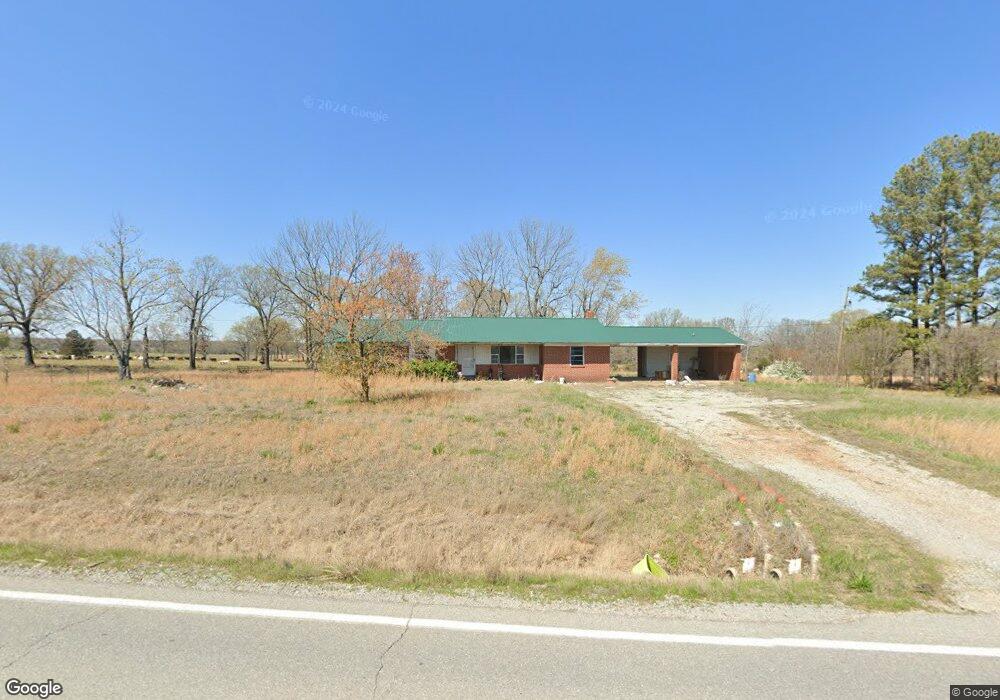
This home is located at 9109 Cord Rd, Cord, AR 72524 and is currently estimated at $94,188, approximately $53 per square foot. 9109 Cord Rd is a home located in Independence County with nearby schools including Cord-Charlotte Elementary School and Cedar Ridge High School.
Ownership History
Date
Name
Owned For
Owner Type
Purchase Details
Closed on
Mar 4, 2024
Sold by
Bradley Randy
Bought by
Bradley Randy
Current Estimated Value
Purchase Details
Closed on
Jun 28, 2018
Sold by
Limbaugh Jessica and Limbaugh Charles Hayden
Bought by
Bradley Tanner
Home Financials for this Owner
Home Financials are based on the most recent Mortgage that was taken out on this home.
Original Mortgage
$54,861
Interest Rate
4.6%
Mortgage Type
Future Advance Clause Open End Mortgage
Create a Home Valuation Report for This Property
The Home Valuation Report is an in-depth analysis detailing your home's value as well as a comparison with similar homes in the area
Home Values in the Area
Average Home Value in this Area
Purchase History
| Date | Buyer | Sale Price | Title Company |
|---|---|---|---|
| Bradley Randy | -- | None Listed On Document | |
| Bradley Randy | -- | None Listed On Document | |
| Bradley Tanner | $52,000 | None Available |
Source: Public Records
Mortgage History
| Date | Status | Borrower | Loan Amount |
|---|---|---|---|
| Previous Owner | Bradley Tanner | $54,861 |
Source: Public Records
Tax History Compared to Growth
Tax History
| Year | Tax Paid | Tax Assessment Tax Assessment Total Assessment is a certain percentage of the fair market value that is determined by local assessors to be the total taxable value of land and additions on the property. | Land | Improvement |
|---|---|---|---|---|
| 2024 | $489 | $10,450 | $1,490 | $8,960 |
| 2023 | $489 | $10,450 | $1,490 | $8,960 |
| 2022 | $489 | $10,450 | $1,490 | $8,960 |
| 2021 | $489 | $10,450 | $1,490 | $8,960 |
| 2020 | $484 | $10,450 | $1,490 | $8,960 |
| 2019 | $440 | $9,400 | $1,200 | $8,200 |
| 2018 | $440 | $9,400 | $1,200 | $8,200 |
| 2017 | $440 | $9,400 | $1,200 | $8,200 |
| 2016 | $440 | $11,980 | $1,200 | $10,780 |
| 2015 | $561 | $11,980 | $1,200 | $10,780 |
| 2014 | $601 | $12,840 | $1,090 | $11,750 |
Source: Public Records
Map
Nearby Homes
- 105 Walden Rd
- 250 Summerset Ln
- 1962 acres Upper Lockhart Rd
- 1962 Upper Lockhart Rd
- 14 Law 351
- 701 Wpa Rd
- 183 Law 352 Strawberry
- 310 Lawrence Road 333
- 6118 Cord Rd
- 201 Cr-319
- 509 Highway 25
- 56 Law 338
- 5976 and 5980 Cord Rd Rd
- 400 Weaver Ln
- 15 Hawks Run
- 127
- 127 Law 335
- 70 and 76 Crow Ln
- 1700 Sanders Rd
- 6820 White Dr
- 9100 Cord Rd
- 9125 Cord Rd
- 9239 Cord Rd
- 0B FM 101 Rd
- 9150 Cord Rd
- 0 Cord Rd Unit 20030459
- 0 Cord Rd Unit 22030451
- 0 Cord Rd Unit 22-98
- 0 Cord Rd
- 0 Cord Rd
- 8979 Cord Rd
- 1205 Blueberry Rd
- 1300 Blueberry Rd
- 1200 Blueberry Rd
- 245 Lower Lockhart Rd
- 1210 Blueberry Rd
- 8889 Cord Rd
- 9330 Cord Rd
- 0 Blueberry Rd
- 1350 Blueberry Rd