Estimated Value: $206,000 - $257,000
3
Beds
2
Baths
1,260
Sq Ft
$184/Sq Ft
Est. Value
About This Home
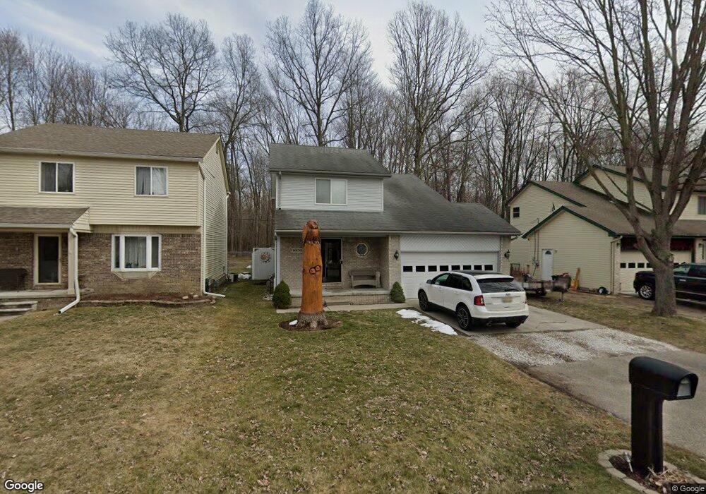
This home is located at 9109 Maple Rd, Clay, MI 48001 and is currently estimated at $232,140, approximately $184 per square foot. 9109 Maple Rd is a home located in St. Clair County.
Ownership History
Date
Name
Owned For
Owner Type
Purchase Details
Closed on
Jun 24, 2013
Sold by
Miner Shannon Lee and Miner Patrick Michael
Bought by
Miner Shannon Lee
Current Estimated Value
Home Financials for this Owner
Home Financials are based on the most recent Mortgage that was taken out on this home.
Original Mortgage
$139,847
Interest Rate
3.75%
Mortgage Type
FHA
Create a Home Valuation Report for This Property
The Home Valuation Report is an in-depth analysis detailing your home's value as well as a comparison with similar homes in the area
Home Values in the Area
Average Home Value in this Area
Purchase History
| Date | Buyer | Sale Price | Title Company |
|---|---|---|---|
| Miner Shannon Lee | -- | Performance Title Inc |
Source: Public Records
Mortgage History
| Date | Status | Borrower | Loan Amount |
|---|---|---|---|
| Closed | Miner Shannon Lee | $139,847 |
Source: Public Records
Tax History
| Year | Tax Paid | Tax Assessment Tax Assessment Total Assessment is a certain percentage of the fair market value that is determined by local assessors to be the total taxable value of land and additions on the property. | Land | Improvement |
|---|---|---|---|---|
| 2025 | $942 | $97,800 | $0 | $0 |
| 2024 | $924 | $91,500 | $0 | $0 |
| 2023 | $890 | $86,000 | $0 | $0 |
| 2022 | $1,605 | $78,700 | $0 | $0 |
| 2020 | $1,514 | $72,100 | $72,100 | $0 |
| 2019 | $1,490 | $64,400 | $0 | $0 |
| 2018 | $1,465 | $53,500 | $0 | $0 |
| 2017 | $1,349 | $51,800 | $0 | $0 |
| 2016 | $731 | $51,800 | $0 | $0 |
| 2015 | -- | $48,800 | $48,800 | $0 |
| 2014 | -- | $37,700 | $37,700 | $0 |
| 2013 | -- | $37,100 | $0 | $0 |
Source: Public Records
Map
Nearby Homes
- 24 Vacant Lots Land
- 9279 Oakdale St
- 9084 Island Dr
- 9309 Oakdale
- 9399 Oakdale St
- 9665 River St
- 0000 Taft Rd
- 00 Taft Rd
- 3202 Fruit St
- 00 Dickinson Island
- 5966 Starboard Ct Unit 284
- 9658 Seaway Dr Unit 91
- 9634 Seaway Dr Unit 38
- 9761 Marina Cir Unit 292
- 2435 Fruit St
- 8846 Stone Rd
- 407-425 N Channel Dr
- 00000 N Channel Dr
- 00 N Channel Dr
- 9642 Nook Rd Unit 7
Your Personal Tour Guide
Ask me questions while you tour the home.