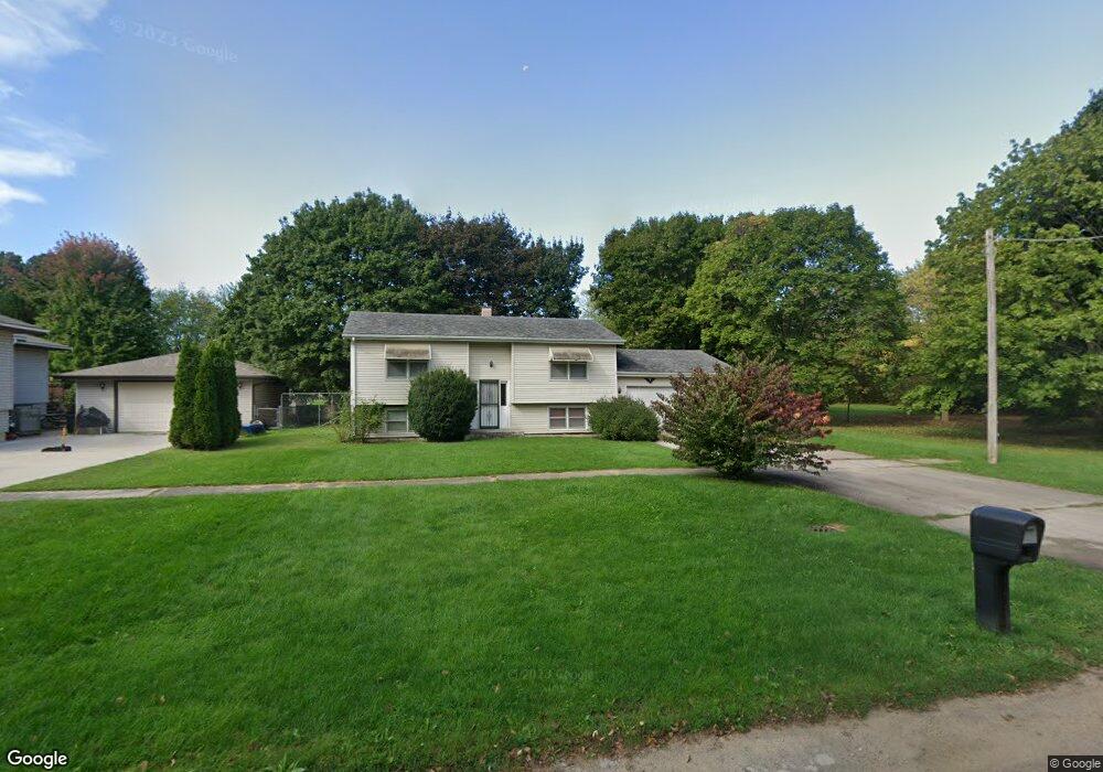
911 9th Ave Belvidere, IL 61008
Estimated Value: $174,000 - $218,084
3
Beds
2
Baths
1,586
Sq Ft
$121/Sq Ft
Est. Value
About This Home
This home is located at 911 9th Ave, Belvidere, IL 61008 and is currently estimated at $192,271, approximately $121 per square foot. 911 9th Ave is a home located in Boone County with nearby schools including Washington Academy, Belvidere South Middle School, and Belvidere High School.
Ownership History
Date
Name
Owned For
Owner Type
Purchase Details
Closed on
Feb 15, 2019
Sold by
Vernetta Mashinter
Bought by
Riffle James E
Current Estimated Value
Home Financials for this Owner
Home Financials are based on the most recent Mortgage that was taken out on this home.
Original Mortgage
$95,950
Outstanding Balance
$84,779
Interest Rate
4.75%
Mortgage Type
Construction
Estimated Equity
$107,492
Purchase Details
Closed on
Feb 2, 2015
Sold by
Waits Elvin
Bought by
Mashinter Vernetta
Create a Home Valuation Report for This Property
The Home Valuation Report is an in-depth analysis detailing your home's value as well as a comparison with similar homes in the area
Home Values in the Area
Average Home Value in this Area
Purchase History
| Date | Buyer | Sale Price | Title Company |
|---|---|---|---|
| Riffle James E | $101,000 | Metropolitan Title Agency Inc | |
| Mashinter Vernetta | -- | -- |
Source: Public Records
Mortgage History
| Date | Status | Borrower | Loan Amount |
|---|---|---|---|
| Open | Riffle James E | $95,950 |
Source: Public Records
Tax History Compared to Growth
Tax History
| Year | Tax Paid | Tax Assessment Tax Assessment Total Assessment is a certain percentage of the fair market value that is determined by local assessors to be the total taxable value of land and additions on the property. | Land | Improvement |
|---|---|---|---|---|
| 2024 | $3,829 | $50,293 | $3,974 | $46,319 |
| 2023 | $3,829 | $44,347 | $6,149 | $38,198 |
| 2022 | $3,381 | $40,906 | $6,149 | $34,757 |
| 2021 | $3,187 | $38,830 | $6,149 | $32,681 |
| 2020 | $2,984 | $34,940 | $6,524 | $28,416 |
| 2019 | $3,621 | $53,880 | $26,095 | $27,785 |
| 2018 | $3,585 | $123,686 | $97,733 | $25,953 |
| 2017 | $3,482 | $32,724 | $6,860 | $25,864 |
| 2016 | $3,448 | $31,088 | $6,749 | $24,339 |
| 2015 | $1,689 | $29,599 | $8,436 | $21,163 |
| 2014 | $1,822 | $29,896 | $8,436 | $21,460 |
Source: Public Records
Map
Nearby Homes
- 932 W 5th St
- 1206 8th Ave
- 1205 7th Ave
- 407 Allen St
- 620 W 7th St
- 421 Franklin St
- 601 Pearl St
- 924 Pearl St
- 821 W Perry St
- 711 Garfield Ave
- 412 W Madison St
- 1025 W Lincoln Ave
- 315 W Hurlbut Ave
- 305 W Perry St
- 522 S State St
- 336 W Menomonie St
- 720 S Main St
- 308 W Marshall St
- 928 Berylan St
- 311 W Marshall St