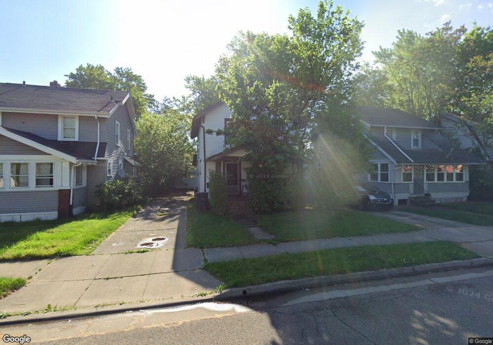
911 Ada St Akron, OH 44306
East Akron NeighborhoodEstimated Value: $70,000 - $102,000
3
Beds
1
Bath
1,063
Sq Ft
$82/Sq Ft
Est. Value
About This Home
This home is located at 911 Ada St, Akron, OH 44306 and is currently estimated at $87,293, approximately $82 per square foot. 911 Ada St is a home located in Summit County with nearby schools including Glover Community Learning Center, Kenmore Garfield Community Learning Center, and Main Preparatory Academy.
Ownership History
Date
Name
Owned For
Owner Type
Purchase Details
Closed on
Mar 20, 2021
Sold by
Weinsheimer Joe and Weinsheimer Phyllis
Bought by
Ray Tony Lamar
Current Estimated Value
Purchase Details
Closed on
Mar 26, 2020
Sold by
Joe Wotowiec
Bought by
Weinsheimer Joe and Weinsheimer Phyllis
Purchase Details
Closed on
Dec 26, 2000
Sold by
Dream Farms Inc
Bought by
Wotowiec Joe
Purchase Details
Closed on
Mar 8, 2000
Sold by
Stiles John E and Stiles Donna M
Bought by
Dream Farms Inc
Purchase Details
Closed on
Sep 29, 1999
Sold by
Bliss Mary E
Bought by
Stiles John E and Stiles Donna M
Purchase Details
Closed on
Jun 20, 1994
Sold by
Hart Madelyn M
Bought by
Stiles John E and Stiles Donna M
Create a Home Valuation Report for This Property
The Home Valuation Report is an in-depth analysis detailing your home's value as well as a comparison with similar homes in the area
Home Values in the Area
Average Home Value in this Area
Purchase History
| Date | Buyer | Sale Price | Title Company |
|---|---|---|---|
| Ray Tony Lamar | $18,000 | None Listed On Document | |
| Weinsheimer Joe | $15,000 | None Listed On Document | |
| Wotowiec Joe | $40,000 | -- | |
| Dream Farms Inc | $30,000 | Tri-County Title | |
| Stiles John E | -- | C&J Title | |
| Stiles John E | $7,000 | -- |
Source: Public Records
Tax History
| Year | Tax Paid | Tax Assessment Tax Assessment Total Assessment is a certain percentage of the fair market value that is determined by local assessors to be the total taxable value of land and additions on the property. | Land | Improvement |
|---|---|---|---|---|
| 2025 | $1,050 | $16,636 | $3,581 | $13,055 |
| 2024 | $1,050 | $16,636 | $3,581 | $13,055 |
| 2023 | $1,050 | $16,636 | $3,581 | $13,055 |
| 2022 | $854 | $10,147 | $2,107 | $8,040 |
| 2021 | $755 | $10,147 | $2,107 | $8,040 |
| 2020 | $757 | $10,340 | $2,110 | $8,230 |
| 2019 | $837 | $10,490 | $2,980 | $7,510 |
| 2018 | $826 | $10,490 | $2,980 | $7,510 |
| 2017 | $993 | $10,490 | $2,980 | $7,510 |
| 2016 | $994 | $12,610 | $3,560 | $9,050 |
| 2015 | $993 | $12,610 | $3,560 | $9,050 |
| 2014 | $985 | $12,610 | $3,560 | $9,050 |
| 2013 | $1,093 | $14,400 | $3,560 | $10,840 |
Source: Public Records
Map
Nearby Homes
- 958 Inman St
- 877 Hammel St
- 982 Merton Ave
- 824 Merton Ave
- 845 Concord Ave
- 718 Virginia Ave
- 884 Lovers Ln
- 734 Corice St
- 887 Hunt St
- 675 Hudson Ave
- 1137 Herberich Ave
- 941 Hunt St
- 568 Stanton Ave
- 586 Morgan Ave
- 0 Clara Ave
- 696 Merton Ave
- 1094 Dietz Ave
- 1051 Brown St
- 870 E Archwood Ave
- 1243 Herberich Ave
Your Personal Tour Guide
Ask me questions while you tour the home.