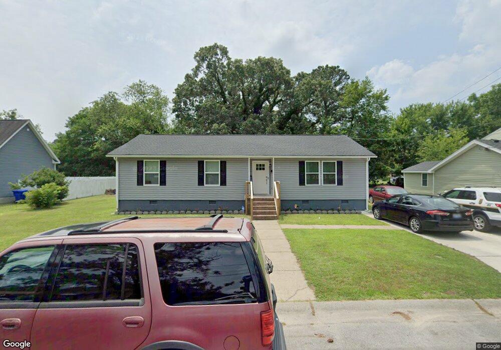
911 Battery Ave Suffolk, VA 23434
Holy Neck NeighborhoodEstimated Value: $265,000 - $294,000
About This Home
This home is located at 911 Battery Ave, Suffolk, VA 23434 and is currently estimated at $282,610, approximately $203 per square foot. 911 Battery Ave is a home located in Suffolk City with nearby schools including Hillpoint Elementary School, Forest Glen Middle School, and Lakeland High School.
Ownership History
We collect this data history from publicly available records. To have your information removed, we recommend requesting removal directly through your county’s website.
Purchase Details
Home Financials for this Owner
Home Financials are based on the most recent Mortgage that was taken out on this home.Home Values in the Area
Average Home Value in this Area
Purchase History
We collect this data history from publicly available records. To have your information removed, we recommend requesting removal directly through your county’s website.
| Date | Buyer | Sale Price | Title Company |
|---|---|---|---|
| $249,900 | None Listed On Document |
Mortgage History
We collect this data history from publicly available records. To have your information removed, we recommend requesting removal directly through your county’s website.
| Date | Status | Borrower | Loan Amount |
|---|---|---|---|
| Open | $245,373 |
Tax History
We collect this data history from publicly available records. To have your information removed, we recommend requesting removal directly through your county’s website.
| Year | Tax Paid | Tax Assessment Tax Assessment Total Assessment is a certain percentage of the fair market value that is determined by local assessors to be the total taxable value of land and additions on the property. | Land | Improvement |
|---|---|---|---|---|
| 2025 | $3,008 | $239,100 | $49,100 | $190,000 |
| 2024 | $3,008 | $231,100 | $49,100 | $182,000 |
| 2023 | $2,866 | $220,400 | $46,800 | $173,600 |
| 2022 | $1,970 | $180,700 | $33,400 | $147,300 |
| 2021 | $1,183 | $106,600 | $26,700 | $79,900 |
| 2020 | $1,079 | $97,200 | $24,300 | $72,900 |
| 2019 | $1,079 | $97,200 | $24,300 | $72,900 |
| 2018 | $1,211 | $97,000 | $24,300 | $72,700 |
| 2017 | $1,038 | $97,000 | $24,300 | $72,700 |
| 2016 | $1,038 | $97,000 | $24,300 | $72,700 |
| 2015 | $657 | $100,500 | $24,300 | $76,200 |
| 2014 | $657 | $100,500 | $24,300 | $76,200 |
Map
- 820 Kilby Ave
- 718 Battery Ave
- 728 Kilby Ave
- 709 Kilby Ave
- 622 Mason Ave
- 1103 Pine Valley Dr
- 526 Brook Ave
- 213 Bosley Ave
- 301 S Broad St
- 507 Wellons St
- 408 Saint James Ave
- 421 Kilby Ave
- 417 Kilby Ave
- 119 Causey Ave
- MM Bedford Phase 5
- 311 Kilby Ave
- 109 Bosley Ave
- 123 Saint James Ave
- 416 Railroad Ave W
- 201 Brook Ave
- 910 Battery Ave
- 908 Battery Ave
- 902 Battery Ave
- 907 Ashley Ave
- 905 Ashley Ave
- 913 Battery Ave
- 900 Battery Ave
- 915 Battery Ave
- 431 Hull St
- 431 Hull St Unit St
- 919 Battery Ave
- 901 Battery Ave
- 832 Battery Ave
- 910 Brook Ave
- 904 Brook Ave
- 830 Battery Ave
- 833 Battery Ave
- 900 Brook Ave
- 916 Brook Ave
- 829 Battery Ave
Ask me questions while you tour the home.