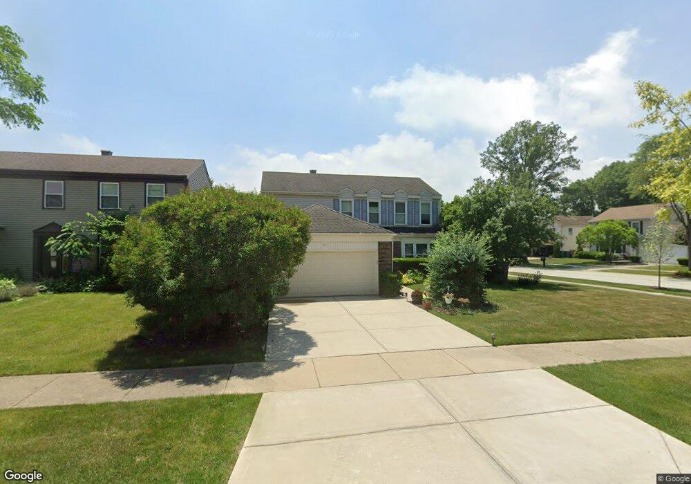
911 Dannet Rd Buffalo Grove, IL 60089
Prairie Park-Lake County NeighborhoodEstimated Value: $501,015 - $575,000
--
Bed
3
Baths
1,920
Sq Ft
$281/Sq Ft
Est. Value
About This Home
This home is located at 911 Dannet Rd, Buffalo Grove, IL 60089 and is currently estimated at $539,504, approximately $280 per square foot. 911 Dannet Rd is a home located in Lake County with nearby schools including Prairie Elementary School, Twin Groves Middle School, and Adlai E Stevenson High School.
Ownership History
Date
Name
Owned For
Owner Type
Purchase Details
Closed on
Oct 5, 2018
Sold by
Shapiro Dennis S and Shapiro Rhoda B
Bought by
Chicago Title Land Trust Co and Trust Number 84 141
Current Estimated Value
Purchase Details
Closed on
Apr 26, 2005
Sold by
Chicago Title Land Trust Co
Bought by
Shapiro Dennis S and Shapiro Rhoda B
Home Financials for this Owner
Home Financials are based on the most recent Mortgage that was taken out on this home.
Original Mortgage
$245,000
Interest Rate
5.87%
Mortgage Type
Fannie Mae Freddie Mac
Purchase Details
Closed on
Nov 8, 2002
Sold by
Shapiro Dennis S and Shapiro Rhoda B
Bought by
Cole Taylor Bank and Trust #84-141
Purchase Details
Closed on
Jun 29, 2001
Sold by
Shapiro Dennis S and Shapiro Rhoda B
Bought by
Cole Taylor Bank and Trust #84-141
Home Financials for this Owner
Home Financials are based on the most recent Mortgage that was taken out on this home.
Original Mortgage
$163,000
Interest Rate
6.69%
Mortgage Type
Purchase Money Mortgage
Purchase Details
Closed on
May 1, 2001
Sold by
Cole Taylor Bank
Bought by
Shapiro Rhoda B and Shapiro Dennis S
Home Financials for this Owner
Home Financials are based on the most recent Mortgage that was taken out on this home.
Original Mortgage
$163,000
Interest Rate
6.69%
Mortgage Type
Purchase Money Mortgage
Purchase Details
Closed on
Feb 9, 1996
Sold by
Shapiro Dennis S and Shapiro Rhoda B
Bought by
Cole Taylor Bank
Purchase Details
Closed on
Nov 14, 1995
Sold by
Cole Taylor Bank
Bought by
Shapiro Dennis S and Shapiro Rhoda B
Home Financials for this Owner
Home Financials are based on the most recent Mortgage that was taken out on this home.
Original Mortgage
$100,000
Interest Rate
7.43%
Create a Home Valuation Report for This Property
The Home Valuation Report is an in-depth analysis detailing your home's value as well as a comparison with similar homes in the area
Home Values in the Area
Average Home Value in this Area
Purchase History
| Date | Buyer | Sale Price | Title Company |
|---|---|---|---|
| Chicago Title Land Trust Co | -- | Chicago Title Land Trust Com | |
| Shapiro Dennis S | -- | -- | |
| Cole Taylor Bank | -- | -- | |
| Cole Taylor Bank | -- | -- | |
| Shapiro Rhoda B | -- | First American Title | |
| Cole Taylor Bank | -- | -- | |
| Shapiro Dennis S | -- | Imperial Land Title Inc |
Source: Public Records
Mortgage History
| Date | Status | Borrower | Loan Amount |
|---|---|---|---|
| Previous Owner | Shapiro Dennis S | $245,000 | |
| Previous Owner | Shapiro Rhoda B | $163,000 | |
| Previous Owner | Shapiro Dennis S | $100,000 |
Source: Public Records
Tax History Compared to Growth
Tax History
| Year | Tax Paid | Tax Assessment Tax Assessment Total Assessment is a certain percentage of the fair market value that is determined by local assessors to be the total taxable value of land and additions on the property. | Land | Improvement |
|---|---|---|---|---|
| 2024 | $12,039 | $141,339 | $32,345 | $108,994 |
| 2023 | $11,679 | $133,364 | $30,520 | $102,844 |
| 2022 | $11,679 | $123,005 | $28,149 | $94,856 |
| 2021 | $11,230 | $121,678 | $27,845 | $93,833 |
| 2020 | $10,968 | $122,093 | $27,940 | $94,153 |
| 2019 | $10,822 | $121,643 | $27,837 | $93,806 |
| 2018 | $5,650 | $122,015 | $27,511 | $94,504 |
| 2017 | $10,304 | $119,167 | $26,869 | $92,298 |
| 2016 | $10,012 | $114,112 | $25,729 | $88,383 |
| 2015 | $9,709 | $106,717 | $24,062 | $82,655 |
| 2014 | $8,859 | $97,066 | $25,842 | $71,224 |
| 2012 | $8,919 | $97,261 | $25,894 | $71,367 |
Source: Public Records
Map
Nearby Homes
- 950 Belmar Ln
- 1152 Courtland Dr Unit 406
- 1032 Courtland Dr Unit 9
- 1141 Devonshire Rd
- 1265 Devonshire Rd
- 890 Knollwood Dr
- 931 Shady Grove Ln
- 12 Cloverdale Ct
- 5107 N Arlington Heights Rd
- 327 Lasalle Ln
- 800 Clohesey Dr
- 1324 Fairfax Ln Unit B32
- 1325 Fairfax Ln
- 1118 Larraway Dr
- 1546 Brandywyn Ln
- 887 Saybrook Ln Unit 2
- 614 Lyon Ct
- 437 Caren Dr
- 1357 Bristol Ln Unit Q4
- 711 Woodhollow Ln
- 909 Dannet Rd
- 1340 Devonshire Rd
- 1212 Dannet Ct
- 1342 Devonshire Rd
- 1208 Dannet Ct
- 1337 Devonshire Rd
- 910 Dannet Rd
- 1339 Devonshire Rd
- 1335 Devonshire Rd
- 1341 Devonshire Rd
- 1204 Dannet Ct
- 1333 Devonshire Rd
- 1344 Devonshire Rd
- 1343 Devonshire Rd
- 1330 Devonshire Rd
- 1331 Devonshire Rd
- 900 Dannet Rd
- 821 Dannet Rd
- 1350 Devonshire Rd
- 1231 Ranch View Ct