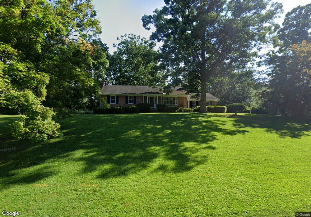
911 Huntsman Rd Towson, MD 21286
Hampton NeighborhoodEstimated Value: $522,674 - $791,000
--
Bed
3
Baths
1,528
Sq Ft
$411/Sq Ft
Est. Value
About This Home
This home is located at 911 Huntsman Rd, Towson, MD 21286 and is currently estimated at $628,669, approximately $411 per square foot. 911 Huntsman Rd is a home located in Baltimore County with nearby schools including Hampton Elementary, Ridgely Middle, and Loch Raven High.
Ownership History
Date
Name
Owned For
Owner Type
Purchase Details
Closed on
Mar 26, 1998
Sold by
Barthelme Neal F
Bought by
Barthelme Neal F and Barthelme Kathryn J
Current Estimated Value
Purchase Details
Closed on
Sep 21, 1993
Sold by
Brownley A W
Bought by
Barthelme Neal F
Home Financials for this Owner
Home Financials are based on the most recent Mortgage that was taken out on this home.
Original Mortgage
$195,000
Interest Rate
7.16%
Create a Home Valuation Report for This Property
The Home Valuation Report is an in-depth analysis detailing your home's value as well as a comparison with similar homes in the area
Home Values in the Area
Average Home Value in this Area
Purchase History
| Date | Buyer | Sale Price | Title Company |
|---|---|---|---|
| Barthelme Neal F | -- | -- | |
| Barthelme Neal F | $219,000 | -- |
Source: Public Records
Mortgage History
| Date | Status | Borrower | Loan Amount |
|---|---|---|---|
| Previous Owner | Barthelme Neal F | $195,000 |
Source: Public Records
Tax History Compared to Growth
Tax History
| Year | Tax Paid | Tax Assessment Tax Assessment Total Assessment is a certain percentage of the fair market value that is determined by local assessors to be the total taxable value of land and additions on the property. | Land | Improvement |
|---|---|---|---|---|
| 2025 | $5,020 | $452,000 | $192,500 | $259,500 |
| 2024 | $5,020 | $427,500 | $0 | $0 |
| 2023 | $2,421 | $403,000 | $0 | $0 |
| 2022 | $4,606 | $378,500 | $192,500 | $186,000 |
| 2021 | $4,647 | $378,500 | $192,500 | $186,000 |
| 2020 | $4,647 | $378,500 | $192,500 | $186,000 |
| 2019 | $4,873 | $397,100 | $192,500 | $204,600 |
| 2018 | $4,767 | $388,333 | $0 | $0 |
| 2017 | $4,619 | $379,567 | $0 | $0 |
| 2016 | $4,218 | $370,800 | $0 | $0 |
| 2015 | $4,218 | $370,800 | $0 | $0 |
| 2014 | $4,218 | $370,800 | $0 | $0 |
Source: Public Records
Map
Nearby Homes
- 1013 Limekiln Ct
- 1004 Dunblane Rd
- 108 Beech Hill Ln
- 1107 Cowpens Ave
- 1402 Autumn Leaf Rd
- 939 Starbit Rd
- 1101 Gypsy Ln W
- 4 Midcrest Ct
- 602 Hampton Ln
- 5 Drake Ct
- 1213 Brook Hollow Rd
- 550 Hampton Ln
- 1312 Gateshead Rd
- 1103 Hampton Garth
- 1108 Hampton Garth
- 514 Hampton Ln
- 1905 Haverhill Rd
- 8808 Littlewood Rd
- 113 Edgewood Rd
- 112 Edgewood Rd
- 909 Huntsman Rd
- 0 Providence Rd Unit 1007036332
- 0 Providence Rd Unit 1006729216
- 0 Providence Rd Unit BC7395619
- 0 Providence Rd Unit BC9001306
- 0 Providence Rd Unit 1003789976
- 0 Providence Rd Unit 1009852344
- 0 Providence Rd Unit 1009808508
- 1200 Providence Rd
- 912 Huntsman Rd
- 910 Huntsman Rd
- 914 Huntsman Rd
- 1209 Providence Rd
- 1207 Providence Rd
- 907 Huntsman Rd
- 1205 Providence Rd
- 1211 Providence Rd
- 1203 Providence Rd
- 1213 Providence Rd
- 908 Huntsman Rd