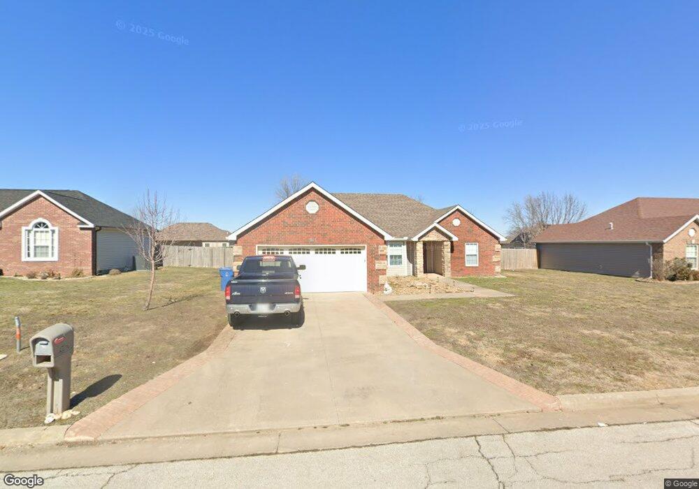
911 Larson St Carl Junction, MO 64834
Estimated Value: $238,341 - $272,000
3
Beds
2
Baths
1,654
Sq Ft
$154/Sq Ft
Est. Value
About This Home
This home is located at 911 Larson St, Carl Junction, MO 64834 and is currently estimated at $254,085, approximately $153 per square foot. 911 Larson St is a home located in Jasper County with nearby schools including Carl Junction Primary School (K-1), Carl Junction Intermediate School, and Carl Junction Primary School (2-3).
Ownership History
Date
Name
Owned For
Owner Type
Purchase Details
Closed on
Feb 11, 2022
Sold by
Ann Navarro Cheryl
Bought by
Harrison Homestead Properties Llc
Current Estimated Value
Home Financials for this Owner
Home Financials are based on the most recent Mortgage that was taken out on this home.
Original Mortgage
$325,136
Outstanding Balance
$301,375
Interest Rate
3.56%
Mortgage Type
New Conventional
Estimated Equity
-$47,290
Purchase Details
Closed on
Jul 6, 2020
Sold by
Navarro Cheryl A and Navaro Jose M
Bought by
Navaro Jose M and Navarro Cheryl A
Purchase Details
Closed on
Mar 15, 2006
Sold by
Redwood Development Inc
Bought by
Navarro Jose M and Navarro Sherry A
Create a Home Valuation Report for This Property
The Home Valuation Report is an in-depth analysis detailing your home's value as well as a comparison with similar homes in the area
Purchase History
| Date | Buyer | Sale Price | Title Company |
|---|---|---|---|
| Harrison Homestead Properties Llc | -- | None Listed On Document | |
| Navaro Jose M | -- | None Available | |
| Navarro Jose M | -- | None Available | |
| Navarro Jose M | -- | Fatco |
Source: Public Records
Mortgage History
| Date | Status | Borrower | Loan Amount |
|---|---|---|---|
| Open | Harrison Homestead Properties Llc | $325,136 |
Source: Public Records
Tax History
| Year | Tax Paid | Tax Assessment Tax Assessment Total Assessment is a certain percentage of the fair market value that is determined by local assessors to be the total taxable value of land and additions on the property. | Land | Improvement |
|---|---|---|---|---|
| 2025 | $1,452 | $26,580 | $2,130 | $24,450 |
| 2024 | $1,461 | $24,810 | $2,130 | $22,680 |
| 2023 | $1,461 | $24,810 | $2,130 | $22,680 |
| 2022 | $1,510 | $25,580 | $2,130 | $23,450 |
| 2021 | $1,296 | $25,580 | $2,130 | $23,450 |
| 2020 | $1,210 | $23,480 | $2,130 | $21,350 |
| 2019 | $1,148 | $23,480 | $2,130 | $21,350 |
| 2018 | $1,170 | $23,970 | $0 | $0 |
| 2017 | $1,173 | $23,970 | $0 | $0 |
| 2016 | $1,187 | $24,490 | $0 | $0 |
Source: Public Records
Map
Nearby Homes
- TBD Route Yy
- 29320 State Highway Yy
- 29250 State Highway Yy
- Tract 3 Prairie Ln
- Tract 2 Prairie Ln
- Tract 1 Prairie Ln
- Tract 4 Prairie Ln
- 711 Prairie Ln
- 9129 Cr-290
- 505 N Broadway Ave
- 809 Aberdeen Ave
- 901 Aberdeen Ave
- 509 W Gault St
- 304 Belgian Blue Blvd
- 804 Aberdeen Ave
- 806 Aberdeen Ave
- 808 Aberdeen Ave
- 902 Aberdeen Ave
- 904 Aberdeen Ave
- 900 Aberdeen Ave
Your Personal Tour Guide
Ask me questions while you tour the home.