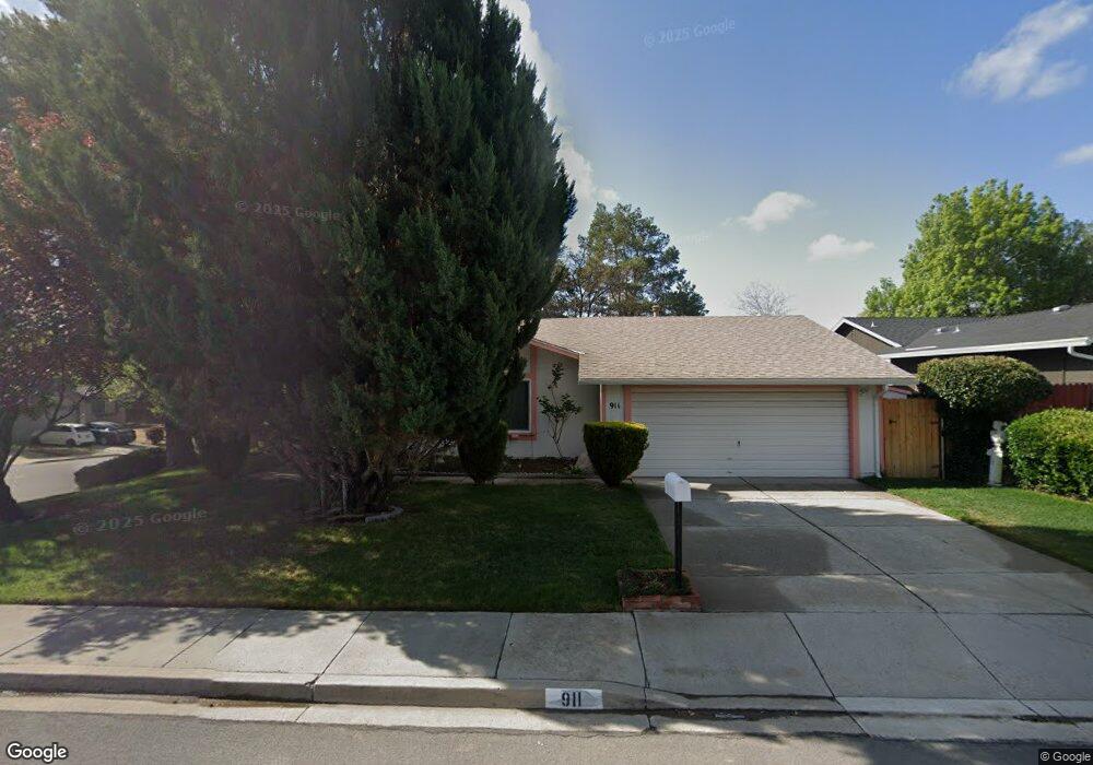
911 Lepori Way Unit 2 Sparks, NV 89431
North Rock NeighborhoodEstimated Value: $440,594 - $464,000
3
Beds
2
Baths
1,428
Sq Ft
$318/Sq Ft
Est. Value
About This Home
This home is located at 911 Lepori Way Unit 2, Sparks, NV 89431 and is currently estimated at $454,399, approximately $318 per square foot. 911 Lepori Way Unit 2 is a home located in Washoe County with nearby schools including Alice Maxwell Elementary School, Sparks Middle School, and Sparks High School.
Ownership History
Date
Name
Owned For
Owner Type
Purchase Details
Closed on
Sep 8, 2016
Sold by
Aimone Whiteside Bonjie Lee
Bought by
Aimone Whitside Bonnie Lee and Aimone Whitside Trust
Current Estimated Value
Purchase Details
Closed on
Sep 22, 2011
Sold by
Whiteside Bonnie Aimone
Bought by
Baugus Barbara
Purchase Details
Closed on
May 31, 2011
Sold by
Baugus Barbara A
Bought by
Aimone Baugus Barbara and Aimone Whiteside Bonnie
Create a Home Valuation Report for This Property
The Home Valuation Report is an in-depth analysis detailing your home's value as well as a comparison with similar homes in the area
Home Values in the Area
Average Home Value in this Area
Purchase History
| Date | Buyer | Sale Price | Title Company |
|---|---|---|---|
| Aimone Whitside Bonnie Lee | -- | None Available | |
| Baugus Barbara | -- | None Available | |
| Aimone Baugus Barbara | $106,500 | None Available |
Source: Public Records
Tax History Compared to Growth
Tax History
| Year | Tax Paid | Tax Assessment Tax Assessment Total Assessment is a certain percentage of the fair market value that is determined by local assessors to be the total taxable value of land and additions on the property. | Land | Improvement |
|---|---|---|---|---|
| 2025 | $1,658 | $64,254 | $35,875 | $28,379 |
| 2024 | $1,658 | $65,423 | $35,875 | $29,548 |
| 2023 | $1,610 | $65,107 | $36,540 | $28,567 |
| 2022 | $1,562 | $53,376 | $28,980 | $24,396 |
| 2021 | $1,519 | $47,114 | $22,225 | $24,889 |
| 2020 | $1,473 | $47,748 | $22,225 | $25,523 |
| 2019 | $1,430 | $46,702 | $21,280 | $25,422 |
| 2018 | $1,389 | $40,986 | $15,610 | $25,376 |
| 2017 | $1,349 | $39,391 | $13,440 | $25,951 |
| 2016 | $1,320 | $39,451 | $12,600 | $26,851 |
| 2015 | $1,319 | $39,035 | $11,725 | $27,310 |
| 2014 | $1,281 | $34,631 | $7,770 | $26,861 |
| 2013 | -- | $34,024 | $7,140 | $26,884 |
Source: Public Records
Map
Nearby Homes
- 3252 Holman Way
- 5650 Wedekind Rd
- 5530 High Rock Way
- 3269 Valley Forge Way
- 780 Emerson Way
- 3465 Dawn Cir
- 465 Lenwood Dr
- 1125 Dodson Way
- 0 N Mccarran Blvd Unit 250052909
- 3607 Keogh Dr
- 1345 Plymouth Way
- 3545 4th St
- 1160 York Way
- 1110 Xman Way
- 3245 Elaine Way
- 119 Devere Way
- 1731 Gault Way Unit D
- 1023 Tyler Way
- 1595 York Way
- 2154 Oppio St
- 913 Lepori Way
- 3345 Saratoga Ct
- 3341 Saratoga Ct
- 923 Lepori Way
- 3365 Wilma Ct Unit 1
- 3350 Wilma Dr
- 3340 Wilma Dr
- 3337 Saratoga Ct
- 920 Lepori Way
- 920 Lepori Way Unit NV
- 3330 Wilma Dr
- 933 Lepori Way
- 3360 Wilma Ct
- 3375 Wilma Ct
- 3333 Saratoga Ct
- 930 Lepori Way
- 3320 Wilma Dr
- 3370 Wilma Ct
- 3305 Saratoga Ct
- 3309 Saratoga Ct