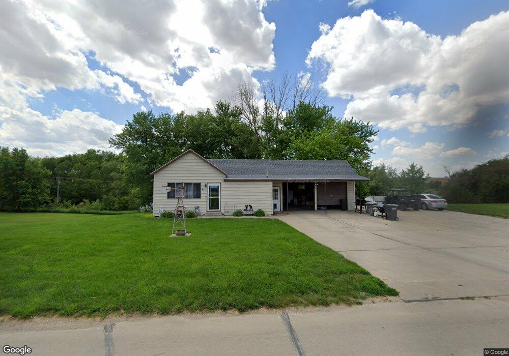
911 Main St Bancroft, NE 68004
Estimated Value: $73,000 - $158,000
1
Bed
2
Baths
968
Sq Ft
$127/Sq Ft
Est. Value
About This Home
This home is located at 911 Main St, Bancroft, NE 68004 and is currently estimated at $123,175, approximately $127 per square foot. 911 Main St is a home located in Cuming County with nearby schools including Bancroft-Rosalie Elementary School.
Ownership History
Date
Name
Owned For
Owner Type
Purchase Details
Closed on
Jun 22, 2009
Sold by
Lill Viki and Lill Larry
Bought by
Buchholz Travis and Buchholz Jody D
Current Estimated Value
Home Financials for this Owner
Home Financials are based on the most recent Mortgage that was taken out on this home.
Original Mortgage
$55,200
Interest Rate
4.84%
Mortgage Type
Future Advance Clause Open End Mortgage
Create a Home Valuation Report for This Property
The Home Valuation Report is an in-depth analysis detailing your home's value as well as a comparison with similar homes in the area
Purchase History
| Date | Buyer | Sale Price | Title Company |
|---|---|---|---|
| Buchholz Travis | $70,000 | -- |
Source: Public Records
Mortgage History
| Date | Status | Borrower | Loan Amount |
|---|---|---|---|
| Closed | Buchholz Travis | $55,200 |
Source: Public Records
Tax History
| Year | Tax Paid | Tax Assessment Tax Assessment Total Assessment is a certain percentage of the fair market value that is determined by local assessors to be the total taxable value of land and additions on the property. | Land | Improvement |
|---|---|---|---|---|
| 2025 | $718 | $78,455 | $3,780 | $74,675 |
| 2024 | $920 | $91,055 | $3,780 | $87,275 |
| 2023 | $801 | $61,645 | $2,805 | $58,840 |
| 2022 | $840 | $58,950 | $2,805 | $56,145 |
| 2021 | $986 | $69,195 | $1,980 | $67,215 |
| 2020 | $1,010 | $69,195 | $1,980 | $67,215 |
| 2019 | $991 | $68,140 | $1,980 | $66,160 |
| 2018 | $817 | $56,625 | $1,980 | $54,645 |
| 2017 | $778 | $56,625 | $1,980 | $54,645 |
| 2016 | $749 | $56,625 | $1,980 | $54,645 |
| 2015 | $742 | $56,625 | $1,980 | $54,645 |
| 2014 | $1,029 | $52,435 | $1,980 | $50,455 |
| 2013 | $1,029 | $52,435 | $1,980 | $50,455 |
Source: Public Records
Map
Nearby Homes
- 209 E Grove St
- 103 Washington St
- 2615 P Ave
- Lot 94 Blue Sage
- 330 Pearl St
- 440 State St
- 325 Crystal St
- 204 2nd St
- 305 Carnes Ave
- 1107 Whitney St
- 1111 Whitney St
- 203 S Little St
- Road 14 Road W Rd
- 1225 Co Road 1
- Lyons Unit NE 68038
- 1245 M Ave
- 820 N Oakland Ave
- 521 N Logan Ave
- 515 N Thomas Ave
- 328 N Oakland Ave
Your Personal Tour Guide
Ask me questions while you tour the home.