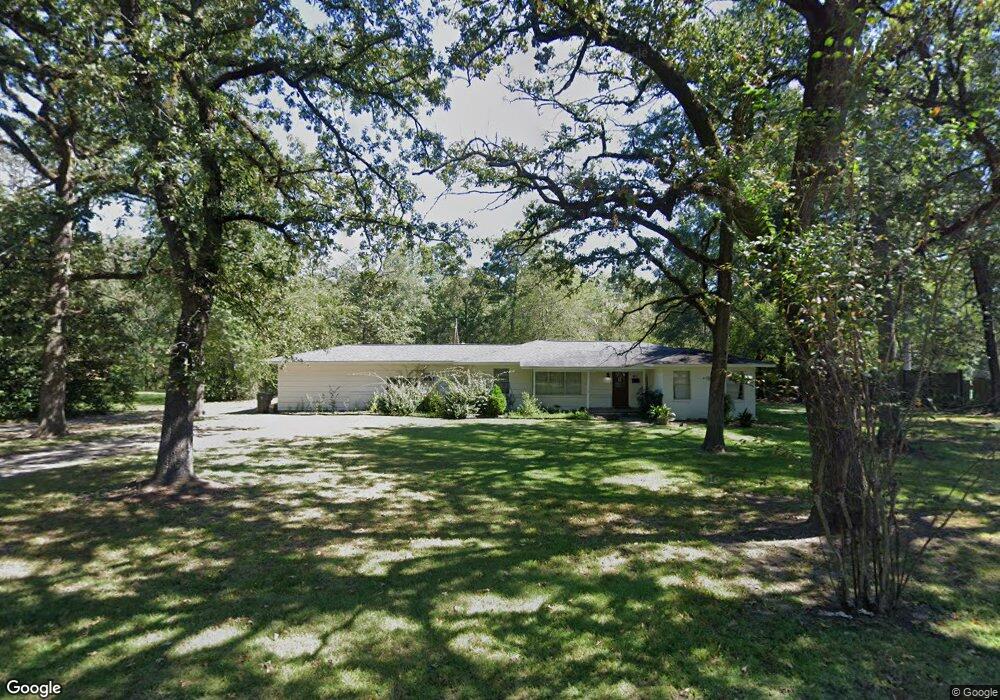
911 Mockingbird Ln Lufkin, TX 75904
Estimated Value: $219,191 - $258,000
--
Bed
7
Baths
2,405
Sq Ft
$103/Sq Ft
Est. Value
About This Home
This home is located at 911 Mockingbird Ln, Lufkin, TX 75904 and is currently estimated at $247,048, approximately $102 per square foot. 911 Mockingbird Ln is a home located in Angelina County with nearby schools including Trout Primary School, Brookhollow Elementary School, and Lufkin Middle School.
Ownership History
Date
Name
Owned For
Owner Type
Purchase Details
Closed on
Aug 26, 2024
Sold by
Walker April Elizabeth
Bought by
Roark Ethan and Roark Haley
Current Estimated Value
Home Financials for this Owner
Home Financials are based on the most recent Mortgage that was taken out on this home.
Original Mortgage
$243,000
Outstanding Balance
$240,197
Interest Rate
6.77%
Mortgage Type
New Conventional
Estimated Equity
$6,851
Purchase Details
Closed on
Feb 10, 2020
Sold by
Talley Mark
Bought by
Walker April
Create a Home Valuation Report for This Property
The Home Valuation Report is an in-depth analysis detailing your home's value as well as a comparison with similar homes in the area
Home Values in the Area
Average Home Value in this Area
Purchase History
| Date | Buyer | Sale Price | Title Company |
|---|---|---|---|
| Roark Ethan | -- | Security Guaranty Abstract | |
| Walker April | -- | None Available |
Source: Public Records
Mortgage History
| Date | Status | Borrower | Loan Amount |
|---|---|---|---|
| Open | Roark Ethan | $243,000 |
Source: Public Records
Tax History Compared to Growth
Tax History
| Year | Tax Paid | Tax Assessment Tax Assessment Total Assessment is a certain percentage of the fair market value that is determined by local assessors to be the total taxable value of land and additions on the property. | Land | Improvement |
|---|---|---|---|---|
| 2025 | $5,067 | $242,470 | $36,460 | $206,010 |
| 2024 | $3,952 | $224,530 | $36,340 | $188,190 |
| 2023 | $3,416 | $221,490 | $36,340 | $185,150 |
| 2022 | $3,560 | $167,030 | $12,470 | $154,560 |
| 2021 | $3,500 | $142,080 | $12,470 | $129,610 |
| 2020 | $3,115 | $126,750 | $12,470 | $114,280 |
| 2019 | $3,301 | $126,980 | $12,470 | $114,510 |
| 2018 | $707 | $122,950 | $12,470 | $110,480 |
| 2017 | $707 | $116,680 | $12,470 | $104,210 |
| 2016 | $2,416 | $112,120 | $12,470 | $99,650 |
| 2015 | $777 | $92,130 | $12,470 | $79,660 |
| 2014 | $777 | $92,140 | $12,470 | $79,670 |
Source: Public Records
Map
Nearby Homes
- 909 Covington Dr
- 297 White Oak Dr
- 603 Morrow Ave
- 1202 Mimosa St
- 420 Vine Dr
- 421 House St
- 417 Vine Dr
- 910 Russell Ave
- 715 Pine Tree Ln
- 328 Sunset Blvd
- 325 Sunset Blvd
- 213 Lee Ln
- 1703 Pershing Ave
- 609 Calvin St
- 1105 Johnson Ave
- 710 Jordan Ave
- 900 Wildbriar Dr
- 408 Lynn Ave
- 505 Avondale St
- 809 Markus Ave
- 905 Mockingbird Ln
- 850 Sherwood Rd
- 900 Mockingbird Ln
- 904 Sherwood Rd
- 814 Park Ln
- 902 Park Ln
- 611 Pinehurst Dr
- 903 Covington Dr
- 605 White Oak Dr
- 612 White Oak Dr
- 904 Park Ln
- 914 Sherwood Rd
- 803 Feagin Dr
- 606 Pinehurst Dr
- 603 White Oak Dr
- 805 Feagin Dr
- 602 White Oak Dr
- 908 Park Ln
- 611 Park Ln
- 00 White Oak Dr