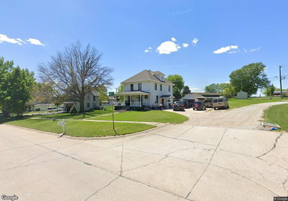
911 N Saunders Ave Sutton, NE 68979
Estimated Value: $165,000 - $236,000
4
Beds
2
Baths
1,912
Sq Ft
$96/Sq Ft
Est. Value
About This Home
This home is located at 911 N Saunders Ave, Sutton, NE 68979 and is currently estimated at $183,323, approximately $95 per square foot. 911 N Saunders Ave is a home located in Clay County with nearby schools including Sutton Elementary School, Sutton Secondary School, and Sutton Christian School.
Ownership History
Date
Name
Owned For
Owner Type
Purchase Details
Closed on
Nov 15, 2019
Sold by
Robinson Michael and Robinson Cynthia
Bought by
Oneil Richard and Oneil Krista
Current Estimated Value
Home Financials for this Owner
Home Financials are based on the most recent Mortgage that was taken out on this home.
Original Mortgage
$83,232
Interest Rate
3.6%
Mortgage Type
New Conventional
Purchase Details
Closed on
Mar 30, 2016
Sold by
Robinson Jeremy
Bought by
Robinson Jeremy and Lichti Amanda
Create a Home Valuation Report for This Property
The Home Valuation Report is an in-depth analysis detailing your home's value as well as a comparison with similar homes in the area
Home Values in the Area
Average Home Value in this Area
Purchase History
| Date | Buyer | Sale Price | Title Company |
|---|---|---|---|
| Oneil Richard | $28,000 | None Available | |
| Robinson Jeremy | -- | None Available |
Source: Public Records
Mortgage History
| Date | Status | Borrower | Loan Amount |
|---|---|---|---|
| Previous Owner | Oneil Richard | $83,232 |
Source: Public Records
Tax History Compared to Growth
Tax History
| Year | Tax Paid | Tax Assessment Tax Assessment Total Assessment is a certain percentage of the fair market value that is determined by local assessors to be the total taxable value of land and additions on the property. | Land | Improvement |
|---|---|---|---|---|
| 2024 | $1,597 | $104,375 | $5,960 | $98,415 |
| 2023 | $1,947 | $104,375 | $5,960 | $98,415 |
| 2022 | $1,415 | $76,640 | $4,460 | $72,180 |
| 2021 | $1,348 | $71,545 | $4,460 | $67,085 |
| 2020 | $1,277 | $71,545 | $4,460 | $67,085 |
| 2019 | $1,097 | $61,800 | $4,460 | $57,340 |
| 2018 | $1,102 | $61,800 | $4,460 | $57,340 |
| 2017 | $1,064 | $61,800 | $4,460 | $57,340 |
| 2016 | $1,116 | $59,420 | $4,460 | $54,960 |
| 2015 | $1,168 | $59,420 | $4,460 | $54,960 |
| 2014 | -- | $59,420 | $4,460 | $54,960 |
| 2013 | -- | $59,420 | $4,460 | $54,960 |
Source: Public Records
Map
Nearby Homes
- 505 N Saunders Ave
- 512 N James Ave
- 506 W Cedar St
- 811 Grandview St
- 403 S Way
- 105 S Maltby Ave
- 302 N Phillips Ave
- 610 E Maple St
- 105 S Main Ave
- 209 E Grove St
- 502 S Maltby Ave
- 507 S Maltby Ave
- . Schwab Subdivision Lots
- Lot 3 Wellman Schwab Subdivision Ave
- 401 Chestnut St
- Rd 323 S X Rd
- 1820 Road 6
- 1580
- 1580 Road 320
- 175 N Jackson Ave
- 905 N Saunders Ave
- 909 Crestridge Circle Dr
- 905 Crestridge Circle Dr
- 1007 N Saunders Ave
- 107 W Lincoln
- 107 W Lincoln
- 901 N Saunders Ave
- 912 N Saunders Ave
- 109 W Lincoln
- 902 N Saunders Ave
- 103 E North St
- 911 Crestridge Circle Dr
- 904 Crestridge Circle Dr
- 106 W Ada St
- 809 N Saunders Ave
- 108 W Ada St
- 913 Crestridge Circle Dr
- 902 Crestridge Circle Dr
- 918 Crestridge Circle Dr
- 909 N Gray Ave