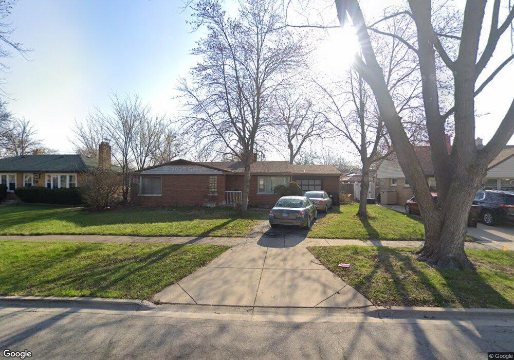
911 Newcastle Ave Westchester, IL 60154
Estimated Value: $256,000 - $317,541
2
Beds
1
Bath
1,133
Sq Ft
$253/Sq Ft
Est. Value
About This Home
This home is located at 911 Newcastle Ave, Westchester, IL 60154 and is currently estimated at $286,847, approximately $253 per square foot. 911 Newcastle Ave is a home located in Cook County with nearby schools including Westchester Primary School, Westchester Intermediate School, and Westchester Middle School.
Ownership History
Date
Name
Owned For
Owner Type
Purchase Details
Closed on
Jun 28, 2012
Sold by
Turek Richard T
Bought by
Zak Damien
Current Estimated Value
Purchase Details
Closed on
May 29, 2012
Sold by
Lutz Linda Lee Moffett
Bought by
Turek Richard T
Purchase Details
Closed on
Jan 21, 2005
Sold by
Moffett Robert Lee and Moffett Maxine Hope
Bought by
Moffett Moffett Robert Lee Robert Lee and Moffett Lutz Linda Lee
Create a Home Valuation Report for This Property
The Home Valuation Report is an in-depth analysis detailing your home's value as well as a comparison with similar homes in the area
Home Values in the Area
Average Home Value in this Area
Purchase History
| Date | Buyer | Sale Price | Title Company |
|---|---|---|---|
| Zak Damien | $64,609 | None Available | |
| Turek Richard T | $62,000 | First American Title | |
| Moffett Moffett Robert Lee Robert Lee | -- | -- |
Source: Public Records
Tax History Compared to Growth
Tax History
| Year | Tax Paid | Tax Assessment Tax Assessment Total Assessment is a certain percentage of the fair market value that is determined by local assessors to be the total taxable value of land and additions on the property. | Land | Improvement |
|---|---|---|---|---|
| 2024 | $5,166 | $23,001 | $5,513 | $17,488 |
| 2023 | $4,653 | $23,001 | $5,513 | $17,488 |
| 2022 | $4,653 | $18,673 | $4,851 | $13,822 |
| 2021 | $4,531 | $18,673 | $4,851 | $13,822 |
| 2020 | $4,493 | $18,673 | $4,851 | $13,822 |
| 2019 | $4,154 | $18,132 | $4,410 | $13,722 |
| 2018 | $4,097 | $18,132 | $4,410 | $13,722 |
| 2017 | $4,035 | $18,132 | $4,410 | $13,722 |
| 2016 | $3,732 | $15,292 | $3,969 | $11,323 |
| 2015 | $3,647 | $15,292 | $3,969 | $11,323 |
| 2014 | $4,301 | $15,292 | $3,969 | $11,323 |
| 2013 | $3,675 | $14,619 | $3,969 | $10,650 |
Source: Public Records
Map
Nearby Homes
- 920 Suffolk Ave
- 1119 Newcastle Ave
- 814 Norfolk Ave
- 805 Norfolk Ave
- 923 Manchester Ave
- 723 Balmoral Ave
- 10072 Drury Ln
- 750 Bristol Ave
- 626 Manchester Ave
- 1136 Park Place
- 1108 31st Ave
- 1035 Bohland Ave
- 1102 31st Ave
- 1102 Marshall Ave
- 1023 Rice Ave
- 1022 Eastern Ave
- 1034 31st Ave
- 1013 Bellwood Ave
- 1247 S Mannheim Rd Unit 3
- 3401 Jackson St
- 917 Newcastle Ave
- 903 Newcastle Ave
- 912 Portsmouth Ave
- 906 Portsmouth Ave
- 923 Newcastle Ave
- 916 Portsmouth Ave
- 900 Portsmouth Ave
- 922 Portsmouth Ave
- 825 Newcastle Ave
- 906 Newcastle Ave
- 912 Newcastle Ave
- 916 Newcastle Ave
- 900 Newcastle Ave
- 926 Portsmouth Ave
- 1003 Newcastle Ave
- 922 Newcastle Ave
- 821 Newcastle Ave
- 824 Portsmouth Ave
- 1000 Portsmouth Ave
- 928 Newcastle Ave