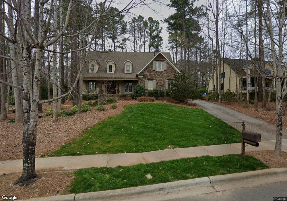
911 Patrick Johnston Ln Davidson, NC 28036
Estimated Value: $1,451,405 - $1,793,000
5
Beds
4
Baths
4,015
Sq Ft
$395/Sq Ft
Est. Value
About This Home
This home is located at 911 Patrick Johnston Ln, Davidson, NC 28036 and is currently estimated at $1,586,351, approximately $395 per square foot. 911 Patrick Johnston Ln is a home located in Mecklenburg County with nearby schools including Davidson Elementary School, William Amos Hough High School, and Davidson Green School.
Ownership History
Date
Name
Owned For
Owner Type
Purchase Details
Closed on
Nov 26, 2002
Sold by
Johnstone Remmey & Shryock Llc
Bought by
Obrien Gregory A and Obrien Margaret C
Current Estimated Value
Home Financials for this Owner
Home Financials are based on the most recent Mortgage that was taken out on this home.
Original Mortgage
$74,000
Outstanding Balance
$31,581
Interest Rate
6.15%
Mortgage Type
Construction
Estimated Equity
$1,554,770
Purchase Details
Closed on
Apr 4, 2002
Sold by
Kimbrough John T
Bought by
Johnstone Remmey & Shryock Llc
Home Financials for this Owner
Home Financials are based on the most recent Mortgage that was taken out on this home.
Original Mortgage
$125,000
Interest Rate
6.8%
Purchase Details
Closed on
Dec 26, 2001
Sold by
Stough Farms Family Ltd Partnership
Bought by
Kimbrough John T
Create a Home Valuation Report for This Property
The Home Valuation Report is an in-depth analysis detailing your home's value as well as a comparison with similar homes in the area
Home Values in the Area
Average Home Value in this Area
Purchase History
| Date | Buyer | Sale Price | Title Company |
|---|---|---|---|
| Obrien Gregory A | $150,000 | -- | |
| Johnstone Remmey & Shryock Llc | $140,000 | -- | |
| Kimbrough John T | -- | -- |
Source: Public Records
Mortgage History
| Date | Status | Borrower | Loan Amount |
|---|---|---|---|
| Open | Obrien Gregory A | $74,000 | |
| Previous Owner | Johnstone Remmey & Shryock Llc | $125,000 |
Source: Public Records
Tax History
| Year | Tax Paid | Tax Assessment Tax Assessment Total Assessment is a certain percentage of the fair market value that is determined by local assessors to be the total taxable value of land and additions on the property. | Land | Improvement |
|---|---|---|---|---|
| 2025 | $9,057 | $1,202,500 | $335,000 | $867,500 |
| 2024 | $9,057 | $1,202,500 | $335,000 | $867,500 |
| 2023 | $8,932 | $1,202,500 | $335,000 | $867,500 |
| 2022 | $9,076 | $959,400 | $360,000 | $599,400 |
| 2021 | $8,941 | $959,400 | $360,000 | $599,400 |
| 2020 | $8,941 | $959,400 | $360,000 | $599,400 |
| 2019 | $8,935 | $959,400 | $360,000 | $599,400 |
| 2018 | $8,613 | $714,700 | $240,000 | $474,700 |
| 2017 | $8,556 | $714,700 | $240,000 | $474,700 |
| 2016 | $8,553 | $714,700 | $240,000 | $474,700 |
| 2015 | $8,549 | $714,700 | $240,000 | $474,700 |
| 2014 | $8,547 | $0 | $0 | $0 |
Source: Public Records
Map
Nearby Homes
- 606 Ardrey Cir
- 316 Kimberly Rd
- 239 Kimberly Rd
- 1425 Samuel Spencer Pkwy Unit 5
- 866 Concord Rd
- High Rock Plan at Davidson Woods
- Glenville Plan at Davidson Woods
- Hickory Plan at Davidson Woods
- 1400 Samuel Spencer Pkwy
- 1413 Samuel Spencer Pkwy Unit 3
- 11916 Westbranch Pkwy
- 11826 Westbranch Pkwy
- 1418 Samuel Spencer Pkwy
- 130 Copper Pine Ln Unit 1
- 129 Hunt Camp Trail Unit 15
- 1430 Samuel Spencer Pkwy Unit 13
- 19149 Newburg Hill Rd
- 19110 Newburg Hill Rd
- 19020 Newburg Hill Rd
- 19056 Newburg Hill Rd
- 901 Patrick Johnston Ln
- 559 Pine Rd
- 628 Ardrey Cir
- 912 Patrick Johnston Ln
- 906 Patrick Johnston Ln
- 918 Patrick Johnston Ln
- 1005 Patrick Johnston Ln
- 551 Pine Rd
- 1004 Patrick Johnston Ln
- 1011 Patrick Johnston Ln
- 836 Patrick Johnston Ln Unit 33
- 836 Patrick Johnston Ln
- 560 Pine Rd
- 543 Pine Rd
- 832 Patrick Johnston Ln Unit 32
- 1016 Patrick Johnston Ln
- 548 Pine Rd
- 828 Patrick Johnston Ln
- 617 Ardrey Cir
- 618 Ardrey Cir
Your Personal Tour Guide
Ask me questions while you tour the home.