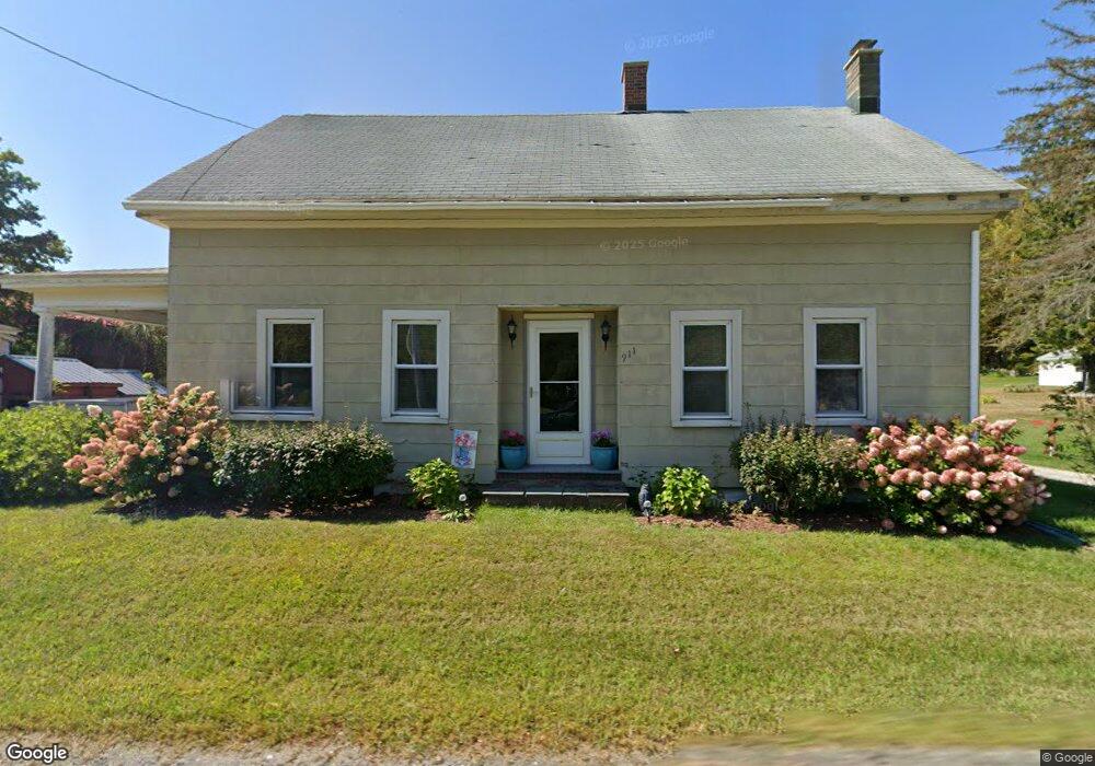
911 River Rd Clarksburg, MA 01247
Estimated Value: $212,000 - $362,000
3
Beds
2
Baths
1,370
Sq Ft
$201/Sq Ft
Est. Value
About This Home
This home is located at 911 River Rd, Clarksburg, MA 01247 and is currently estimated at $275,539, approximately $201 per square foot. 911 River Rd is a home located in Berkshire County with nearby schools including Clarksburg Elementary School.
Ownership History
Date
Name
Owned For
Owner Type
Purchase Details
Closed on
May 16, 2008
Sold by
Perry Fred C
Bought by
Perry Steven B and Perry Jerilyn L
Current Estimated Value
Home Financials for this Owner
Home Financials are based on the most recent Mortgage that was taken out on this home.
Original Mortgage
$79,500
Outstanding Balance
$50,426
Interest Rate
5.91%
Mortgage Type
Purchase Money Mortgage
Estimated Equity
$225,113
Create a Home Valuation Report for This Property
The Home Valuation Report is an in-depth analysis detailing your home's value as well as a comparison with similar homes in the area
Home Values in the Area
Average Home Value in this Area
Purchase History
| Date | Buyer | Sale Price | Title Company |
|---|---|---|---|
| Perry Steven B | $125,000 | -- |
Source: Public Records
Mortgage History
| Date | Status | Borrower | Loan Amount |
|---|---|---|---|
| Open | Perry Steven B | $79,500 |
Source: Public Records
Tax History Compared to Growth
Tax History
| Year | Tax Paid | Tax Assessment Tax Assessment Total Assessment is a certain percentage of the fair market value that is determined by local assessors to be the total taxable value of land and additions on the property. | Land | Improvement |
|---|---|---|---|---|
| 2025 | $2,421 | $178,300 | $44,800 | $133,500 |
| 2024 | $2,594 | $169,000 | $38,300 | $130,700 |
| 2023 | $2,532 | $163,800 | $38,300 | $125,500 |
| 2022 | $2,526 | $153,300 | $38,300 | $115,000 |
| 2021 | $2,258 | $142,700 | $38,200 | $104,500 |
| 2020 | $2,497 | $139,600 | $47,200 | $92,400 |
| 2019 | $2,207 | $138,100 | $46,700 | $91,400 |
| 2018 | $2,212 | $144,500 | $46,700 | $97,800 |
| 2016 | $2,016 | $131,600 | $46,700 | $84,900 |
| 2015 | $1,987 | $141,000 | $50,200 | $90,800 |
| 2014 | $1,881 | $140,800 | $50,200 | $90,600 |
Source: Public Records
Map
Nearby Homes