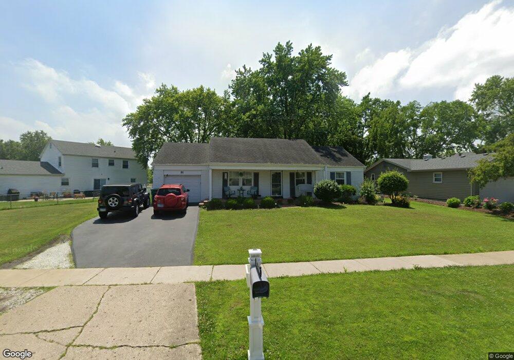
911 Shady Grove Ln Buffalo Grove, IL 60089
Estimated Value: $374,939 - $412,000
3
Beds
2
Baths
1,176
Sq Ft
$338/Sq Ft
Est. Value
About This Home
This home is located at 911 Shady Grove Ln, Buffalo Grove, IL 60089 and is currently estimated at $397,735, approximately $338 per square foot. 911 Shady Grove Ln is a home located in Lake County with nearby schools including Ivy Hall Elementary School, Twin Groves Middle School, and Adlai E Stevenson High School.
Ownership History
Date
Name
Owned For
Owner Type
Purchase Details
Closed on
Aug 12, 2004
Sold by
Sherman Daniel C and Sherman Mary K
Bought by
Sweeney Peggy
Current Estimated Value
Home Financials for this Owner
Home Financials are based on the most recent Mortgage that was taken out on this home.
Original Mortgage
$170,000
Outstanding Balance
$75,861
Interest Rate
4.51%
Mortgage Type
Purchase Money Mortgage
Estimated Equity
$321,874
Create a Home Valuation Report for This Property
The Home Valuation Report is an in-depth analysis detailing your home's value as well as a comparison with similar homes in the area
Home Values in the Area
Average Home Value in this Area
Purchase History
| Date | Buyer | Sale Price | Title Company |
|---|---|---|---|
| Sweeney Peggy | $262,500 | Rtc |
Source: Public Records
Mortgage History
| Date | Status | Borrower | Loan Amount |
|---|---|---|---|
| Open | Sweeney Peggy | $170,000 |
Source: Public Records
Tax History Compared to Growth
Tax History
| Year | Tax Paid | Tax Assessment Tax Assessment Total Assessment is a certain percentage of the fair market value that is determined by local assessors to be the total taxable value of land and additions on the property. | Land | Improvement |
|---|---|---|---|---|
| 2024 | $9,337 | $104,945 | $39,267 | $65,678 |
| 2023 | $8,476 | $99,023 | $37,051 | $61,972 |
| 2022 | $8,476 | $87,290 | $32,661 | $54,629 |
| 2021 | $8,153 | $86,349 | $32,309 | $54,040 |
| 2020 | $7,961 | $86,643 | $32,419 | $54,224 |
| 2019 | $7,854 | $86,323 | $32,299 | $54,024 |
| 2018 | $7,511 | $85,319 | $31,922 | $53,397 |
| 2017 | $7,366 | $83,328 | $31,177 | $52,151 |
| 2016 | $7,395 | $82,166 | $29,854 | $52,312 |
| 2015 | $7,186 | $76,841 | $27,919 | $48,922 |
| 2014 | $6,611 | $70,235 | $29,986 | $40,249 |
| 2012 | $6,413 | $70,376 | $30,046 | $40,330 |
Source: Public Records
Map
Nearby Homes
- 810 Silver Rock Ln
- 760 Checker Dr
- 620 Twisted Oak Ln
- 1315 Gail Dr
- 630 Woodhollow Ln
- 1027 Courtland Dr Unit 20
- 12 Cloverdale Ct
- 938 Hidden Lake Dr
- 1327 Larchmont Dr
- 531 Lasalle Ln
- 1325 Fairfax Ln
- 412 Chateau Dr
- 5107 N Arlington Heights Rd
- 131 Autumn Ct Unit CT10602
- 1117 Franklin Ln Unit C52
- 1272 Sandhurst Dr
- 690 Dunhill Dr
- 728 Old Checker Rd Unit C4
- 746 Old Checker Rd Unit E5
- 5135 Bridlewood Ct
- 921 Shady Grove Ln
- 901 Silver Rock Ln
- 891 Silver Rock Ln Unit 8
- 930 Shady Grove Ln
- 920 Shady Grove Ln
- 930 Checker Dr
- 881 Silver Rock Ln
- 940 Shady Grove Ln
- 920 Checker Dr
- 910 Shady Grove Ln Unit 8
- 890 Shady Grove Ln
- 871 Shady Grove Ln
- 880 Shady Grove Ln
- 950 Shady Grove Ln
- 910 Checker Dr
- 871 Silver Rock Ln
- 870 Shady Grove Ln
- 870 Silver Rock Ln
- 880 Checker Dr
- 861 Shady Grove Ln